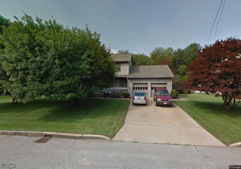
30 Fox Run Cranston, RI 02921
Western Cranston NeighborhoodEstimated Value: $672,895 - $1,057,000
3
Beds
3
Baths
1,904
Sq Ft
$418/Sq Ft
Est. Value
About This Home
This home is located at 30 Fox Run, Cranston, RI 02921 and is currently estimated at $796,474, approximately $418 per square foot. 30 Fox Run is a home located in Providence County with nearby schools including Oak Lawn School, Western Hills Middle School, and Cranston High School West.
Ownership History
Date
Name
Owned For
Owner Type
Purchase Details
Closed on
Jul 18, 2019
Sold by
Difabio Enrico and Difabio Megan K
Bought by
Bianchi Andrew and Waters Jessica L
Current Estimated Value
Home Financials for this Owner
Home Financials are based on the most recent Mortgage that was taken out on this home.
Original Mortgage
$372,500
Outstanding Balance
$326,343
Interest Rate
3.82%
Mortgage Type
Purchase Money Mortgage
Estimated Equity
$470,131
Purchase Details
Closed on
Aug 8, 2018
Sold by
Malachowski Robert P and Malachowski Elaine M
Bought by
Malachowski Ft 2018
Purchase Details
Closed on
Oct 28, 1991
Sold by
Constantino Gene M
Bought by
Malachowski Robert
Home Financials for this Owner
Home Financials are based on the most recent Mortgage that was taken out on this home.
Original Mortgage
$100,000
Interest Rate
8.98%
Create a Home Valuation Report for This Property
The Home Valuation Report is an in-depth analysis detailing your home's value as well as a comparison with similar homes in the area
Home Values in the Area
Average Home Value in this Area
Purchase History
We collect this data history from publicly available records. To have your information removed, we recommend requesting removal directly through your county’s website.
| Date | Buyer | Sale Price | Title Company |
|---|---|---|---|
| Bianchi Andrew | $472,500 | -- | |
| Malachowski Ft 2018 | -- | -- | |
| Malachowski Robert | $225,000 | -- |
Source: Public Records
Mortgage History
We collect this data history from publicly available records. To have your information removed, we recommend requesting removal directly through your county’s website.
| Date | Status | Borrower | Loan Amount |
|---|---|---|---|
| Open | Bianchi Andrew | $372,500 | |
| Previous Owner | Malachowski Robert | $80,000 | |
| Previous Owner | Malachowski Robert | $100,000 |
Source: Public Records
Tax History
| Year | Tax Paid | Tax Assessment Tax Assessment Total Assessment is a certain percentage of the fair market value that is determined by local assessors to be the total taxable value of land and additions on the property. | Land | Improvement |
|---|---|---|---|---|
| 2025 | $7,399 | $533,100 | $172,600 | $360,500 |
| 2024 | $7,255 | $533,100 | $172,600 | $360,500 |
| 2023 | $7,254 | $383,800 | $123,300 | $260,500 |
| 2022 | $7,104 | $383,800 | $123,300 | $260,500 |
| 2021 | $6,908 | $383,800 | $123,300 | $260,500 |
| 2020 | $6,993 | $336,700 | $127,700 | $209,000 |
| 2019 | $6,993 | $336,700 | $127,700 | $209,000 |
| 2018 | $6,832 | $336,700 | $127,700 | $209,000 |
| 2017 | $6,802 | $296,500 | $114,500 | $182,000 |
| 2016 | $6,656 | $296,500 | $114,500 | $182,000 |
| 2015 | $6,656 | $296,500 | $114,500 | $182,000 |
| 2014 | $6,509 | $285,000 | $110,100 | $174,900 |
Source: Public Records
Map
Nearby Homes
- 11 Fox Run
- 117 Moccasin Trail
- 62 Canonchet Trail
- 25 Red Hawk Dr
- 82 Mohawk Trail
- 136 Hope Hill Terrace
- 136 Rome Ct
- 22 Chicory Ln
- 311 Hope Rd
- 1221 Phenix Ave
- 76 Woods Ln
- 38 Angela Ave
- 44 Orchard Valley Dr
- 480 Comstock Pkwy
- 45 Briarbrooke Ln
- 1495 Pippin Orchard Rd
- 1497 Pippin Orchard Rd
- 1499 Pippin Orchard Rd
- 1100 Phenix Ave
- 75 Elite Dr
Your Personal Tour Guide
Ask me questions while you tour the home.