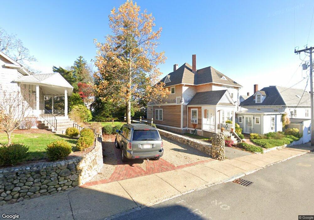
30 Greenleaf Ave Vineyard Haven, MA 02568
Oak Bluffs NeighborhoodEstimated Value: $2,341,000 - $2,643,000
4
Beds
4
Baths
2,224
Sq Ft
$1,095/Sq Ft
Est. Value
About This Home
This home is located at 30 Greenleaf Ave, Vineyard Haven, MA 02568 and is currently estimated at $2,434,907, approximately $1,094 per square foot. 30 Greenleaf Ave is a home located in Dukes County with nearby schools including Oak Bluffs Elementary School, Martha's Vineyard Regional High School, and Vineyard Montessori School.
Ownership History
Date
Name
Owned For
Owner Type
Purchase Details
Closed on
Feb 15, 2013
Sold by
Lyle David S and Lyle Monica M
Bought by
Lyle Lytle Lyle Ft
Current Estimated Value
Purchase Details
Closed on
Jul 12, 2004
Sold by
Lowe Robert I
Bought by
Lyle David S and Lyle Monica M
Home Financials for this Owner
Home Financials are based on the most recent Mortgage that was taken out on this home.
Original Mortgage
$592,000
Interest Rate
6.32%
Mortgage Type
Purchase Money Mortgage
Create a Home Valuation Report for This Property
The Home Valuation Report is an in-depth analysis detailing your home's value as well as a comparison with similar homes in the area
Home Values in the Area
Average Home Value in this Area
Purchase History
| Date | Buyer | Sale Price | Title Company |
|---|---|---|---|
| Lyle Lytle Lyle Ft | -- | -- | |
| Lyle David S | $740,000 | -- |
Source: Public Records
Mortgage History
| Date | Status | Borrower | Loan Amount |
|---|---|---|---|
| Previous Owner | Lyle David S | $592,000 |
Source: Public Records
Tax History Compared to Growth
Tax History
| Year | Tax Paid | Tax Assessment Tax Assessment Total Assessment is a certain percentage of the fair market value that is determined by local assessors to be the total taxable value of land and additions on the property. | Land | Improvement |
|---|---|---|---|---|
| 2025 | $11,635 | $2,304,000 | $1,533,600 | $770,400 |
| 2024 | $11,146 | $2,131,200 | $1,393,700 | $737,500 |
| 2023 | $9,917 | $1,878,300 | $1,354,200 | $524,100 |
| 2022 | $9,304 | $1,370,300 | $1,029,300 | $341,000 |
| 2021 | $8,626 | $1,170,400 | $874,700 | $295,700 |
| 2020 | $8,125 | $1,092,100 | $833,000 | $259,100 |
| 2019 | $7,828 | $1,018,000 | $763,600 | $254,400 |
| 2018 | $7,623 | $973,600 | $719,200 | $254,400 |
| 2017 | $7,113 | $872,800 | $644,400 | $228,400 |
| 2016 | $7,001 | $863,300 | $664,400 | $198,900 |
| 2015 | $6,761 | $849,400 | $664,400 | $185,000 |
| 2014 | $6,339 | $811,700 | $622,400 | $189,300 |
Source: Public Records
Map
Nearby Homes
- 22 Greenleaf Ave
- 22 Greenleaf Ave
- 9 Brunswick Ave
- 26 Hampson Ave
- 25 Hampson Ave
- 23 Laurel Ave
- 17 Siloam Ave
- 10 Siloam Ave
- 12 & 14 Maple Ave
- 41 Trinity Park
- 2 Lincoln Ave
- 16 Cottage Park
- 1 Cottage Park
- 79 Circuit Ave
- 54 Towanticut Ave
- 34 Massasoit Ave
- 47 E East Chop Dr Unit 5
- 47 E Chop Dr Unit 5
- 47 E Chop Dr Unit 4
- 47 E Chop Dr Unit 3
- 12 Greenleaf Ave
- 26 Greenleaf Ave
- 30 Green Leaf Ave
- 28 Greenleaf Ave
- 28 Greenleaf Ave
- 1 Elizabeth's Way
- 7 Rowland Ave
- 24 Greenleaf Ave Unit A
- 24 Greenleaf Ave
- 5 Rowland Ave
- 11 Rowland Ave
- 9 Rowland Ave
- 25 Huntington Ave
- 3 Gorham Ave
- 15 Rowland Ave
- 20 Greenleaf Ave
- 20 Greenleaf Ave
- 9 Brunswick Ave
- 27 Huntington Ave
- 7 Brunswick Ave