Estimated Value: $623,000 - $906,000
3
Beds
2
Baths
1,344
Sq Ft
$534/Sq Ft
Est. Value
About This Home
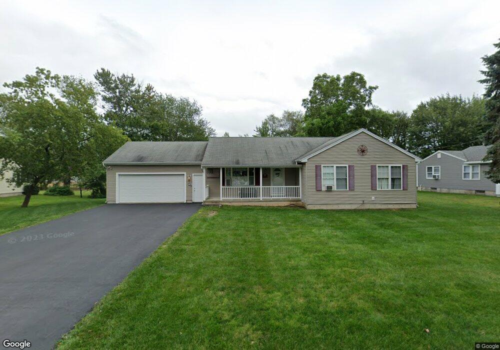
This home is located at 30 Heather Ln, Wells, ME 04090 and is currently estimated at $717,030, approximately $533 per square foot. 30 Heather Ln is a home located in York County with nearby schools including Wells Junior High School, Wells Elementary School, and Wells High School.
Ownership History
Date
Name
Owned For
Owner Type
Purchase Details
Closed on
Jan 2, 2014
Sold by
Jensen Joseph J
Bought by
Masters Laura
Current Estimated Value
Purchase Details
Closed on
Oct 4, 2007
Sold by
Maine Homecrafters
Bought by
Jensen Laura C and Jensen Joseph J
Home Financials for this Owner
Home Financials are based on the most recent Mortgage that was taken out on this home.
Original Mortgage
$20,000
Interest Rate
6.47%
Mortgage Type
Unknown
Create a Home Valuation Report for This Property
The Home Valuation Report is an in-depth analysis detailing your home's value as well as a comparison with similar homes in the area
Home Values in the Area
Average Home Value in this Area
Purchase History
| Date | Buyer | Sale Price | Title Company |
|---|---|---|---|
| Masters Laura | -- | -- | |
| Jensen Laura C | -- | -- | |
| Jensen Laura C | -- | -- |
Source: Public Records
Mortgage History
| Date | Status | Borrower | Loan Amount |
|---|---|---|---|
| Previous Owner | Jensen Laura C | $221,000 | |
| Previous Owner | Jensen Laura C | $75,000 | |
| Previous Owner | Jensen Laura C | $20,000 |
Source: Public Records
Tax History Compared to Growth
Tax History
| Year | Tax Paid | Tax Assessment Tax Assessment Total Assessment is a certain percentage of the fair market value that is determined by local assessors to be the total taxable value of land and additions on the property. | Land | Improvement |
|---|---|---|---|---|
| 2024 | $4,048 | $665,730 | $380,760 | $284,970 |
| 2023 | $3,968 | $665,730 | $380,760 | $284,970 |
| 2022 | $3,338 | $319,140 | $153,460 | $165,680 |
| 2021 | $3,304 | $314,070 | $153,460 | $160,610 |
| 2020 | $3,291 | $314,070 | $153,460 | $160,610 |
| 2019 | $3,273 | $314,070 | $153,460 | $160,610 |
| 2018 | $3,241 | $314,070 | $153,460 | $160,610 |
| 2017 | $3,191 | $314,070 | $153,460 | $160,610 |
| 2016 | $3,160 | $314,070 | $153,460 | $160,610 |
| 2015 | $3,125 | $314,070 | $153,460 | $160,610 |
| 2013 | $2,864 | $314,070 | $153,460 | $160,610 |
Source: Public Records
Map
Nearby Homes
- 16 Howard Ave
- 7 Wilson Ave
- 835 Ocean Ave
- 562 Post Rd
- 813 Ocean Ave
- 778 Ocean Ave Unit 5
- 620 Post Rd Unit 20
- 620 Post Rd Unit 71
- 733 Post Rd Unit 124
- 733 Post Rd Unit 126
- 733 Post Rd Unit 225
- 719 Post Rd
- 11 Partridge Ln
- 302 Furbish Rd
- 126 Blanchard St
- 454 Post Rd Unit 339
- 454 Post Rd Unit 305
- 454 Post Rd Unit 235
- 454 Post Rd Unit 464
- 454 Ocean Ave