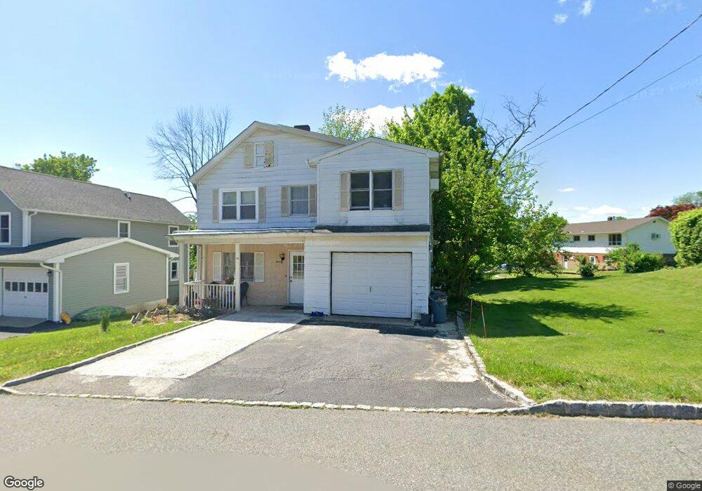
30 High St Andover, NJ 07821
Andover NeighborhoodEstimated Value: $429,000 - $474,609
4
Beds
3
Baths
1,830
Sq Ft
$246/Sq Ft
Est. Value
About This Home
This home is located at 30 High St, Andover, NJ 07821 and is currently estimated at $449,902, approximately $245 per square foot. 30 High St is a home located in Sussex County with nearby schools including Florence M. Burd School, Long Pond School, and Tranquility Adventist School.
Ownership History
Date
Name
Owned For
Owner Type
Purchase Details
Closed on
Sep 18, 2014
Sold by
Ho Hing K
Bought by
Ho Property Llc
Current Estimated Value
Purchase Details
Closed on
Oct 17, 2013
Sold by
Federal National Mortgage Association
Bought by
Ho Hing K
Purchase Details
Closed on
Nov 19, 2012
Sold by
Tonzola Diane
Bought by
Federal National Mortgage Association
Purchase Details
Closed on
Oct 30, 2004
Sold by
Tonzola John and Tonzola Diane
Bought by
Tonzola Diane
Home Financials for this Owner
Home Financials are based on the most recent Mortgage that was taken out on this home.
Original Mortgage
$145,000
Interest Rate
5.5%
Mortgage Type
New Conventional
Create a Home Valuation Report for This Property
The Home Valuation Report is an in-depth analysis detailing your home's value as well as a comparison with similar homes in the area
Home Values in the Area
Average Home Value in this Area
Purchase History
| Date | Buyer | Sale Price | Title Company |
|---|---|---|---|
| Ho Property Llc | -- | Agent For First American Tit | |
| Ho Hing K | -- | North American Title Co | |
| Federal National Mortgage Association | -- | None Available | |
| Tonzola Diane | -- | New Vision Title Agency Llc |
Source: Public Records
Mortgage History
| Date | Status | Borrower | Loan Amount |
|---|---|---|---|
| Previous Owner | Tonzola Diane | $145,000 |
Source: Public Records
Tax History Compared to Growth
Tax History
| Year | Tax Paid | Tax Assessment Tax Assessment Total Assessment is a certain percentage of the fair market value that is determined by local assessors to be the total taxable value of land and additions on the property. | Land | Improvement |
|---|---|---|---|---|
| 2025 | $6,960 | $214,100 | $93,200 | $120,900 |
| 2024 | $6,935 | $214,100 | $93,200 | $120,900 |
| 2023 | $6,935 | $214,100 | $93,200 | $120,900 |
| 2022 | $6,507 | $214,100 | $93,200 | $120,900 |
| 2021 | $6,232 | $214,100 | $93,200 | $120,900 |
| 2020 | $6,440 | $214,100 | $93,200 | $120,900 |
| 2019 | $6,485 | $214,100 | $93,200 | $120,900 |
| 2018 | $6,519 | $214,100 | $93,200 | $120,900 |
| 2017 | $6,243 | $214,100 | $93,200 | $120,900 |
| 2016 | $6,173 | $214,100 | $93,200 | $120,900 |
| 2015 | $6,018 | $214,100 | $93,200 | $120,900 |
| 2014 | $6,193 | $146,500 | $46,800 | $99,700 |
Source: Public Records
Map
Nearby Homes
- 8 Brighton Ave
- 25 Prospect Ave
- 1 High St
- 3 Smith St
- 54 Lenape Rd
- 81 Forest Lake Dr N
- 8 Cub Lake Rd
- 34 Winding Way
- 6 Jans Way
- 221 Sussex Ave
- 11 Ayers Cir
- 24 the Rotunda
- 5 Percy Place
- 1 Pine Park
- 22 Ballantine Woods Way
- 56A Sleepy Hollow Rd
- 6 Pinecliff Rd
- 27 Mountainview Dr
- 52 Tamarack Rd
- 49 Hemlock Ave