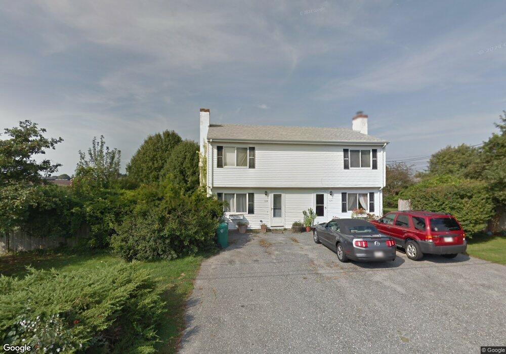
30 Honeyman Ave Middletown, RI 02842
Estimated Value: $517,000 - $824,130
4
Beds
2
Baths
2,196
Sq Ft
$328/Sq Ft
Est. Value
About This Home
This home is located at 30 Honeyman Ave, Middletown, RI 02842 and is currently estimated at $721,283, approximately $328 per square foot. 30 Honeyman Ave is a home located in Newport County with nearby schools including Middletown High School, All Saints STEAM Academy, and St George's School.
Ownership History
Date
Name
Owned For
Owner Type
Purchase Details
Closed on
Jul 25, 2018
Sold by
Deutsche Bk Natl T Co
Bought by
Defreitas Jason
Current Estimated Value
Purchase Details
Closed on
Mar 17, 1998
Sold by
Mcgoff Inc
Bought by
Cochrane Athol D and Cochrane Lori
Home Financials for this Owner
Home Financials are based on the most recent Mortgage that was taken out on this home.
Original Mortgage
$119,428
Interest Rate
7.03%
Create a Home Valuation Report for This Property
The Home Valuation Report is an in-depth analysis detailing your home's value as well as a comparison with similar homes in the area
Home Values in the Area
Average Home Value in this Area
Purchase History
| Date | Buyer | Sale Price | Title Company |
|---|---|---|---|
| Defreitas Jason | $247,000 | -- | |
| Cochrane Athol D | $120,000 | -- |
Source: Public Records
Mortgage History
| Date | Status | Borrower | Loan Amount |
|---|---|---|---|
| Previous Owner | Cochrane Athol D | $180,000 | |
| Previous Owner | Cochrane Athol D | $25,000 | |
| Previous Owner | Cochrane Athol D | $119,428 |
Source: Public Records
Tax History Compared to Growth
Tax History
| Year | Tax Paid | Tax Assessment Tax Assessment Total Assessment is a certain percentage of the fair market value that is determined by local assessors to be the total taxable value of land and additions on the property. | Land | Improvement |
|---|---|---|---|---|
| 2025 | $7,709 | $653,900 | $368,400 | $285,500 |
| 2024 | $7,363 | $653,900 | $368,400 | $285,500 |
| 2023 | $4,626 | $367,400 | $206,700 | $160,700 |
| 2022 | $4,416 | $367,400 | $206,700 | $160,700 |
| 2021 | $4,416 | $367,400 | $206,700 | $160,700 |
| 2020 | $4,366 | $317,300 | $152,700 | $164,600 |
| 2018 | $4,363 | $317,300 | $152,700 | $164,600 |
| 2016 | $4,518 | $293,000 | $128,100 | $164,900 |
| 2015 | $4,407 | $293,000 | $128,100 | $164,900 |
| 2014 | $4,141 | $257,700 | $116,500 | $141,200 |
| 2013 | $4,048 | $257,700 | $116,500 | $141,200 |
Source: Public Records
Map
Nearby Homes
- 0 Honeyman Ave
- 476 Green End Ave
- 318 Corey Ln
- 310 Corey Ln
- 223 Corey Ln
- 119 Corey Ln
- 55 John Clarke Rd Unit 8
- 55 John Clarke Rd Unit 3
- 0 Wolcott Ave
- 138 Green End Ave
- 980 Green End Ave
- 6 Wabasso Terrace
- 74 Valley Rd
- 118 Wolcott Ave
- 1 Shangri-La Ln
- 65 Seascape Ave
- 16 Sachuest Dr
- 0 Saltwood Dr
- 36 Kay Blvd
- 162 Center Ave
- 488 Green End Ave
- 20 Honeyman Ave
- 20 Honeyman Ave Unit B
- 40 Honeyman Ave
- 38 Honeyman Ave
- 31 Honeyman Ave
- 23 Honeyman Ave
- 39 Honeyman Ave
- 8 Honeyman Ave
- 9 Honeyman Ave
- 47 Honeyman Ave
- 512 Green End Ave
- 20 Harvey Rd
- 12 Harvey Rd
- 28 Harvey Rd
- 59 Honeyman Ave
- 476 Green End Ave Unit B
- 528 Green End Ave
- 36 Harvey Rd
- 5 Bayview St