Estimated Value: $470,000 - $529,000
3
Beds
3
Baths
2,673
Sq Ft
$189/Sq Ft
Est. Value
About This Home
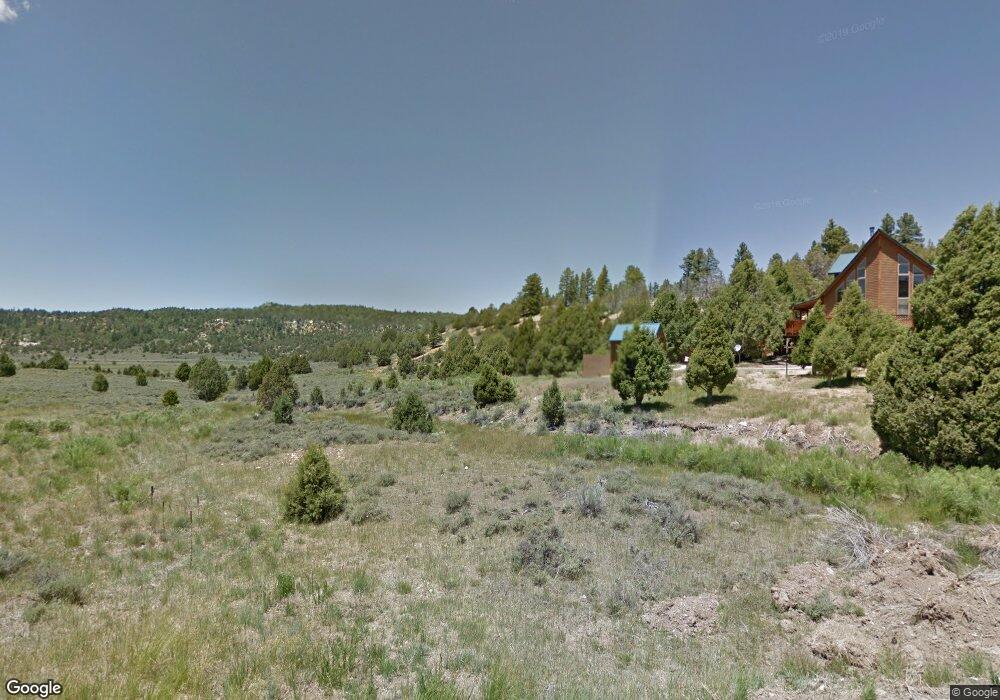
This home is located at 30 Kaibab Cir, Alton, UT 84710 and is currently estimated at $505,667, approximately $189 per square foot. 30 Kaibab Cir is a home located in Kane County with nearby schools including Valley Elementary School and Valley High School.
Ownership History
Date
Name
Owned For
Owner Type
Purchase Details
Closed on
Jun 7, 2012
Sold by
Citibank Na
Bought by
Rivers Rod
Current Estimated Value
Purchase Details
Closed on
Jul 12, 2011
Sold by
Wells Fargo Bank Na
Bought by
Wells Fargo Financial National Bank
Purchase Details
Closed on
Jul 30, 2008
Sold by
Swenson Lorraine and Hahn Lorraine Swenson
Bought by
Hahn Juergen and Hahn Lorraine Swenson
Purchase Details
Closed on
May 22, 2006
Sold by
Swenson Lorraine
Bought by
Swenson Lorraine and Loraine Swenson Trust 3/11/1997
Create a Home Valuation Report for This Property
The Home Valuation Report is an in-depth analysis detailing your home's value as well as a comparison with similar homes in the area
Purchase History
| Date | Buyer | Sale Price | Title Company |
|---|---|---|---|
| Rivers Rod | -- | -- | |
| Wells Fargo Financial National Bank | -- | -- | |
| Hahn Juergen | -- | -- | |
| Swenson Lorraine | -- | -- |
Source: Public Records
Tax History
| Year | Tax Paid | Tax Assessment Tax Assessment Total Assessment is a certain percentage of the fair market value that is determined by local assessors to be the total taxable value of land and additions on the property. | Land | Improvement |
|---|---|---|---|---|
| 2025 | $2,042 | $296,856 | $99,644 | $197,212 |
| 2024 | $2,007 | $159,020 | $58,601 | $100,419 |
| 2023 | $1,717 | $144,564 | $53,274 | $91,290 |
| 2022 | $1,697 | $126,405 | $39,462 | $86,943 |
| 2021 | $1,464 | $163,804 | $42,205 | $121,599 |
| 2020 | $1,320 | $142,508 | $38,280 | $104,228 |
| 2019 | $1,358 | $142,508 | $38,280 | $104,228 |
| 2018 | $1,336 | $139,028 | $34,800 | $104,228 |
| 2017 | $1,304 | $129,905 | $34,800 | $95,105 |
| 2016 | $1,340 | $129,905 | $34,800 | $95,105 |
| 2015 | $1,177 | $113,828 | $35,992 | $77,836 |
| 2014 | $1,177 | $113,828 | $35,992 | $77,836 |
| 2013 | -- | $113,828 | $0 | $0 |
Source: Public Records
Map
Nearby Homes
- 11 Chippewa
- 4685 Havasupai
- 0 Havasupai Dr Unit 2808855
- 0 Havasupai Dr Unit Lot 4
- 0 Havasupai Dr Unit 26-270649
- Lot 21 N Uintah Dr
- 11 Goshute
- 41 Ouray
- 38 S 6 W 13
- 3870 Wapiti Dr
- 3870 Wapiti
- 3815 Wapiti
- 0 Ranch Dr Red Deer Trail Unit 2808789
- 0 Ranch Dr Red Deer Trail Unit 114042
- 0 Ranch Dr Red Deer Trail Unit 25-267270
- 3540 Wapiti
- 3280 Tule
- 3745 Wapiti
- 2820 Dead Horse Cir
- 2814 N Dead Horse Loop
- 20 Kaibab Cir
- 30 Kaibab
- 35 E Kaibab Cir
- 63 E Kaibab Cir
- 97 E Seneca Ct
- 15 E Kaibab Cir
- 4360 N Cree Way
- 4665 N Chippewa Dr
- 4535 N Chippewa Dr
- 98 E Seneca Ct
- 70 E Kaibab Cir
- 0 E Seneca Ct
- 120 E Seneca Ct
- 149 E Seneca Ct Unit Long Valley Est D-3&
- 149 E Seneca Ct
- 100 E Seneca Ct
- Block A Utes Way
- 0 Utes Way
- 4637 N Chippewa Dr
- 0 Kaibab Cir
Your Personal Tour Guide
Ask me questions while you tour the home.