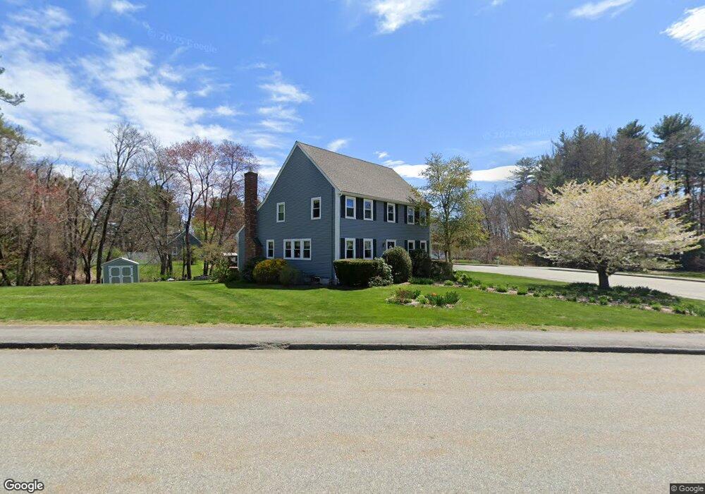
30 Lafayette Dr Marlborough, MA 01752
Estimated Value: $718,000 - $1,057,000
4
Beds
3
Baths
2,180
Sq Ft
$388/Sq Ft
Est. Value
About This Home
This home is located at 30 Lafayette Dr, Marlborough, MA 01752 and is currently estimated at $845,192, approximately $387 per square foot. 30 Lafayette Dr is a home located in Middlesex County with nearby schools including Marlborough High School, New Covenant Christian School, and Glenhaven Academy - JRI School.
Ownership History
Date
Name
Owned For
Owner Type
Purchase Details
Closed on
May 27, 1998
Sold by
Gorski Tamara S and Gorski Joseph P
Bought by
Proteau Michael A and Proteau Judith E
Current Estimated Value
Home Financials for this Owner
Home Financials are based on the most recent Mortgage that was taken out on this home.
Original Mortgage
$217,700
Outstanding Balance
$43,817
Interest Rate
7.12%
Mortgage Type
Purchase Money Mortgage
Estimated Equity
$801,375
Create a Home Valuation Report for This Property
The Home Valuation Report is an in-depth analysis detailing your home's value as well as a comparison with similar homes in the area
Home Values in the Area
Average Home Value in this Area
Purchase History
| Date | Buyer | Sale Price | Title Company |
|---|---|---|---|
| Proteau Michael A | $241,900 | -- |
Source: Public Records
Mortgage History
| Date | Status | Borrower | Loan Amount |
|---|---|---|---|
| Open | Proteau Michael A | $217,700 |
Source: Public Records
Tax History Compared to Growth
Tax History
| Year | Tax Paid | Tax Assessment Tax Assessment Total Assessment is a certain percentage of the fair market value that is determined by local assessors to be the total taxable value of land and additions on the property. | Land | Improvement |
|---|---|---|---|---|
| 2025 | $6,576 | $666,900 | $231,800 | $435,100 |
| 2024 | $6,295 | $614,700 | $210,800 | $403,900 |
| 2023 | $6,825 | $591,400 | $182,300 | $409,100 |
| 2022 | $6,628 | $505,200 | $173,600 | $331,600 |
| 2021 | $6,447 | $467,200 | $144,700 | $322,500 |
| 2020 | $6,319 | $445,600 | $136,800 | $308,800 |
| 2019 | $6,042 | $429,400 | $135,100 | $294,300 |
| 2018 | $6,006 | $410,500 | $118,700 | $291,800 |
| 2017 | $5,832 | $380,700 | $118,900 | $261,800 |
| 2016 | $5,633 | $367,200 | $118,900 | $248,300 |
| 2015 | $5,626 | $357,000 | $122,300 | $234,700 |
Source: Public Records
Map
Nearby Homes
- 608 Boston Post Rd E Unit 11
- 596 Boston Post Rd E Unit 13
- 596 Boston Post Rd E
- 624 Boston Post Rd E Unit 7
- 109 Westminster Dr Unit 109
- 688 Boston Post Rd E Unit 202
- 688 Boston Post Rd E Unit 304
- 688 Boston Post Rd E Unit 100
- 688 Boston Post Rd E Unit 324
- 688 Boston Post Rd E Unit 228
- 10 Eldorado Dr
- 114 Linda Cir
- 32 Ethel
- 3 Garabed Blvd
- 53 Wagon Hill Rd
- 20 Virginia Ave
- 23 Victoria Ln
- 271 Boston Post Rd E Unit 4
- 261 Boston Post Rd E Unit 1
- 11 Azalea Ln
- 22 Lafayette Dr
- 7 Heath St
- 16 Heath St
- 44 Lafayette Dr
- 100 Wilson St
- 37 Lafayette Dr
- 66 Wilson St
- 60 Lafayette Dr
- 17 Lafayette Dr
- 51 Lafayette Dr
- 75 Wilson St
- 99 Wilson St
- 93 Wilson St Unit A2
- 93 Wilson St Unit 6
- 93 Wilson St Unit 5
- 93 Wilson St Unit 4
- 93 Wilson St Unit 3
- 93 Wilson St Unit 2
- 93 Wilson St Unit 1
- 93 Wilson St Unit 28