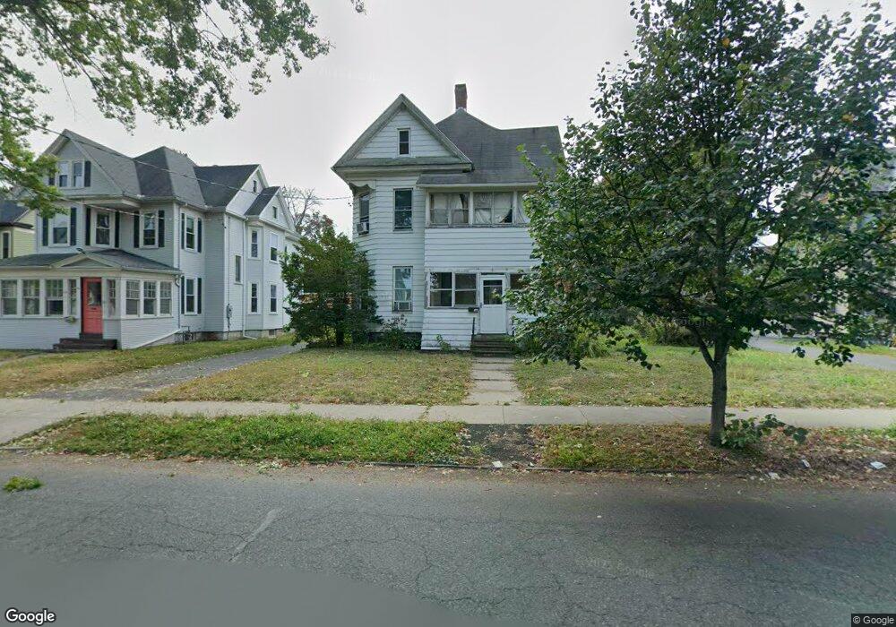
30 Laurel St Unit 32 Holyoke, MA 01040
Estimated Value: $306,800 - $348,000
4
Beds
2
Baths
1,988
Sq Ft
$167/Sq Ft
Est. Value
About This Home
This home is located at 30 Laurel St Unit 32, Holyoke, MA 01040 and is currently estimated at $331,450, approximately $166 per square foot. 30 Laurel St Unit 32 is a home located in Hampden County with nearby schools including Maurice A. Donahue Elementary School, Holyoke High School, and Holyoke Community Charter School.
Ownership History
Date
Name
Owned For
Owner Type
Purchase Details
Closed on
Sep 13, 1996
Sold by
Wallis Richard E and Wallis Sandra C
Bought by
Fredette Holly A and Fredette Helena A
Current Estimated Value
Home Financials for this Owner
Home Financials are based on the most recent Mortgage that was taken out on this home.
Original Mortgage
$72,900
Outstanding Balance
$6,249
Interest Rate
8.18%
Mortgage Type
Purchase Money Mortgage
Estimated Equity
$325,201
Purchase Details
Closed on
Jun 10, 1987
Sold by
Cousens Arthur M
Bought by
Wallis Richard E
Home Financials for this Owner
Home Financials are based on the most recent Mortgage that was taken out on this home.
Original Mortgage
$68,000
Interest Rate
10.47%
Mortgage Type
Purchase Money Mortgage
Create a Home Valuation Report for This Property
The Home Valuation Report is an in-depth analysis detailing your home's value as well as a comparison with similar homes in the area
Home Values in the Area
Average Home Value in this Area
Purchase History
| Date | Buyer | Sale Price | Title Company |
|---|---|---|---|
| Fredette Holly A | $76,750 | -- | |
| Wallis Richard E | $85,000 | -- |
Source: Public Records
Mortgage History
| Date | Status | Borrower | Loan Amount |
|---|---|---|---|
| Open | Wallis Richard E | $72,900 | |
| Previous Owner | Wallis Richard E | $68,000 |
Source: Public Records
Tax History
| Year | Tax Paid | Tax Assessment Tax Assessment Total Assessment is a certain percentage of the fair market value that is determined by local assessors to be the total taxable value of land and additions on the property. | Land | Improvement |
|---|---|---|---|---|
| 2025 | $4,213 | $241,300 | $42,300 | $199,000 |
| 2024 | $3,826 | $201,900 | $40,100 | $161,800 |
| 2023 | $3,626 | $193,300 | $40,100 | $153,200 |
| 2022 | $3,467 | $180,000 | $40,100 | $139,900 |
| 2021 | $3,255 | $168,900 | $36,500 | $132,400 |
| 2020 | $3,080 | $161,400 | $36,500 | $124,900 |
| 2019 | $2,874 | $149,000 | $31,100 | $117,900 |
| 2018 | $2,732 | $142,800 | $31,100 | $111,700 |
| 2017 | $2,737 | $142,800 | $31,100 | $111,700 |
| 2016 | $2,690 | $140,700 | $31,100 | $109,600 |
| 2015 | $2,679 | $140,700 | $31,100 | $109,600 |
Source: Public Records
Map
Nearby Homes
- 133-135 Brown Ave
- 18 Harrison Ave
- 10 View St
- 25-27 Elmwood Ave
- 42 Lawler St
- 2129 Northampton St
- 60 Chapin St Unit D
- 69 Gates St
- 934 Main St
- 0 High St
- 958 Main St
- 551 Lafleur Dr
- 286 Westfield Rd
- 124 Walter St
- 329 Beech St
- 337 Westfield Rd
- 141 Saint Jerome Ave
- 301-303 Linden St
- 30 Catherine St
- 94 Vermont St
Your Personal Tour Guide
Ask me questions while you tour the home.