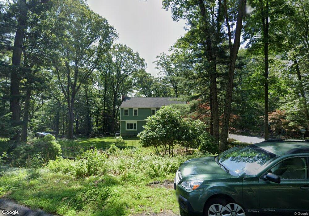
30 Long Ridge Rd Randolph, NJ 07869
Estimated Value: $805,000 - $914,000
--
Bed
--
Bath
2,363
Sq Ft
$368/Sq Ft
Est. Value
About This Home
This home is located at 30 Long Ridge Rd, Randolph, NJ 07869 and is currently estimated at $868,605, approximately $367 per square foot. 30 Long Ridge Rd is a home located in Morris County with nearby schools including Mount Tabor School, Brooklawn Middle School, and Parsippany Hills High School.
Ownership History
Date
Name
Owned For
Owner Type
Purchase Details
Closed on
May 27, 2010
Sold by
Rymer Timothy J and Rymer Meredith M
Bought by
Stone Paul and Stone Alethia
Current Estimated Value
Home Financials for this Owner
Home Financials are based on the most recent Mortgage that was taken out on this home.
Original Mortgage
$417,000
Outstanding Balance
$281,387
Interest Rate
5.11%
Mortgage Type
New Conventional
Estimated Equity
$587,218
Purchase Details
Closed on
Apr 7, 2006
Sold by
Marckmann Jules H
Bought by
Rymer Timothy and Rymer Meridith
Home Financials for this Owner
Home Financials are based on the most recent Mortgage that was taken out on this home.
Original Mortgage
$325,000
Interest Rate
6.37%
Create a Home Valuation Report for This Property
The Home Valuation Report is an in-depth analysis detailing your home's value as well as a comparison with similar homes in the area
Home Values in the Area
Average Home Value in this Area
Purchase History
| Date | Buyer | Sale Price | Title Company |
|---|---|---|---|
| Stone Paul | $555,000 | Prestige Title Agency Inc | |
| Rymer Timothy | $600,000 | -- |
Source: Public Records
Mortgage History
| Date | Status | Borrower | Loan Amount |
|---|---|---|---|
| Open | Stone Paul | $417,000 | |
| Previous Owner | Rymer Timothy | $325,000 |
Source: Public Records
Tax History Compared to Growth
Tax History
| Year | Tax Paid | Tax Assessment Tax Assessment Total Assessment is a certain percentage of the fair market value that is determined by local assessors to be the total taxable value of land and additions on the property. | Land | Improvement |
|---|---|---|---|---|
| 2025 | $15,838 | $455,900 | $273,900 | $182,000 |
| 2024 | $15,537 | $455,900 | $273,900 | $182,000 |
| 2023 | $15,537 | $455,900 | $273,900 | $182,000 |
| 2022 | $14,457 | $455,900 | $273,900 | $182,000 |
| 2021 | $14,457 | $455,900 | $273,900 | $182,000 |
| 2020 | $14,060 | $455,900 | $273,900 | $182,000 |
| 2019 | $13,682 | $455,900 | $273,900 | $182,000 |
| 2018 | $13,294 | $455,900 | $273,900 | $182,000 |
| 2017 | $12,993 | $455,900 | $273,900 | $182,000 |
| 2016 | $12,770 | $455,900 | $273,900 | $182,000 |
| 2015 | $12,446 | $455,900 | $273,900 | $182,000 |
| 2014 | $12,264 | $455,900 | $273,900 | $182,000 |
Source: Public Records
Map
Nearby Homes
- 160 W Hanover Ave
- 41 Beverly St
- 20 Longhill Rd
- 11 Hillcrest Dr
- 21 Puddingstone Rd
- 34 Starlight Dr
- 18 Rosewood Ln
- 4 Waterview Ln
- 44 Shongum Rd
- 6 Raleigh Ct
- 3 Springhill Rd
- 7 Drake Ct
- 22 Walt Whitman Trail
- 62 Smith Rd
- 58 Autumn Ridge Rd
- 41 Shongum Rd
- 44 Averell Dr
- 10 Campo Rd
- 2 Bickford Dr
- 6 Knoll Top Ct
- 28 Long Ridge Rd
- 32 Long Ridge Rd
- 29 Long Ridge Rd
- 27 Long Ridge Rd
- 31 Long Ridge Rd
- 26 Long Ridge Rd
- 34 Long Ridge Rd
- 25 Long Ridge Rd
- 25 High Ridge Rd
- 27 High Ridge Rd
- 23 High Ridge Rd
- 33 Long Ridge Rd
- 36 Long Ridge Rd
- 24 Long Ridge Rd
- 29 High Ridge Rd
- 23 Long Ridge Rd
- 21 High Ridge Rd
- 22 High Ridge Rd
- 37 Long Ridge Rd
- 31 High Ridge Rd