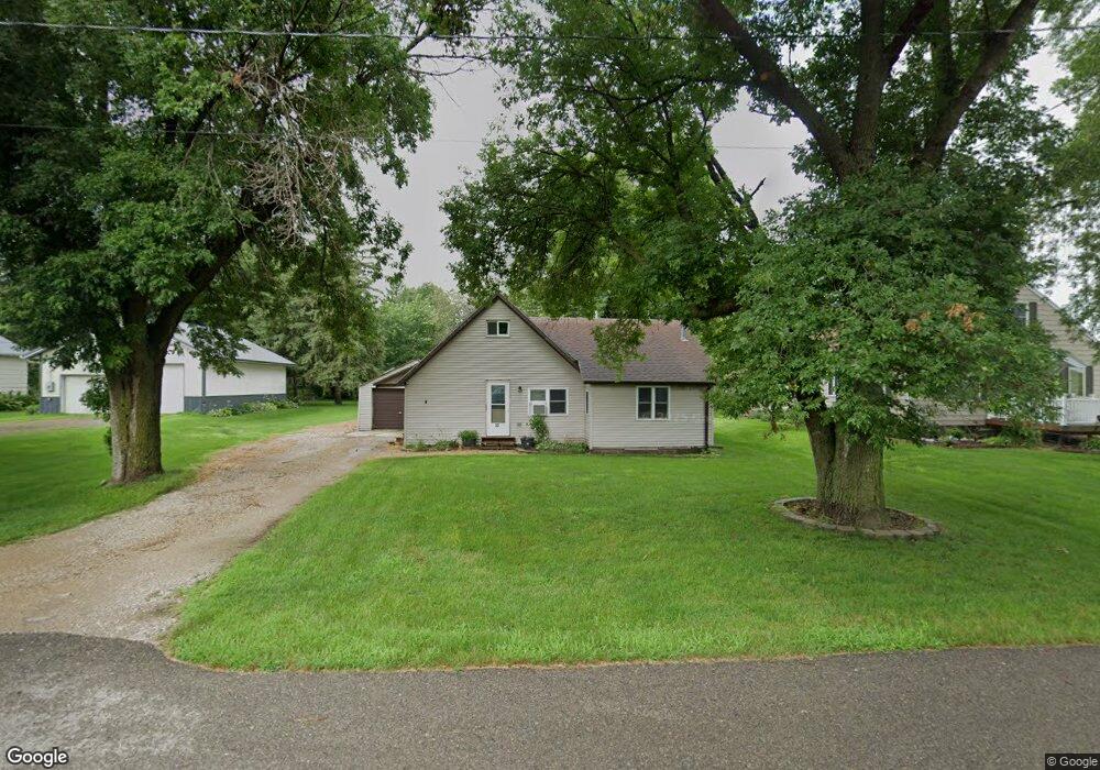
30 Maple St Conger, MN 56020
Estimated Value: $99,000 - $113,000
2
Beds
1
Bath
1,105
Sq Ft
$96/Sq Ft
Est. Value
About This Home
This home is located at 30 Maple St, Conger, MN 56020 and is currently estimated at $105,752, approximately $95 per square foot. 30 Maple St is a home located in Freeborn County with nearby schools including Alden-Conger Elementary School and Alden-Conger Secondary School.
Ownership History
Date
Name
Owned For
Owner Type
Purchase Details
Closed on
Jan 9, 2024
Sold by
Paulson Dylan
Bought by
Saxton Chase
Current Estimated Value
Purchase Details
Closed on
Apr 19, 2018
Sold by
Behle Joel Joel
Bought by
Paulson Dylan Dylan
Home Financials for this Owner
Home Financials are based on the most recent Mortgage that was taken out on this home.
Original Mortgage
$28,500
Interest Rate
4.46%
Create a Home Valuation Report for This Property
The Home Valuation Report is an in-depth analysis detailing your home's value as well as a comparison with similar homes in the area
Purchase History
| Date | Buyer | Sale Price | Title Company |
|---|---|---|---|
| Saxton Chase | $75,000 | -- | |
| Paulson Dylan Dylan | $31,500 | -- | |
| Paulson Dylan | $31,500 | None Available |
Source: Public Records
Mortgage History
| Date | Status | Borrower | Loan Amount |
|---|---|---|---|
| Previous Owner | Paulson Dylan Dylan | $28,500 |
Source: Public Records
Tax History
| Year | Tax Paid | Tax Assessment Tax Assessment Total Assessment is a certain percentage of the fair market value that is determined by local assessors to be the total taxable value of land and additions on the property. | Land | Improvement |
|---|---|---|---|---|
| 2025 | $1,304 | $85,700 | $8,700 | $77,000 |
| 2024 | $1,452 | $74,100 | $5,600 | $68,500 |
| 2023 | $1,288 | $48,400 | $5,600 | $42,800 |
| 2022 | $1,088 | $51,800 | $5,600 | $46,200 |
| 2021 | $1,102 | $34,500 | $5,600 | $28,900 |
| 2020 | $1,202 | $36,300 | $5,300 | $31,000 |
| 2019 | $1,200 | $34,500 | $5,300 | $29,200 |
| 2018 | $1,194 | $0 | $0 | $0 |
| 2016 | $1,228 | $0 | $0 | $0 |
| 2015 | $890 | $0 | $0 | $0 |
| 2014 | $894 | $0 | $0 | $0 |
| 2012 | $886 | $0 | $0 | $0 |
Source: Public Records
Map
Nearby Homes
- 16612 670th Ave
- 15742 675th Ave
- 19908 650th Ave
- 304 S Broadway
- 136 1st Ave W
- 201 Euclid St
- 245 N Broadway
- S N Broadway
- 146 Washington Ave
- 119 Hall Ln
- 236 Wilson St
- 22598 700th Ave
- 23371 650th Ave
- 15592 720th Ave
- 21824 Douglas Ave
- 135th Street
- 2330 W 9th St
- 2334 W 9th St
- 2313 W 9th St
- 808 Lake Chapeau Dr Unit 108
Your Personal Tour Guide
Ask me questions while you tour the home.