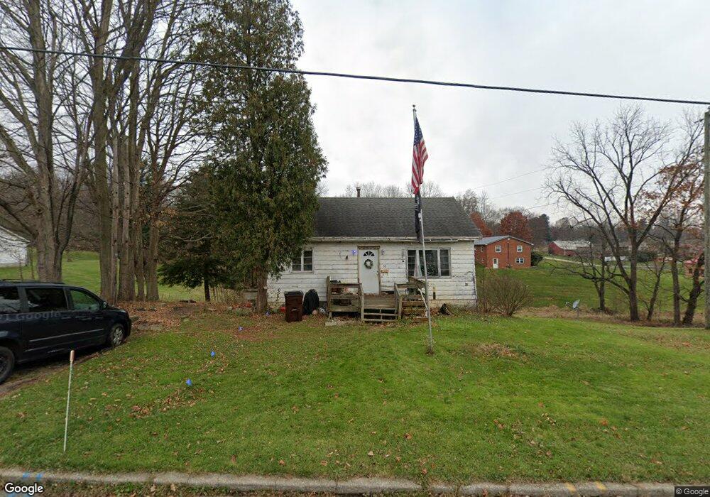
30 Maple St Mansfield, OH 44904
Estimated Value: $122,969 - $147,000
2
Beds
1
Bath
768
Sq Ft
$174/Sq Ft
Est. Value
About This Home
This home is located at 30 Maple St, Mansfield, OH 44904 and is currently estimated at $133,742, approximately $174 per square foot. 30 Maple St is a home located in Richland County with nearby schools including Lexington High School, Grace Christian School, and Mansfield Seventh-day Adventist School.
Ownership History
Date
Name
Owned For
Owner Type
Purchase Details
Closed on
Sep 18, 2024
Sold by
Simpson Homes Llc
Bought by
Stelliot Properties Llc
Current Estimated Value
Home Financials for this Owner
Home Financials are based on the most recent Mortgage that was taken out on this home.
Original Mortgage
$126,320
Outstanding Balance
$123,124
Interest Rate
6.47%
Mortgage Type
New Conventional
Estimated Equity
$10,618
Purchase Details
Closed on
Oct 3, 2023
Sold by
Reed Helen
Bought by
Simpson Homes Llc
Purchase Details
Closed on
Dec 15, 2020
Sold by
Estate Of Robert Earl Reed
Bought by
Reed Helen
Create a Home Valuation Report for This Property
The Home Valuation Report is an in-depth analysis detailing your home's value as well as a comparison with similar homes in the area
Home Values in the Area
Average Home Value in this Area
Purchase History
| Date | Buyer | Sale Price | Title Company |
|---|---|---|---|
| Stelliot Properties Llc | $157,900 | None Listed On Document | |
| Simpson Homes Llc | -- | Empofta Title | |
| Reed Helen | -- | None Available |
Source: Public Records
Mortgage History
| Date | Status | Borrower | Loan Amount |
|---|---|---|---|
| Open | Stelliot Properties Llc | $126,320 |
Source: Public Records
Tax History
| Year | Tax Paid | Tax Assessment Tax Assessment Total Assessment is a certain percentage of the fair market value that is determined by local assessors to be the total taxable value of land and additions on the property. | Land | Improvement |
|---|---|---|---|---|
| 2024 | $1,506 | $26,960 | $9,300 | $17,660 |
| 2023 | $1,473 | $26,960 | $9,300 | $17,660 |
| 2022 | $1,369 | $21,460 | $8,200 | $13,260 |
| 2021 | $1,374 | $21,460 | $8,200 | $13,260 |
| 2020 | $1,375 | $21,460 | $8,200 | $13,260 |
| 2019 | $1,248 | $17,820 | $6,810 | $11,010 |
| 2018 | $552 | $17,820 | $6,810 | $11,010 |
| 2017 | $546 | $17,820 | $6,810 | $11,010 |
| 2016 | $485 | $16,630 | $6,120 | $10,510 |
| 2015 | $485 | $16,630 | $6,120 | $10,510 |
| 2014 | $469 | $16,630 | $6,120 | $10,510 |
| 2012 | $237 | $17,150 | $6,310 | $10,840 |
Source: Public Records
Map
Nearby Homes
Your Personal Tour Guide
Ask me questions while you tour the home.