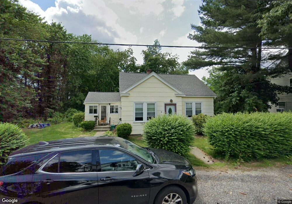
30 Marcius Rd Worcester, MA 01607
Broadmeadow Brook NeighborhoodEstimated Value: $310,000 - $337,763
3
Beds
1
Bath
1,008
Sq Ft
$322/Sq Ft
Est. Value
About This Home
This home is located at 30 Marcius Rd, Worcester, MA 01607 and is currently estimated at $324,441, approximately $321 per square foot. 30 Marcius Rd is a home located in Worcester County with nearby schools including Quinsigamond School, Jacob Hiatt Magnet School, and Chandler Magnet.
Ownership History
Date
Name
Owned For
Owner Type
Purchase Details
Closed on
Jan 27, 2026
Sold by
Barrett Linda Est and Gentile
Bought by
Gentile Brenda
Current Estimated Value
Purchase Details
Closed on
Mar 9, 2011
Sold by
Zybas Anna
Bought by
Barrett William F and Barrett Linda M
Home Financials for this Owner
Home Financials are based on the most recent Mortgage that was taken out on this home.
Original Mortgage
$80,000
Interest Rate
4.83%
Mortgage Type
Purchase Money Mortgage
Create a Home Valuation Report for This Property
The Home Valuation Report is an in-depth analysis detailing your home's value as well as a comparison with similar homes in the area
Home Values in the Area
Average Home Value in this Area
Purchase History
| Date | Buyer | Sale Price | Title Company |
|---|---|---|---|
| Gentile Brenda | -- | -- | |
| Barrett William F | $100,000 | -- |
Source: Public Records
Mortgage History
| Date | Status | Borrower | Loan Amount |
|---|---|---|---|
| Previous Owner | Barrett William F | $80,000 |
Source: Public Records
Tax History
| Year | Tax Paid | Tax Assessment Tax Assessment Total Assessment is a certain percentage of the fair market value that is determined by local assessors to be the total taxable value of land and additions on the property. | Land | Improvement |
|---|---|---|---|---|
| 2025 | $2,928 | $222,000 | $118,400 | $103,600 |
| 2024 | $2,930 | $213,100 | $118,400 | $94,700 |
| 2023 | $2,760 | $192,500 | $103,000 | $89,500 |
| 2022 | $2,470 | $162,400 | $82,400 | $80,000 |
| 2021 | $2,398 | $147,300 | $65,900 | $81,400 |
| 2020 | $2,475 | $145,600 | $65,900 | $79,700 |
| 2019 | $2,437 | $135,400 | $59,300 | $76,100 |
| 2018 | $2,470 | $130,600 | $59,300 | $71,300 |
| 2017 | $2,376 | $123,600 | $59,300 | $64,300 |
| 2016 | $2,263 | $109,800 | $43,400 | $66,400 |
| 2015 | $2,204 | $109,800 | $43,400 | $66,400 |
| 2014 | $2,136 | $109,300 | $43,400 | $65,900 |
Source: Public Records
Map
Nearby Homes
- 457 Granite St
- 464-466 Granite St
- 460-462 Granite St
- 460-466 Granite St
- 300 Millbury Ave
- 2 Mystic St
- 47 Gibbs St
- 25 Upton St
- 2 Wilson Rd Unit B
- 2 Wilson Rd Unit A
- 557 SW Cutoff Unit 55
- 557 SW Cutoff Unit 17
- 3 Julien Ave
- 30 Ekman St
- 29 Steele St
- 8 Nightview Place
- 4 Stockholm St
- 2 Diane St
- 6 Beckman St
- 266 Massasoit Rd
Your Personal Tour Guide
Ask me questions while you tour the home.