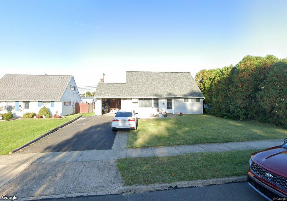
30 Margin Rd Levittown, PA 19056
Mill Creek Falls NeighborhoodEstimated Value: $346,657 - $365,000
3
Beds
2
Baths
1,238
Sq Ft
$288/Sq Ft
Est. Value
About This Home
This home is located at 30 Margin Rd, Levittown, PA 19056 and is currently estimated at $356,414, approximately $287 per square foot. 30 Margin Rd is a home located in Bucks County with nearby schools including Truman Senior High School, First Presbyterian Church School, and Emilie Christian Day School.
Ownership History
Date
Name
Owned For
Owner Type
Purchase Details
Closed on
Nov 9, 1993
Bought by
Woodall Daniel E and Ardie Louise
Current Estimated Value
Create a Home Valuation Report for This Property
The Home Valuation Report is an in-depth analysis detailing your home's value as well as a comparison with similar homes in the area
Home Values in the Area
Average Home Value in this Area
Purchase History
| Date | Buyer | Sale Price | Title Company |
|---|---|---|---|
| Woodall Daniel E | -- | -- |
Source: Public Records
Tax History
| Year | Tax Paid | Tax Assessment Tax Assessment Total Assessment is a certain percentage of the fair market value that is determined by local assessors to be the total taxable value of land and additions on the property. | Land | Improvement |
|---|---|---|---|---|
| 2025 | $4,562 | $16,800 | $3,960 | $12,840 |
| 2024 | $4,562 | $16,800 | $3,960 | $12,840 |
| 2023 | $4,529 | $16,800 | $3,960 | $12,840 |
| 2022 | $4,529 | $16,800 | $3,960 | $12,840 |
| 2021 | $4,529 | $16,800 | $3,960 | $12,840 |
| 2020 | $4,529 | $16,800 | $3,960 | $12,840 |
| 2019 | $4,512 | $16,800 | $3,960 | $12,840 |
| 2018 | $4,439 | $16,800 | $3,960 | $12,840 |
| 2017 | $4,372 | $16,800 | $3,960 | $12,840 |
| 2016 | $4,372 | $16,800 | $3,960 | $12,840 |
| 2015 | $3,117 | $16,800 | $3,960 | $12,840 |
| 2014 | $3,117 | $16,800 | $3,960 | $12,840 |
Source: Public Records
Map
Nearby Homes
- 28 Macintosh Rd
- 111 Border Rock Rd
- 43 Petunia Rd
- 238 Colette Ct Unit 1311
- 35 Beechtree Rd
- 137 Idlewild Rd
- 2 Michele Ct
- 145 Mill Dr
- 3000 Butler Ave
- 2715 Crest Ave
- 1019 Green Ln
- 86 Wildflower Rd
- 122 Ivy Hill Rd
- 2519 Woodlawn Dr
- 5 June Rd
- 18 Jump Hill Rd
- 118 Wildflower Rd
- 2416 Fleetwing Dr
- 56 Indian Red Rd
- 45 Indian Creek Entry