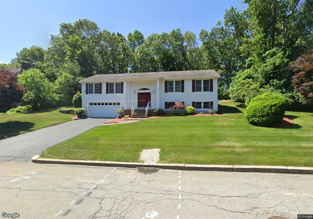
30 Mark Dr Lincoln, RI 02865
Marieville NeighborhoodEstimated Value: $633,000 - $711,000
3
Beds
3
Baths
1,771
Sq Ft
$371/Sq Ft
Est. Value
About This Home
This home is located at 30 Mark Dr, Lincoln, RI 02865 and is currently estimated at $656,199, approximately $370 per square foot. 30 Mark Dr is a home located in Providence County with nearby schools including Lincoln Senior High School, Blackstone Valley Prep Upper Elementary School, and Blackstone Valley Prep Junior High School.
Ownership History
Date
Name
Owned For
Owner Type
Purchase Details
Closed on
Dec 24, 2012
Sold by
Liberatore Domenic J and Liberatore Carol A
Bought by
Liberatore Tr Domenic J
Current Estimated Value
Purchase Details
Closed on
May 3, 1989
Sold by
Prestige Bldrs Inc
Bought by
Liberatore Domenic J
Home Financials for this Owner
Home Financials are based on the most recent Mortgage that was taken out on this home.
Original Mortgage
$30,000
Interest Rate
11.13%
Mortgage Type
Purchase Money Mortgage
Create a Home Valuation Report for This Property
The Home Valuation Report is an in-depth analysis detailing your home's value as well as a comparison with similar homes in the area
Home Values in the Area
Average Home Value in this Area
Purchase History
| Date | Buyer | Sale Price | Title Company |
|---|---|---|---|
| Liberatore Tr Domenic J | -- | -- | |
| Liberatore Domenic J | $201,000 | -- |
Source: Public Records
Mortgage History
| Date | Status | Borrower | Loan Amount |
|---|---|---|---|
| Open | Liberatore Domenic J | $18,000 | |
| Previous Owner | Liberatore Domenic J | $30,000 |
Source: Public Records
Tax History Compared to Growth
Tax History
| Year | Tax Paid | Tax Assessment Tax Assessment Total Assessment is a certain percentage of the fair market value that is determined by local assessors to be the total taxable value of land and additions on the property. | Land | Improvement |
|---|---|---|---|---|
| 2025 | $7,474 | $552,800 | $152,300 | $400,500 |
| 2024 | $7,419 | $427,600 | $141,300 | $286,300 |
| 2023 | $7,051 | $427,600 | $141,300 | $286,300 |
| 2022 | $7,034 | $427,600 | $141,300 | $286,300 |
| 2021 | $7,183 | $354,000 | $121,900 | $232,100 |
| 2020 | $7,130 | $354,000 | $121,900 | $232,100 |
| 2018 | $6,846 | $306,300 | $117,300 | $189,000 |
| 2017 | $6,708 | $306,300 | $117,300 | $189,000 |
| 2016 | $6,616 | $306,300 | $117,300 | $189,000 |
| 2015 | $6,410 | $272,400 | $106,200 | $166,200 |
| 2014 | $6,420 | $272,400 | $106,200 | $166,200 |
Source: Public Records
Map
Nearby Homes
- 101 Cobble Hill Rd
- 0 Martha St
- 2 Cobble Hill Rd
- 1190 Charles St Unit 20
- 1190 Charles St Unit 12
- 27 Gillen Ave Unit 205A
- 36 Cooper St
- 199 Morris Ave
- 4 Orford St
- 48 Cleveland St
- 15 Bassett St
- 21 Orford St
- 123 Francis Ave
- 8 Arnold Ave
- 1111 Charles St
- 149 Oakdale Ave
- 3 Arnold Ave
- 102 Francis Ave
- 136 Samuel Ave
- 132 Hobson Ave
- 32 Mark Dr
- 28 Mark Dr
- 18 Heritage Dr
- 4 Kerry Ln
- 26 Mark Dr
- 37 Mark Dr
- 109 Manchester Farm Rd
- 33 Mark Dr
- 34 Mark Dr
- 107 Manchester Farm Rd
- 105 Manchester Farm Rd
- 111 Manchester Farm Rd
- 31 Mark Dr
- 19 Heritage Dr
- 41 Mark Dr
- 103 Manchester Farm Rd
- 36 Mark Dr
- 115 Manchester Farm Rd
- 12 Heritage Dr
- 108 Manchester Farm Rd