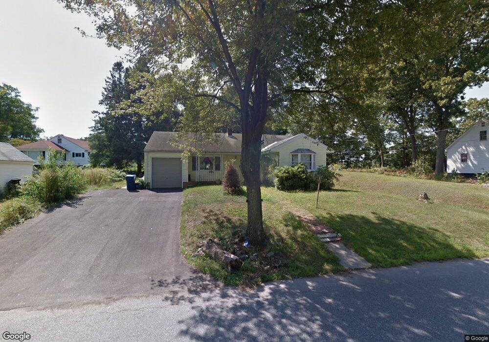
30 Marlboro St Lawrence, MA 01843
Colonial Heights NeighborhoodEstimated Value: $509,000 - $616,000
3
Beds
1
Bath
1,429
Sq Ft
$387/Sq Ft
Est. Value
About This Home
This home is located at 30 Marlboro St, Lawrence, MA 01843 and is currently estimated at $552,463, approximately $386 per square foot. 30 Marlboro St is a home located in Essex County with nearby schools including Vardaman Elementary School, Olive Branch Elementary School, and Rowan Elementary School.
Ownership History
Date
Name
Owned For
Owner Type
Purchase Details
Closed on
Jun 6, 2018
Sold by
Mencia Isai C and Mencia Gladys M
Bought by
Mencia Gladys M
Current Estimated Value
Purchase Details
Closed on
Sep 17, 1993
Sold by
Community Sb
Bought by
Mencia Isai
Home Financials for this Owner
Home Financials are based on the most recent Mortgage that was taken out on this home.
Original Mortgage
$76,000
Interest Rate
7.16%
Mortgage Type
Purchase Money Mortgage
Purchase Details
Closed on
Jul 15, 1988
Sold by
Marlboro Ctry Rt
Bought by
Scott Patrick
Create a Home Valuation Report for This Property
The Home Valuation Report is an in-depth analysis detailing your home's value as well as a comparison with similar homes in the area
Home Values in the Area
Average Home Value in this Area
Purchase History
| Date | Buyer | Sale Price | Title Company |
|---|---|---|---|
| Mencia Gladys M | -- | -- | |
| Mencia Isai | $80,000 | -- | |
| Mencia Isai | $80,000 | -- | |
| Scott Patrick | $170,000 | -- |
Source: Public Records
Mortgage History
| Date | Status | Borrower | Loan Amount |
|---|---|---|---|
| Previous Owner | Scott Patrick | $20,000 | |
| Previous Owner | Scott Patrick | $20,000 | |
| Previous Owner | Scott Patrick | $76,000 |
Source: Public Records
Tax History Compared to Growth
Tax History
| Year | Tax Paid | Tax Assessment Tax Assessment Total Assessment is a certain percentage of the fair market value that is determined by local assessors to be the total taxable value of land and additions on the property. | Land | Improvement |
|---|---|---|---|---|
| 2025 | $3,935 | $447,200 | $150,500 | $296,700 |
| 2024 | $3,725 | $402,700 | $131,800 | $270,900 |
| 2023 | $3,909 | $384,700 | $131,800 | $252,900 |
| 2022 | $3,740 | $326,900 | $117,500 | $209,400 |
| 2021 | $3,469 | $282,700 | $113,700 | $169,000 |
| 2020 | $3,243 | $260,900 | $97,400 | $163,500 |
| 2019 | $3,364 | $245,900 | $101,100 | $144,800 |
| 2018 | $3,175 | $221,700 | $99,200 | $122,500 |
| 2017 | $3,246 | $211,600 | $105,000 | $106,600 |
| 2016 | $2,868 | $184,900 | $75,000 | $109,900 |
| 2015 | $2,644 | $174,900 | $65,000 | $109,900 |
Source: Public Records
Map
Nearby Homes
- 5 Lafayette Ave
- 24 Inman St Unit 32
- 27-29 Dorchester St
- 437 N Main St Unit C
- 356-360 S Union St
- 31 Garfield St
- 34 Leeds Terrace
- 102 Weare St
- 5 W Kenneth St
- 11 W Hawley St
- 91 Farnham St
- 78-80 Osgood St
- 33 Jefferson St
- 67-69 Osgood St
- 57 Glenwood St
- 49 Bowdoin St Unit 51
- 42 Beresford St
- 77-79 Shawsheen Rd
- 19 Front St
- 64 Salem St
- 28 Marlboro St
- 300 Colonial Rd
- 24 Marlboro St
- 292 Colonial Rd
- 31 Marlboro St
- 22 Marlboro St
- 29 Marlboro St
- 39 Marlboro St
- 27 Marlboro St
- 20 Marlboro St
- 30 Lynn St Unit 34
- 280 Colonial Rd
- 608 S Union St Unit B
- 608 S Union St
- 25 Marlboro St
- 37 Marlboro St
- 26 Lynn St
- 301 Colonial Rd
- 24 Lynn St
- 291 Colonial Rd