
Seller's Agent in 2025
William Thompson
Keller Williams Elite
(774) 280-5764
54 in this area
212 Total Sales
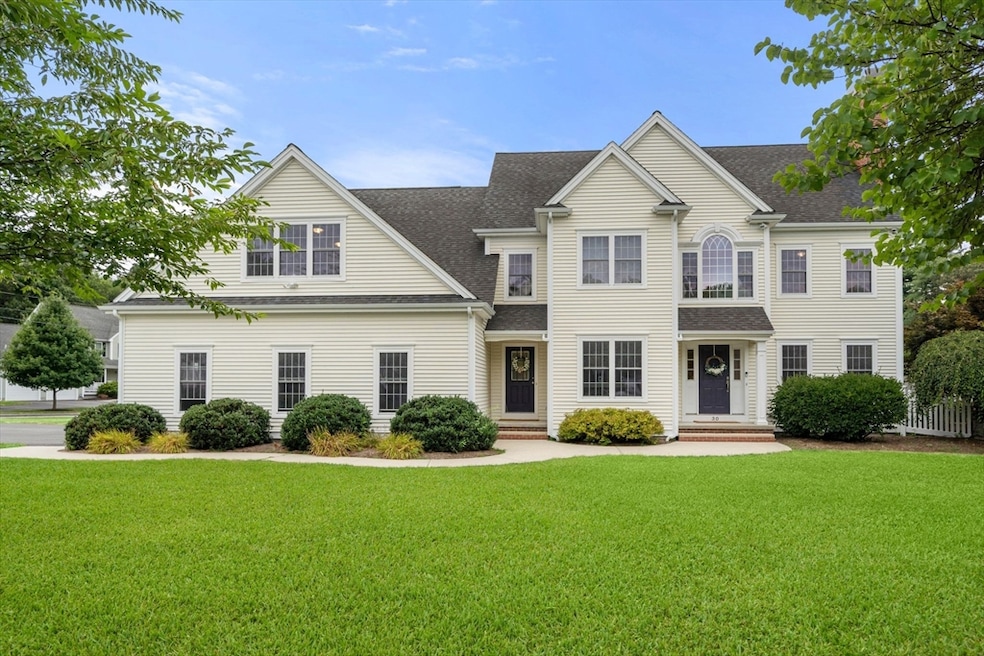
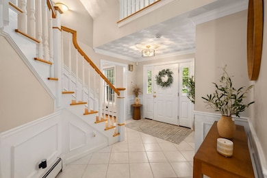
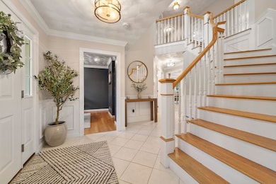
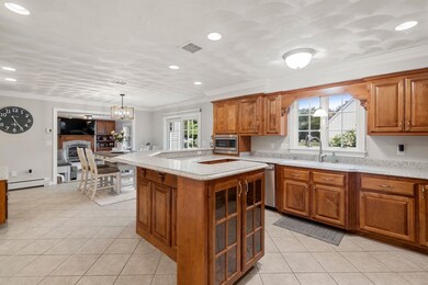
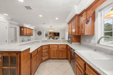
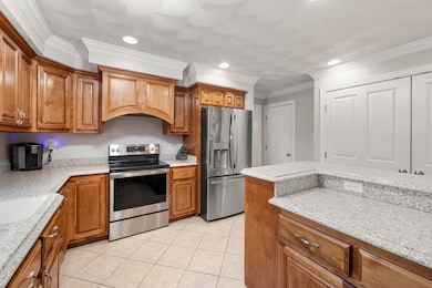
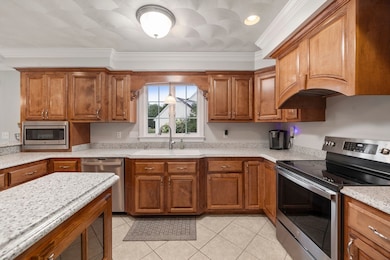
A MUST-SEE! Tucked away on a serene cul-de-sac, this stunning 5 bedroom, 3.5 bath home is filled with space, style, and luxury upgrades including radiant heated tile floors and a whole house air filtration system. The first floor offers a comfortable living room, generous sunken family room, elegant dining room, bright home office, and half bath. The chef’s kitchen features a large island, custom cabinetry, and direct access to the oversized wrap-around deck, perfect for entertaining. Upstairs, the expansive primary suite impresses with a sitting area, walk-in closet, laundry room, and spa-like bath with jacuzzi tub. Three additional bedrooms and another full bath complete the second floor. The spacious partially finished basement with direct garage access offers endless possibilities, while the walk-up attic provides even more room for future expansion. With abundant living space, thoughtful upgrades, and a peaceful location, this home is truly special. You don't want to miss it!
| Date | Type | Sale Price | Title Company |
|---|---|---|---|
| Quit Claim Deed | $1,030,000 | -- | |
| Quit Claim Deed | $959,000 | None Available | |
| Quit Claim Deed | -- | None Available | |
| Quit Claim Deed | -- | None Available | |
| Deed | $85,000 | -- | |
| Deed | $85,000 | -- | |
| Deed | $85,000 | -- | |
| Deed | $85,000 | -- |
| Date | Status | Loan Amount | Loan Type |
|---|---|---|---|
| Open | $721,000 | New Conventional | |
| Previous Owner | $671,300 | Purchase Money Mortgage | |
| Previous Owner | $350,000 | No Value Available |
| Date | Event | Price | List to Sale | Price per Sq Ft |
|---|---|---|---|---|
| 12/05/2025 12/05/25 | Sold | $1,030,000 | 0.0% | $247 / Sq Ft |
| 11/11/2025 11/11/25 | Pending | -- | -- | -- |
| 11/10/2025 11/10/25 | For Sale | $1,030,000 | -- | $247 / Sq Ft |
| Year | Tax Paid | Tax Assessment Tax Assessment Total Assessment is a certain percentage of the fair market value that is determined by local assessors to be the total taxable value of land and additions on the property. | Land | Improvement |
|---|---|---|---|---|
| 2025 | $10,961 | $873,400 | $189,100 | $684,300 |
| 2024 | $10,863 | $853,300 | $207,900 | $645,400 |
| 2023 | $9,693 | $708,000 | $182,500 | $525,500 |
| 2022 | $9,024 | $624,500 | $161,300 | $463,200 |
| 2021 | $8,843 | $597,500 | $155,100 | $442,400 |
| 2020 | $8,424 | $578,600 | $147,100 | $431,500 |
| 2019 | $8,226 | $580,900 | $144,300 | $436,600 |
| 2018 | $7,884 | $532,000 | $140,100 | $391,900 |
| 2017 | $7,826 | $537,900 | $145,700 | $392,200 |
| 2016 | $7,346 | $495,700 | $120,300 | $375,400 |
| 2015 | $7,102 | $482,800 | $120,300 | $362,500 |
| 2014 | $7,024 | $473,000 | $115,100 | $357,900 |
Seller's Agent in 2025
William Thompson
Keller Williams Elite
(774) 280-5764
54 in this area
212 Total Sales
Source: MLS Property Information Network (MLS PIN)
MLS Number: 73453407
APN: ATTL-000137-000000-000002-X000000
Disclaimer: Certain information contained herein is derived from information provided by parties other than Homes.com. All information provided is deemed reliable, but is not guaranteed to be accurate and should be independently verified.
![]() The property listing data and information, or the Images, set forth herein were provided to MLS Property Information Network, Inc. from third party sources, including sellers, lessors and public records, and were compiled by MLS Property Information Network, Inc. The property listing data and information, and the Images, are for the personal, non-commercial use of consumers having a good faith interest in purchasing or leasing listed properties of the type displayed to them and may not be used for any purpose other than to identify prospective properties which such consumers may have a good faith interest in purchasing or leasing. MLS Property Information Network, Inc. and its subscribers disclaim any and all representations and warranties as to the accuracy of the property listing data and information, or as to the accuracy of any of the Images, set forth herein.
The property listing data and information, or the Images, set forth herein were provided to MLS Property Information Network, Inc. from third party sources, including sellers, lessors and public records, and were compiled by MLS Property Information Network, Inc. The property listing data and information, and the Images, are for the personal, non-commercial use of consumers having a good faith interest in purchasing or leasing listed properties of the type displayed to them and may not be used for any purpose other than to identify prospective properties which such consumers may have a good faith interest in purchasing or leasing. MLS Property Information Network, Inc. and its subscribers disclaim any and all representations and warranties as to the accuracy of the property listing data and information, or as to the accuracy of any of the Images, set forth herein.
Ask me questions while you tour the home.