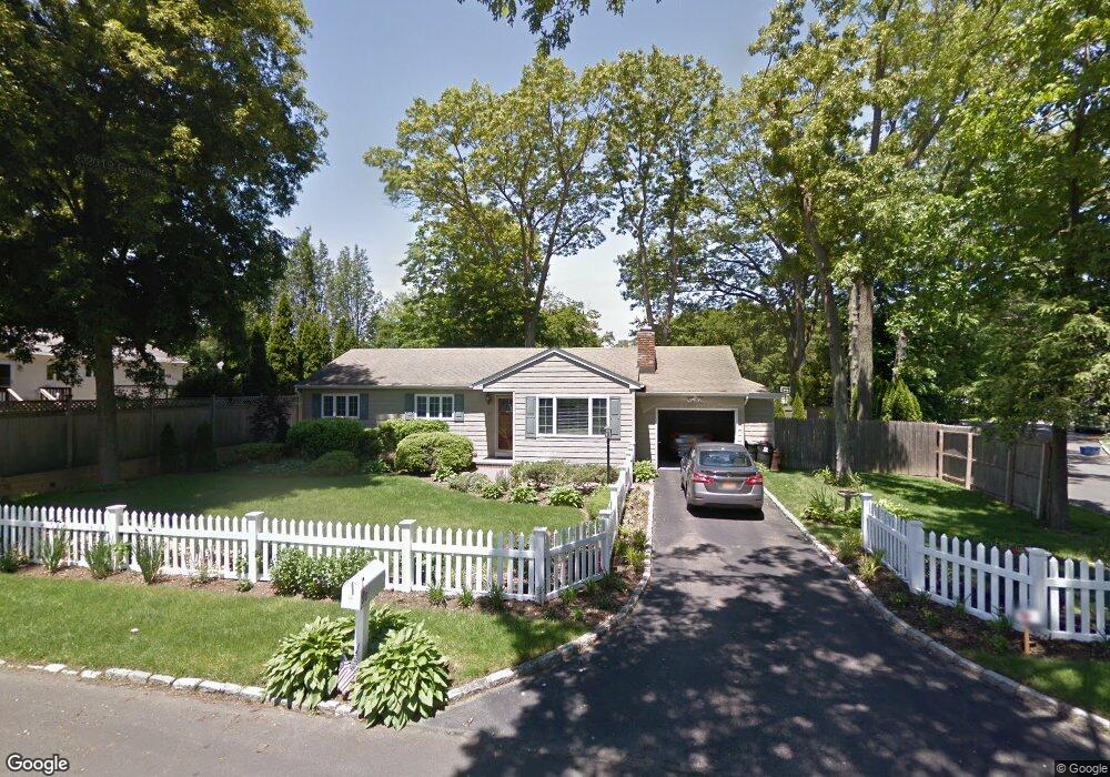
30 Mohawk St Centerport, NY 11721
Estimated Value: $664,000 - $777,000
2
Beds
2
Baths
--
Sq Ft
9,148
Sq Ft Lot
About This Home
This home is located at 30 Mohawk St, Centerport, NY 11721 and is currently estimated at $727,625. 30 Mohawk St is a home located in Suffolk County with nearby schools including Washington Drive Primary School, Thomas J Lahey Elementary School, and Oldfield Middle School.
Ownership History
Date
Name
Owned For
Owner Type
Purchase Details
Closed on
Sep 19, 2008
Sold by
Harvey Louise
Bought by
Roderik Alafis B
Current Estimated Value
Purchase Details
Closed on
May 7, 2007
Purchase Details
Closed on
May 23, 2005
Purchase Details
Closed on
Feb 28, 2003
Sold by
Forman Anne C and Forman David S
Bought by
Forman Anne
Home Financials for this Owner
Home Financials are based on the most recent Mortgage that was taken out on this home.
Original Mortgage
$270,000
Interest Rate
5.82%
Purchase Details
Closed on
Jun 17, 2002
Sold by
Forman Anne C
Bought by
Forman David S and Harvey Laurie
Purchase Details
Closed on
Dec 14, 1995
Sold by
Forman David
Bought by
Forman Anne C
Create a Home Valuation Report for This Property
The Home Valuation Report is an in-depth analysis detailing your home's value as well as a comparison with similar homes in the area
Home Values in the Area
Average Home Value in this Area
Purchase History
| Date | Buyer | Sale Price | Title Company |
|---|---|---|---|
| Roderik Alafis B | $449,000 | Robert Bridges | |
| -- | -- | -- | |
| -- | -- | -- | |
| Forman Anne | -- | -- | |
| Forman Anne C | -- | -- | |
| Forman David S | -- | Commonwealth Land Title Ins | |
| Forman Anne C | -- | First American Title Ins Co |
Source: Public Records
Mortgage History
| Date | Status | Borrower | Loan Amount |
|---|---|---|---|
| Previous Owner | Forman Anne C | $270,000 |
Source: Public Records
Tax History Compared to Growth
Tax History
| Year | Tax Paid | Tax Assessment Tax Assessment Total Assessment is a certain percentage of the fair market value that is determined by local assessors to be the total taxable value of land and additions on the property. | Land | Improvement |
|---|---|---|---|---|
| 2024 | $12,368 | $2,925 | $125 | $2,800 |
| 2023 | $6,184 | $2,925 | $125 | $2,800 |
| 2022 | $11,969 | $2,925 | $125 | $2,800 |
| 2021 | $11,820 | $2,925 | $125 | $2,800 |
| 2020 | $11,613 | $2,925 | $125 | $2,800 |
| 2019 | $23,226 | $0 | $0 | $0 |
| 2018 | $11,062 | $2,925 | $125 | $2,800 |
| 2017 | $11,062 | $2,925 | $125 | $2,800 |
| 2016 | $10,866 | $2,925 | $125 | $2,800 |
| 2015 | -- | $2,925 | $125 | $2,800 |
| 2014 | -- | $2,925 | $125 | $2,800 |
Source: Public Records
Map
Nearby Homes
- 74 Tuscarora Dr
- 349 E Main St
- 0 E Main St
- 111 Van Buren Dr
- 176 Hoover Place
- 390 E Main St
- 39 Fleets Cove Rd
- 10 Courtyard Cir
- 45 Forest Dr
- 54 Bankside Dr
- 20 Cranbrook Ct
- 315 Mckinley Terrace
- 115 Taft Crescent
- 69 Bankside Dr
- 1000 Washington Dr
- 37 Salem Ridge Dr
- 1025 Harrison Dr
- 1014 Washington Dr
- 14 Thorman Ln
- 9 Flower Hill Ct