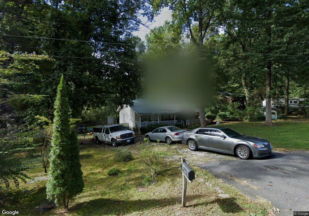
30 Mountainside Dr E Dawsonville, GA 30534
Estimated Value: $154,000 - $291,000
3
Beds
2
Baths
1,040
Sq Ft
$231/Sq Ft
Est. Value
About This Home
This home is located at 30 Mountainside Dr E, Dawsonville, GA 30534 and is currently estimated at $240,012, approximately $230 per square foot. 30 Mountainside Dr E is a home with nearby schools including Kilough Elementary School, Dawson County Junior High School, and Dawson County Middle School.
Ownership History
Date
Name
Owned For
Owner Type
Purchase Details
Closed on
Oct 22, 2013
Sold by
Sheffield Johnnie
Bought by
Blalock Norman and Blalock Kathy
Current Estimated Value
Purchase Details
Closed on
Sep 13, 2004
Sold by
Kuter Henry Donald
Bought by
Sheffield Tommy and Sheffield Johnnie
Purchase Details
Closed on
Apr 19, 2004
Sold by
Sheffield Tommy and Sheffield Johnnie
Bought by
Secretary Of Housing & Urban Developemen
Purchase Details
Closed on
Jan 29, 2001
Sold by
Lively Mica L
Bought by
Kuter Henry Donald
Purchase Details
Closed on
Jan 14, 1998
Sold by
Allinger Craig
Bought by
Lively John J and Lively Mica
Purchase Details
Closed on
Sep 27, 1996
Bought by
Moss D W
Create a Home Valuation Report for This Property
The Home Valuation Report is an in-depth analysis detailing your home's value as well as a comparison with similar homes in the area
Home Values in the Area
Average Home Value in this Area
Purchase History
| Date | Buyer | Sale Price | Title Company |
|---|---|---|---|
| Blalock Norman | $50,000 | -- | |
| Sheffield Tommy | -- | -- | |
| Secretary Of Housing & Urban Developemen | -- | -- | |
| Wells Fargo Home Mortgage As Attorny-In- | -- | -- | |
| Kuter Henry Donald | $92,600 | -- | |
| Lively Mica L | -- | -- | |
| Lively John J | $63,300 | -- | |
| Moss D W | -- | -- |
Source: Public Records
Tax History Compared to Growth
Tax History
| Year | Tax Paid | Tax Assessment Tax Assessment Total Assessment is a certain percentage of the fair market value that is determined by local assessors to be the total taxable value of land and additions on the property. | Land | Improvement |
|---|---|---|---|---|
| 2024 | $1,200 | $73,024 | $14,000 | $59,024 |
| 2023 | $1,305 | $79,424 | $14,000 | $65,424 |
| 2022 | $1,297 | $60,536 | $14,000 | $46,536 |
| 2021 | $1,121 | $49,544 | $14,000 | $35,544 |
| 2020 | $1,156 | $48,864 | $14,000 | $34,864 |
| 2019 | $989 | $41,424 | $14,000 | $27,424 |
| 2018 | $991 | $41,424 | $14,000 | $27,424 |
| 2017 | $728 | $30,450 | $8,000 | $22,450 |
| 2016 | $716 | $29,955 | $8,000 | $21,955 |
| 2015 | $615 | $24,923 | $7,360 | $17,563 |
| 2014 | $510 | $22,374 | $6,800 | $15,574 |
| 2013 | -- | $18,602 | $5,600 | $13,002 |
Source: Public Records
Map
Nearby Homes
- 22 Springleaf Way
- 31 Briarwood Dr W
- Hampstead Plan at Creekside
- Pearson Plan at Creekside
- 165 Foxhill Dr
- Savoy Plan at Creekside
- 175 Foxhill Dr
- 57 Toto Dr
- 56 Knollwood Ct
- 10 Knollwood Ct
- 75 Stoneridge Ct
- 145 Dogwood Way
- 147 Blue Heron Bluff
- 94 Dawson Dr
- 75 Night Fire Ln
- 87 Carsons Creek Dr
- 1619 Price Rd
- 0 Auraria Rd Unit 10646579
- 0 Auraria Rd Unit 7683543
- 503 Night Fire Dr
- 10 Mountainside Dr E
- 64 Mountainside Dr E
- 64 Mountainside Dr E Unit 13
- 107 Mountain Side Dr E
- 148 Mountain Side Dr E
- 98 Mountainside Dr E
- 11 Mountainside Dr E
- 98 Mountain Side Dr E
- 11 Mountainside Dr W
- 174 Mountainside Dr E
- 39 Mountainside Dr E
- 65 Mountainside Dr E
- 26 Mountainside Dr W
- 173 Mtn Side Dr
- 173 Mountainside Dr E
- 83 Mountainside Dr E
- 33 Mountainside Dr W
- 261 Moss Rd
- 107 Mountainside Dr E
- 260 Moss Rd