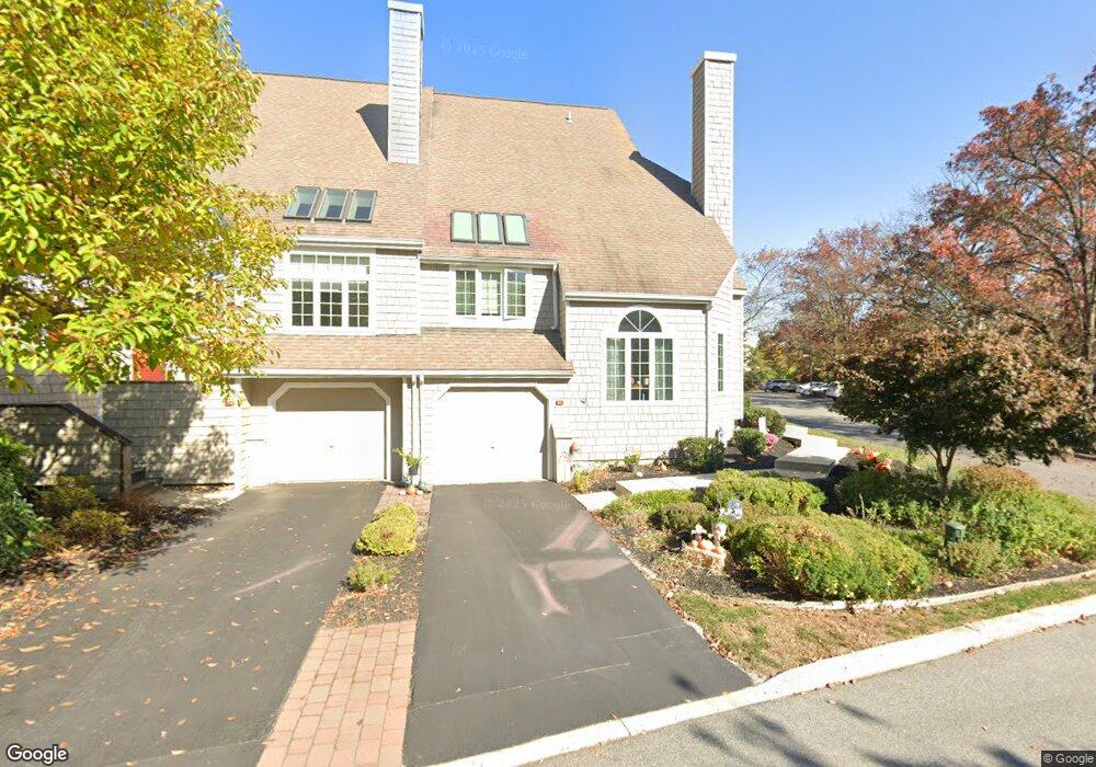
30 Newport Dr Chesterbrook, PA 19087
Estimated Value: $681,023 - $783,000
3
Beds
2
Baths
2,528
Sq Ft
$293/Sq Ft
Est. Value
About This Home
This home is located at 30 Newport Dr, Chesterbrook, PA 19087 and is currently estimated at $741,756, approximately $293 per square foot. 30 Newport Dr is a home located in Chester County with nearby schools including Valley Forge Elementary School, Valley Forge Middle School, and Conestoga Senior High School.
Ownership History
Date
Name
Owned For
Owner Type
Purchase Details
Closed on
Feb 13, 2006
Sold by
Bruce Mary T
Bought by
Albed Michelle A
Current Estimated Value
Home Financials for this Owner
Home Financials are based on the most recent Mortgage that was taken out on this home.
Original Mortgage
$250,000
Outstanding Balance
$140,490
Interest Rate
6.17%
Mortgage Type
Fannie Mae Freddie Mac
Estimated Equity
$601,266
Purchase Details
Closed on
May 23, 2003
Sold by
Langston James A
Bought by
Bruce Mary T
Purchase Details
Closed on
Aug 3, 2001
Sold by
Quinn Peter D
Bought by
Langston James A
Home Financials for this Owner
Home Financials are based on the most recent Mortgage that was taken out on this home.
Original Mortgage
$240,000
Interest Rate
6.75%
Create a Home Valuation Report for This Property
The Home Valuation Report is an in-depth analysis detailing your home's value as well as a comparison with similar homes in the area
Home Values in the Area
Average Home Value in this Area
Purchase History
| Date | Buyer | Sale Price | Title Company |
|---|---|---|---|
| Albed Michelle A | $404,900 | None Available | |
| Bruce Mary T | $325,000 | -- | |
| Langston James A | $300,000 | Fidelity National Title Ins |
Source: Public Records
Mortgage History
| Date | Status | Borrower | Loan Amount |
|---|---|---|---|
| Open | Albed Michelle A | $250,000 | |
| Previous Owner | Langston James A | $240,000 |
Source: Public Records
Tax History Compared to Growth
Tax History
| Year | Tax Paid | Tax Assessment Tax Assessment Total Assessment is a certain percentage of the fair market value that is determined by local assessors to be the total taxable value of land and additions on the property. | Land | Improvement |
|---|---|---|---|---|
| 2025 | $7,376 | $209,400 | $63,640 | $145,760 |
| 2024 | $7,376 | $209,400 | $63,640 | $145,760 |
| 2023 | $6,928 | $209,400 | $63,640 | $145,760 |
| 2022 | $6,750 | $209,400 | $63,640 | $145,760 |
| 2021 | $6,621 | $209,400 | $63,640 | $145,760 |
| 2020 | $6,439 | $209,400 | $63,640 | $145,760 |
| 2019 | $6,235 | $209,400 | $63,640 | $145,760 |
| 2018 | $6,112 | $209,400 | $63,640 | $145,760 |
| 2017 | $5,966 | $209,400 | $63,640 | $145,760 |
| 2016 | -- | $209,400 | $63,640 | $145,760 |
| 2015 | -- | $209,400 | $63,640 | $145,760 |
| 2014 | -- | $209,400 | $63,640 | $145,760 |
Source: Public Records
Map
Nearby Homes
- 13 Woodstream Dr
- 107 Reveille Rd
- 32 Main St
- 620 Washington Place Unit 20
- 1410 Washington Place Unit 10
- 722 Washington Place Unit 22
- 108 Valley Stream Cir Unit 108A
- 324 Brigade Ct
- 412 Cannon Ct Unit 412
- 101 Cavalry Ct
- 293 Valley Stream Ln
- 0 Valley Stream Ln Unit PACT2109946
- 19 Painters Ln
- 16 Valley Stream Ln
- 307 Cheswold Ct Unit 307
- 1969 Welsh Valley Rd
- 1804 Mountainview Dr
- 50 Parkview Cir
- 101 Amity Dr
- 1250 Swedesford Rd