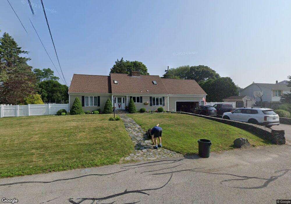
30 Oakdale Ave Portsmouth, RI 02871
Common Fence Point NeighborhoodEstimated Value: $766,000 - $1,008,000
3
Beds
5
Baths
2,806
Sq Ft
$307/Sq Ft
Est. Value
About This Home
This home is located at 30 Oakdale Ave, Portsmouth, RI 02871 and is currently estimated at $862,558, approximately $307 per square foot. 30 Oakdale Ave is a home located in Newport County with nearby schools including Portsmouth High School.
Ownership History
Date
Name
Owned For
Owner Type
Purchase Details
Closed on
May 26, 2006
Sold by
Ferell Roy and Decastro Richard
Bought by
Horley Brian and Horley Courtney
Current Estimated Value
Home Financials for this Owner
Home Financials are based on the most recent Mortgage that was taken out on this home.
Original Mortgage
$355,000
Interest Rate
6.53%
Mortgage Type
Purchase Money Mortgage
Purchase Details
Closed on
Nov 30, 2001
Sold by
Bouffard Bertrand A and Bouffard Marlene
Bought by
Faucher Tia M and Hebert Kevin
Create a Home Valuation Report for This Property
The Home Valuation Report is an in-depth analysis detailing your home's value as well as a comparison with similar homes in the area
Home Values in the Area
Average Home Value in this Area
Purchase History
| Date | Buyer | Sale Price | Title Company |
|---|---|---|---|
| Horley Brian | $475,000 | -- | |
| Faucher Tia M | $350,000 | -- |
Source: Public Records
Mortgage History
| Date | Status | Borrower | Loan Amount |
|---|---|---|---|
| Open | Faucher Tia M | $40,000 | |
| Open | Faucher Tia M | $280,500 | |
| Closed | Faucher Tia M | $335,000 | |
| Closed | Faucher Tia M | $355,000 |
Source: Public Records
Tax History Compared to Growth
Tax History
| Year | Tax Paid | Tax Assessment Tax Assessment Total Assessment is a certain percentage of the fair market value that is determined by local assessors to be the total taxable value of land and additions on the property. | Land | Improvement |
|---|---|---|---|---|
| 2025 | $7,356 | $553,900 | $182,600 | $371,300 |
| 2024 | $7,300 | $553,900 | $182,600 | $371,300 |
| 2023 | $7,079 | $553,900 | $182,600 | $371,300 |
| 2022 | $6,882 | $442,300 | $153,300 | $289,000 |
| 2021 | $6,772 | $442,300 | $153,300 | $289,000 |
| 2020 | $6,665 | $442,300 | $153,300 | $289,000 |
| 2019 | $6,403 | $390,400 | $114,800 | $275,600 |
| 2018 | $6,235 | $390,400 | $114,800 | $275,600 |
| 2017 | $6,020 | $390,400 | $114,800 | $275,600 |
| 2016 | $5,837 | $364,800 | $112,000 | $252,800 |
| 2015 | $5,764 | $364,800 | $112,000 | $252,800 |
| 2014 | $5,764 | $364,800 | $112,000 | $252,800 |
Source: Public Records
Map
Nearby Homes
- 0 Common Fence Blvd Unit 1364650
- 0 Common Fence Blvd Unit 1397142
- 10 Mount Hope Ave
- 169 Narragansett Blvd
- 0 Island Rd
- 134 Greenfield Ave
- 1055 Anthony Rd
- 72 Rhode Island Blvd
- 0 Dighton Ave
- 8 Tucker Ave
- 42 Lewis St
- 50 Stevens St
- 1350 Anthony Rd
- 83 Waters Edge Unit 24
- 87 Waters Edge
- 9 Cutter Ln
- 1660 Main Rd
- 47 Watermark Dr
- 171 Leeshore Ln
- 15 Rocky Ave
- 40 Oakdale Ave
- 247 Rhode Island Blvd
- 241 Rhode Island Blvd
- 235 Rhode Island Blvd
- 48 Oakdale Ave
- 251 Rhode Island Blvd
- 231 Rhode Island Blvd
- 20 Oakdale Ave
- 225 Rhode Island Blvd
- 16 Oakdale Ave
- 263 Rhode Island Blvd
- 219 Rhode Island Blvd
- 72 Norwood Ave
- 12 Oakdale Ave
- 244 Rhode Island Blvd
- 76 Norwood Ave
- 215 Rhode Island Blvd
- 82 Norwood Ave
- 271 Rhode Island Blvd
- 230 Rhode Island Blvd