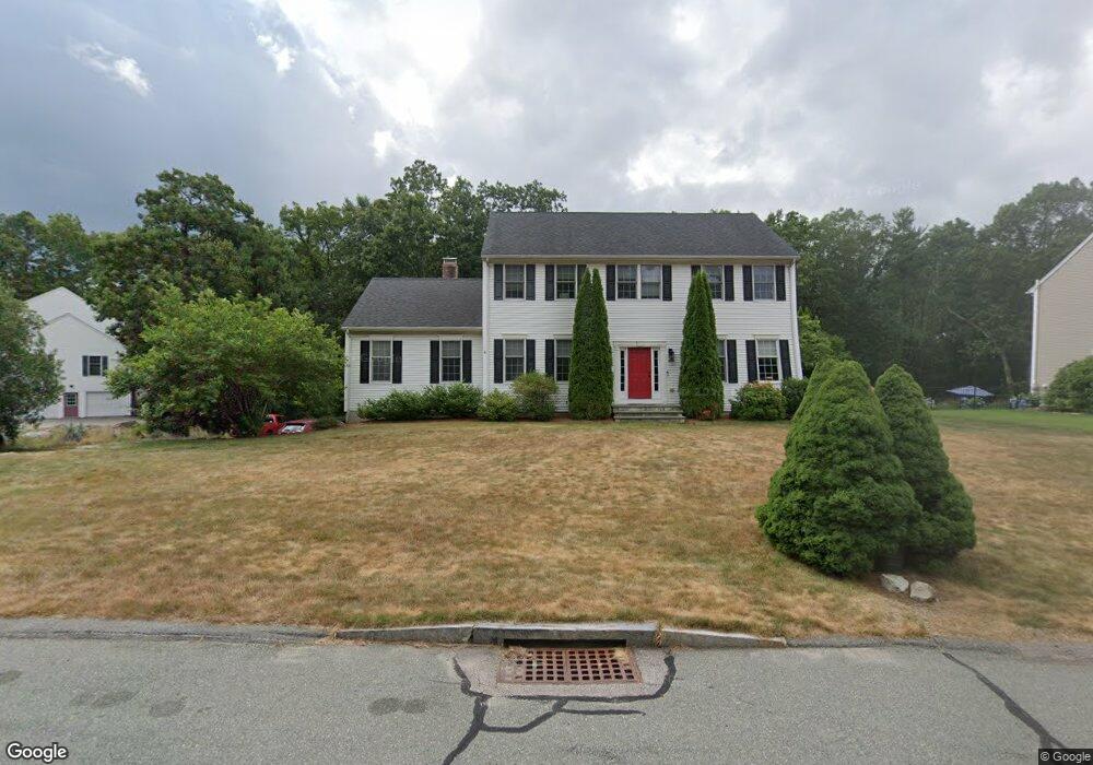
30 Old Quarry Rd Wrentham, MA 02093
Estimated Value: $687,000 - $1,004,000
4
Beds
3
Baths
2,672
Sq Ft
$326/Sq Ft
Est. Value
About This Home
This home is located at 30 Old Quarry Rd, Wrentham, MA 02093 and is currently estimated at $872,280, approximately $326 per square foot. 30 Old Quarry Rd is a home located in Norfolk County with nearby schools including Delaney Elementary School, Charles E Roderick, and Foxborough Regional Charter School.
Ownership History
Date
Name
Owned For
Owner Type
Purchase Details
Closed on
Jul 9, 2002
Sold by
Mountain Dog Bldg Corp
Bought by
Desrochers Lynn M and Desrochers Roland A
Current Estimated Value
Create a Home Valuation Report for This Property
The Home Valuation Report is an in-depth analysis detailing your home's value as well as a comparison with similar homes in the area
Home Values in the Area
Average Home Value in this Area
Purchase History
| Date | Buyer | Sale Price | Title Company |
|---|---|---|---|
| Desrochers Lynn M | $450,000 | -- |
Source: Public Records
Tax History Compared to Growth
Tax History
| Year | Tax Paid | Tax Assessment Tax Assessment Total Assessment is a certain percentage of the fair market value that is determined by local assessors to be the total taxable value of land and additions on the property. | Land | Improvement |
|---|---|---|---|---|
| 2025 | $9,565 | $825,300 | $327,700 | $497,600 |
| 2024 | $9,192 | $766,000 | $327,700 | $438,300 |
| 2023 | $9,184 | $727,700 | $298,000 | $429,700 |
| 2022 | $8,104 | $592,800 | $229,800 | $363,000 |
| 2021 | $8,106 | $576,100 | $240,600 | $335,500 |
| 2020 | $8,276 | $580,800 | $217,200 | $363,600 |
| 2019 | $8,214 | $581,700 | $233,700 | $348,000 |
| 2018 | $7,983 | $560,600 | $234,000 | $326,600 |
| 2017 | $7,806 | $547,800 | $229,500 | $318,300 |
| 2016 | $7,688 | $538,400 | $222,900 | $315,500 |
| 2015 | $7,066 | $471,700 | $183,900 | $287,800 |
| 2014 | $7,096 | $463,500 | $176,900 | $286,600 |
Source: Public Records
Map
Nearby Homes
- 483 Thurston St
- 120 Hawes St
- 65 Pond St
- 80 Mill St
- 155 Clark Rd Unit 155
- 362 East St
- 11 Goodwin Dr
- 131 Washington St Unit 42
- 319 Taunton St
- 406 South St
- 1 Lorraine Metcalf Dr
- 25 Foxboro Rd
- 16 Treasure Island Rd
- 9 Oak Dr
- 270 Dedham St
- 10 Nature View Dr
- 15 Nature View Dr
- 11 Orchard Place Unit 11
- 126 Washington St
- 130 Washington St
- 20 Old Quarry Rd
- 20 Old Quarry Rd Unit 1
- 10 Granite Way
- 15 Old Quarry Rd
- 25 Old Quarry Rd
- 10 Old Quarry Rd
- 30 High Point Way
- 40 Old Quarry Rd
- 20 High Point Way
- 20 Granite Way
- 10 Oak Ridge Dr
- 10 Oak Ridge Dr Unit 1
- 5 Old Quarry Rd
- 15 Granite Way
- 565 Thurston St
- 10 High Point Way
- 16 Old Quarry Rd
- 14 Old Quarry Rd
- 24 Old Quarry Rd
- 15 Oak Ridge Dr