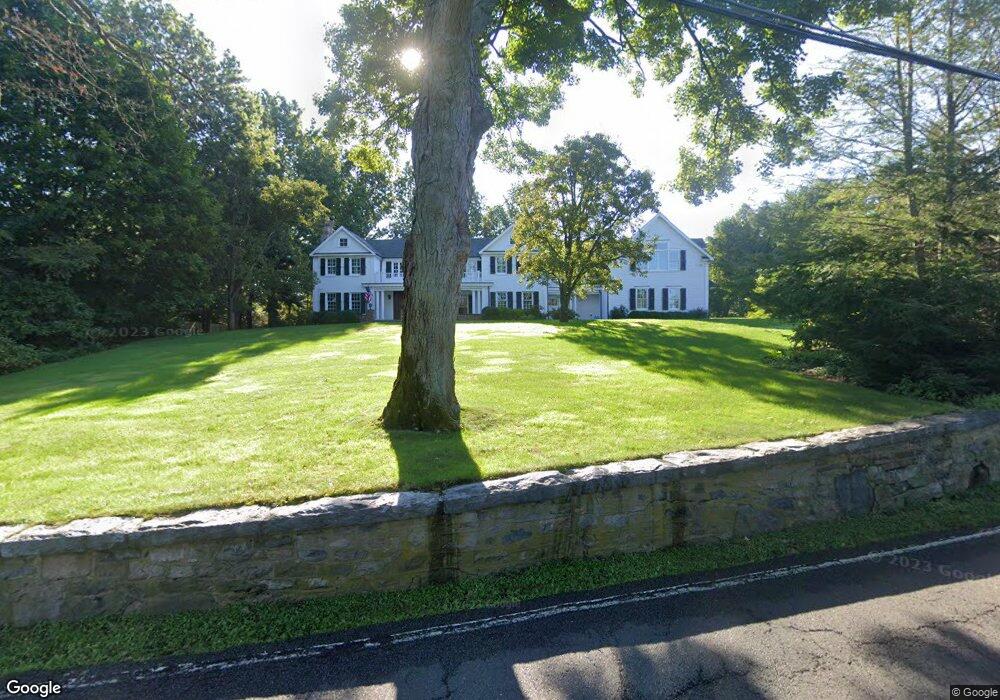
30 Pear Tree Point Rd Darien, CT 06820
Estimated Value: $5,608,463 - $7,010,000
5
Beds
7
Baths
8,000
Sq Ft
$789/Sq Ft
Est. Value
About This Home
This home is located at 30 Pear Tree Point Rd, Darien, CT 06820 and is currently estimated at $6,310,488, approximately $788 per square foot. 30 Pear Tree Point Rd is a home located in Fairfield County with nearby schools including Tokeneke Elementary School, Middlesex Middle School, and Darien High School.
Ownership History
Date
Name
Owned For
Owner Type
Purchase Details
Closed on
Dec 7, 2012
Sold by
Santos-Buch Charles J and Pfeiffer Elizabeth R
Bought by
Mozingo Jason S and Mozingo Patricia
Current Estimated Value
Purchase Details
Closed on
Aug 26, 2003
Sold by
Chacos Andrew B and Chacos Deborah M
Bought by
Santos Buch Charles J
Purchase Details
Closed on
Jun 14, 1990
Sold by
Whalen Robert
Bought by
Chacos Andrew
Purchase Details
Closed on
Jan 23, 1987
Sold by
Dht Assoc
Bought by
Whalen Ii Robert
Create a Home Valuation Report for This Property
The Home Valuation Report is an in-depth analysis detailing your home's value as well as a comparison with similar homes in the area
Home Values in the Area
Average Home Value in this Area
Purchase History
| Date | Buyer | Sale Price | Title Company |
|---|---|---|---|
| Mozingo Jason S | $4,150,000 | -- | |
| Santos Buch Charles J | $3,000,000 | -- | |
| Chacos Andrew | $1,450,000 | -- | |
| Whalen Ii Robert | $1,133,000 | -- |
Source: Public Records
Mortgage History
| Date | Status | Borrower | Loan Amount |
|---|---|---|---|
| Previous Owner | Whalen Ii Robert | $1,100,000 | |
| Previous Owner | Whalen Ii Robert | $1,100,000 |
Source: Public Records
Tax History Compared to Growth
Tax History
| Year | Tax Paid | Tax Assessment Tax Assessment Total Assessment is a certain percentage of the fair market value that is determined by local assessors to be the total taxable value of land and additions on the property. | Land | Improvement |
|---|---|---|---|---|
| 2025 | $50,658 | $3,272,500 | $1,606,990 | $1,665,510 |
| 2024 | $48,073 | $3,272,500 | $1,606,990 | $1,665,510 |
| 2023 | $50,695 | $2,878,750 | $1,392,860 | $1,485,890 |
| 2022 | $49,601 | $2,878,750 | $1,392,860 | $1,485,890 |
| 2021 | $48,478 | $2,878,750 | $1,392,860 | $1,485,890 |
| 2020 | $47,096 | $2,878,750 | $1,392,860 | $1,485,890 |
| 2019 | $47,413 | $2,878,750 | $1,392,860 | $1,485,890 |
| 2018 | $43,555 | $2,708,650 | $1,125,670 | $1,582,980 |
| 2017 | $43,772 | $2,708,650 | $1,125,670 | $1,582,980 |
| 2016 | $42,715 | $2,708,650 | $1,125,670 | $1,582,980 |
| 2015 | $41,578 | $2,708,650 | $1,125,670 | $1,582,980 |
| 2014 | $40,657 | $2,708,650 | $1,125,670 | $1,582,980 |
Source: Public Records
Map
Nearby Homes
- 92 Pear Tree Point Rd
- 88 Pear Tree Point Rd
- 74 Long Neck Point Rd
- 5 Shipway Rd
- 5 Mayflower Rd
- 53 Noroton Ave
- 45 Hecker Ave
- 17 Brushy Hill Rd
- 28 Aquila Rd
- 77 Maple St
- 47 Hollow Tree Ridge Rd
- 18 Tokeneke Trail
- 72 Old Kings Hwy S
- 17 Contentment Island Rd
- 33 Dora St
- 39 Noroton Ave
- 120 Webb Ave
- 105 Houston Terrace
- 16 Neponsit St
- 19 Anthony Ln
- 35 Pear Tree Point Rd
- 28 Long Neck Point Rd
- 37 Pear Tree Point Rd Unit 1
- 37 Pear Tree Point Rd
- 40 Pear Tree Point Rd
- 18 Long Neck Point Rd
- 39 Pear Tree Point Rd
- 43 Pear Tree Point Rd
- 38 Long Neck Point Rd
- 47 Pear Tree Point Rd
- 58 Pear Tree Point Rd
- 45 Pear Tree Point Rd
- 44 Long Neck Point Rd
- 48 Long Neck Point Rd
- 66 Pear Tree Point Rd
- 60 Long Neck Point Rd
- 65 Pear Tree Point Rd
- 3 Long Neck Point Rd
- 23 Harbor Rd
- 86 Pear Tree Point Rd