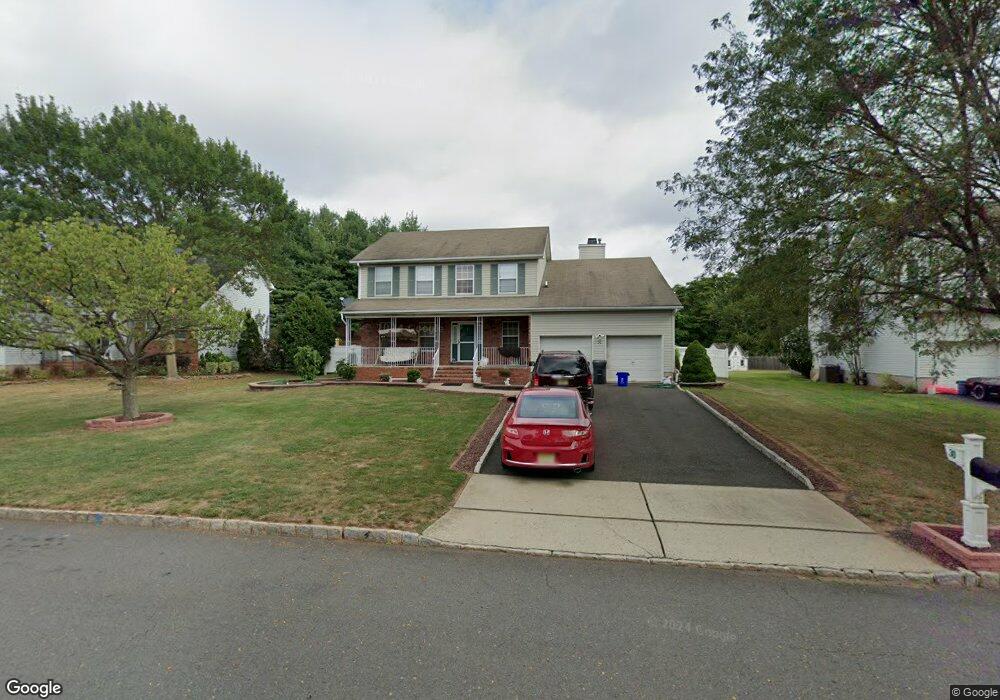
30 Peterson Rd Hillsborough, NJ 08844
Estimated Value: $852,000 - $883,000
--
Bed
--
Bath
2,420
Sq Ft
$358/Sq Ft
Est. Value
About This Home
This home is located at 30 Peterson Rd, Hillsborough, NJ 08844 and is currently estimated at $866,303, approximately $357 per square foot. 30 Peterson Rd is a home located in Somerset County with nearby schools including Hillsborough High School, Cherry Blossom Montessori School, and Brighthorizons at Hillsborough.
Ownership History
Date
Name
Owned For
Owner Type
Purchase Details
Closed on
Aug 11, 2006
Sold by
Sab Michael P Sabo Aka Michael
Bought by
Portillo Saul
Current Estimated Value
Home Financials for this Owner
Home Financials are based on the most recent Mortgage that was taken out on this home.
Original Mortgage
$500,000
Outstanding Balance
$302,144
Interest Rate
6.88%
Mortgage Type
Purchase Money Mortgage
Estimated Equity
$564,159
Purchase Details
Closed on
May 11, 2004
Sold by
Kassai Christopher
Bought by
Sabo Michael P and Sabo Christina L
Home Financials for this Owner
Home Financials are based on the most recent Mortgage that was taken out on this home.
Original Mortgage
$150,000
Interest Rate
5.75%
Mortgage Type
Purchase Money Mortgage
Purchase Details
Closed on
Dec 29, 2000
Sold by
Mason Jeff
Bought by
Kassai Chris and Kassai Diane
Home Financials for this Owner
Home Financials are based on the most recent Mortgage that was taken out on this home.
Original Mortgage
$240,000
Interest Rate
7.69%
Mortgage Type
Purchase Money Mortgage
Purchase Details
Closed on
Nov 21, 1997
Sold by
Rohill Village
Bought by
Mason Jeff and Mason Monica
Home Financials for this Owner
Home Financials are based on the most recent Mortgage that was taken out on this home.
Original Mortgage
$197,000
Interest Rate
7.26%
Mortgage Type
Purchase Money Mortgage
Create a Home Valuation Report for This Property
The Home Valuation Report is an in-depth analysis detailing your home's value as well as a comparison with similar homes in the area
Home Values in the Area
Average Home Value in this Area
Purchase History
| Date | Buyer | Sale Price | Title Company |
|---|---|---|---|
| Portillo Saul | $555,900 | -- | |
| Sabo Michael P | $450,000 | -- | |
| Kassai Chris | $316,450 | -- | |
| Mason Jeff | $218,790 | -- |
Source: Public Records
Mortgage History
| Date | Status | Borrower | Loan Amount |
|---|---|---|---|
| Open | Portillo Saul | $500,000 | |
| Previous Owner | Sabo Michael P | $150,000 | |
| Previous Owner | Kassai Chris | $240,000 | |
| Previous Owner | Mason Jeff | $197,000 |
Source: Public Records
Tax History Compared to Growth
Tax History
| Year | Tax Paid | Tax Assessment Tax Assessment Total Assessment is a certain percentage of the fair market value that is determined by local assessors to be the total taxable value of land and additions on the property. | Land | Improvement |
|---|---|---|---|---|
| 2025 | $14,180 | $728,500 | $375,300 | $353,200 |
| 2024 | $14,180 | $661,700 | $342,100 | $319,600 |
| 2023 | $13,157 | $611,100 | $289,800 | $321,300 |
| 2022 | $12,637 | $565,900 | $285,100 | $280,800 |
| 2021 | $12,012 | $511,600 | $237,600 | $274,000 |
| 2020 | $12,118 | $508,300 | $232,800 | $275,500 |
| 2019 | $11,799 | $490,800 | $213,800 | $277,000 |
| 2018 | $11,795 | $487,600 | $204,300 | $283,300 |
| 2017 | $11,268 | $466,600 | $180,600 | $286,000 |
| 2016 | $11,071 | $458,600 | $171,100 | $287,500 |
| 2015 | $10,985 | $460,800 | $171,100 | $289,700 |
| 2014 | $10,424 | $446,600 | $171,100 | $275,500 |
Source: Public Records
Map
Nearby Homes
- 436 Conover Dr
- 106 Perrine Pike
- 101 Hodge Rd
- 71 Buckland Dr
- 68 Dunedain St
- 30 Dewitt Ln
- 42 Bateman Way Unit 9
- 39 Flemming Dr
- 104 Devonshire Ct
- 2109 Jamestown Common
- 1404 Washington Common Unit 4
- 3 Tunison Close
- 303 Gemini Dr Unit 2B
- 911 Merritt Dr Unit B2
- 710 Whitenack Ct
- 118 Bluebird Dr Unit 3
- 903A Marlborough Common
- 897 Merritt Dr Unit D
- 912 Merritt Dr Unit D
- 38 Fox Hill Ln