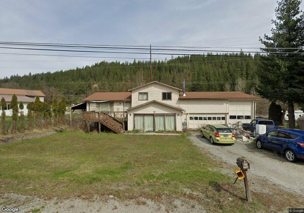
30 Power Ave Kingston, ID 83839
Estimated Value: $354,075 - $544,000
4
Beds
2
Baths
2,462
Sq Ft
$169/Sq Ft
Est. Value
About This Home
This home is located at 30 Power Ave, Kingston, ID 83839 and is currently estimated at $417,269, approximately $169 per square foot. 30 Power Ave is a home located in Shoshone County with nearby schools including Pinehurst Elementary School, Kellogg Middle School, and Kellogg High School.
Ownership History
Date
Name
Owned For
Owner Type
Purchase Details
Closed on
Apr 3, 2023
Sold by
Ford Laura M
Bought by
Krous Tristin and Ward Chad
Current Estimated Value
Purchase Details
Closed on
Jun 8, 2006
Sold by
Koziuk Melanie G
Bought by
Zubillaga Jose G and Zubillaga Caroline M
Home Financials for this Owner
Home Financials are based on the most recent Mortgage that was taken out on this home.
Original Mortgage
$192,000
Interest Rate
6.56%
Create a Home Valuation Report for This Property
The Home Valuation Report is an in-depth analysis detailing your home's value as well as a comparison with similar homes in the area
Home Values in the Area
Average Home Value in this Area
Purchase History
| Date | Buyer | Sale Price | Title Company |
|---|---|---|---|
| Krous Tristin | -- | Flying S Title | |
| Zubillaga Jose G | -- | -- |
Source: Public Records
Mortgage History
| Date | Status | Borrower | Loan Amount |
|---|---|---|---|
| Previous Owner | Zubillaga Jose G | $192,000 |
Source: Public Records
Tax History
| Year | Tax Paid | Tax Assessment Tax Assessment Total Assessment is a certain percentage of the fair market value that is determined by local assessors to be the total taxable value of land and additions on the property. | Land | Improvement |
|---|---|---|---|---|
| 2025 | $2,296 | $310,507 | $66,326 | $244,181 |
| 2024 | $2,837 | $310,507 | $66,326 | $244,181 |
| 2023 | $2,837 | $314,532 | $66,326 | $248,206 |
| 2022 | $3,129 | $284,102 | $58,274 | $225,828 |
| 2021 | $3,149 | $198,731 | $42,205 | $156,526 |
| 2020 | $3,061 | $188,711 | $39,385 | $149,326 |
| 2019 | $3,188 | $184,111 | $34,705 | $149,406 |
| 2018 | $2,818 | $143,007 | $29,705 | $113,302 |
| 2017 | $2,546 | $143,007 | $29,705 | $113,302 |
| 2016 | $2,165 | $133,135 | $29,705 | $103,430 |
| 2015 | -- | $134,339 | $30,019 | $104,320 |
| 2014 | -- | $107,768 | $30,018 | $77,750 |
Source: Public Records
Map
Nearby Homes
- 14 Lilac Ave
- 483 Paradise Ln
- 208 S 6th St
- 140 Wright
- 502 Wyoming Ave
- 754 Paradise Ln
- 207 S Division St
- 63 Reinoehl Rd
- 301 Woodland Dr
- 6 Maple Ave
- 49 Adams Rd
- 99 Lookout Peak Dr
- 1 Elsie Peak Ct Unit B1, BLDG B
- 608 Country Club Ln
- 202 Silver Saddle Ct
- 43143 Riverview Dr Unit 8
- 0 Lot J Frosty Ln Unit 25-9282
- Lot 2 of the Replat of Lot 2 Blk 1
- 833 Drummond Peak Rd
- 100 Brandons Rd
Your Personal Tour Guide
Ask me questions while you tour the home.