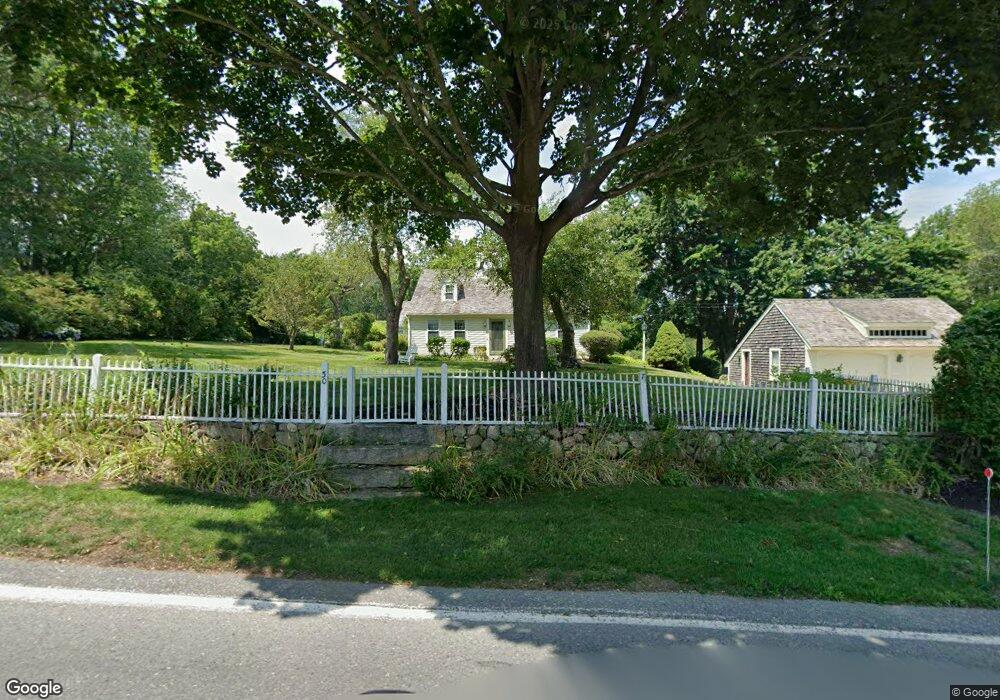
30 Prospect St Marshfield, MA 02050
Estimated Value: $1,247,611 - $1,674,000
4
Beds
4
Baths
2,792
Sq Ft
$491/Sq Ft
Est. Value
About This Home
This home is located at 30 Prospect St, Marshfield, MA 02050 and is currently estimated at $1,371,653, approximately $491 per square foot. 30 Prospect St is a home located in Plymouth County with nearby schools including Eames Way School, Furnace Brook Middle School, and Marshfield High School.
Ownership History
Date
Name
Owned For
Owner Type
Purchase Details
Closed on
Jun 25, 2004
Sold by
Cashman Linda S
Bought by
Linda S Cashman Rt and Cashman Linda S
Current Estimated Value
Purchase Details
Closed on
May 15, 1995
Sold by
Canniff Michael F and Canniff Amy L
Bought by
Cashman Linda S
Home Financials for this Owner
Home Financials are based on the most recent Mortgage that was taken out on this home.
Original Mortgage
$10,000
Interest Rate
8.8%
Purchase Details
Closed on
Nov 30, 1990
Sold by
Krener Penelope K
Bought by
Canniff Michael F
Create a Home Valuation Report for This Property
The Home Valuation Report is an in-depth analysis detailing your home's value as well as a comparison with similar homes in the area
Home Values in the Area
Average Home Value in this Area
Purchase History
| Date | Buyer | Sale Price | Title Company |
|---|---|---|---|
| Linda S Cashman Rt | -- | -- | |
| Cashman Linda S | $425,000 | -- | |
| Canniff Michael F | $200,000 | -- |
Source: Public Records
Mortgage History
| Date | Status | Borrower | Loan Amount |
|---|---|---|---|
| Previous Owner | Canniff Michael F | $16,000 | |
| Previous Owner | Canniff Michael F | $10,000 | |
| Previous Owner | Canniff Michael F | $10,000 |
Source: Public Records
Tax History Compared to Growth
Tax History
| Year | Tax Paid | Tax Assessment Tax Assessment Total Assessment is a certain percentage of the fair market value that is determined by local assessors to be the total taxable value of land and additions on the property. | Land | Improvement |
|---|---|---|---|---|
| 2025 | $10,942 | $1,105,300 | $396,400 | $708,900 |
| 2024 | $10,442 | $1,005,000 | $381,100 | $623,900 |
| 2023 | $9,474 | $880,700 | $352,900 | $527,800 |
| 2022 | $9,474 | $731,600 | $292,200 | $439,400 |
| 2021 | $9,054 | $686,400 | $290,000 | $396,400 |
| 2020 | $8,671 | $650,500 | $270,400 | $380,100 |
| 2019 | $8,486 | $634,200 | $270,400 | $363,800 |
| 2018 | $8,479 | $634,200 | $270,400 | $363,800 |
| 2017 | $8,316 | $606,100 | $259,500 | $346,600 |
| 2016 | $8,080 | $582,100 | $248,600 | $333,500 |
| 2015 | $7,736 | $582,100 | $248,600 | $333,500 |
| 2014 | $7,401 | $556,900 | $233,400 | $323,500 |
Source: Public Records
Map
Nearby Homes
- 55 Macombers Way
- 110 Damons Point Rd
- 480 Pleasant St
- 26 Damons Point Cir
- 2167 Main St
- 248 Highland St
- 3 Cottage Ln
- 287 Summer St
- 46 Oakman Way
- 28 Riverside Cir
- 1 Trouants Island
- 563 Spring St
- 91 Metacomet Way
- 48 Neal Gate St
- 105 Cedar Acres Rd
- 9 Cushing Park Rd
- 16 Salt Meadow Ln
- 3 Summer St
- 56 Wiltshire Ln
- 4 Summer St
- 44 Prospect St
- 29 Prospect St
- 36 Prospect St
- 20 Prospect St
- 15 Prospect St
- 49 Prospect St
- 76 Prospect St
- 67 Prospect St
- 715 Summer St
- 783 Summer St
- 758 Summer St
- 695 Summer St
- 793 Summer St
- 77 Prospect St
- 90 Prospect St
- 85 Prospect St
- 705 Summer St
- 705R Summer Street Off
- 96 Prospect St
- 93 Prospect St