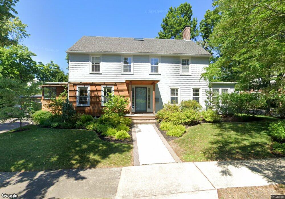
30 Ransom Rd Newton Center, MA 02459
Newton Centre NeighborhoodEstimated Value: $2,283,000 - $2,566,000
5
Beds
4
Baths
3,135
Sq Ft
$775/Sq Ft
Est. Value
About This Home
This home is located at 30 Ransom Rd, Newton Center, MA 02459 and is currently estimated at $2,428,707, approximately $774 per square foot. 30 Ransom Rd is a home located in Middlesex County with nearby schools including Mason Rice Elementary School, Charles E Brown Middle School, and Newton North High School.
Ownership History
Date
Name
Owned For
Owner Type
Purchase Details
Closed on
Jan 18, 2008
Sold by
Joglekar Aruna N and Joglekar Nitindra R
Bought by
Quisel John D and Hamburg Naomi M
Current Estimated Value
Home Financials for this Owner
Home Financials are based on the most recent Mortgage that was taken out on this home.
Original Mortgage
$816,000
Outstanding Balance
$511,305
Interest Rate
6.02%
Mortgage Type
Purchase Money Mortgage
Estimated Equity
$1,917,402
Purchase Details
Closed on
May 29, 1996
Sold by
Cloran William M and Cloran Rosemary H
Bought by
Joglekar Nitindra R and Joglekar Aruna N
Home Financials for this Owner
Home Financials are based on the most recent Mortgage that was taken out on this home.
Original Mortgage
$354,400
Interest Rate
7.91%
Mortgage Type
Purchase Money Mortgage
Create a Home Valuation Report for This Property
The Home Valuation Report is an in-depth analysis detailing your home's value as well as a comparison with similar homes in the area
Home Values in the Area
Average Home Value in this Area
Purchase History
| Date | Buyer | Sale Price | Title Company |
|---|---|---|---|
| Quisel John D | $1,020,000 | -- | |
| Joglekar Nitindra R | $443,000 | -- |
Source: Public Records
Mortgage History
| Date | Status | Borrower | Loan Amount |
|---|---|---|---|
| Open | Quisel John D | $816,000 | |
| Previous Owner | Joglekar Nitindra R | $402,000 | |
| Previous Owner | Joglekar Nitindra R | $50,000 | |
| Previous Owner | Joglekar Nitindra R | $354,400 |
Source: Public Records
Tax History Compared to Growth
Tax History
| Year | Tax Paid | Tax Assessment Tax Assessment Total Assessment is a certain percentage of the fair market value that is determined by local assessors to be the total taxable value of land and additions on the property. | Land | Improvement |
|---|---|---|---|---|
| 2025 | $20,656 | $2,107,800 | $1,224,700 | $883,100 |
| 2024 | $19,973 | $2,046,400 | $1,189,000 | $857,400 |
| 2023 | $19,062 | $1,872,500 | $908,300 | $964,200 |
| 2022 | $18,240 | $1,733,800 | $841,000 | $892,800 |
| 2021 | $17,600 | $1,635,700 | $793,400 | $842,300 |
| 2020 | $17,077 | $1,635,700 | $793,400 | $842,300 |
| 2019 | $16,596 | $1,588,100 | $770,300 | $817,800 |
| 2018 | $13,328 | $1,231,800 | $696,000 | $535,800 |
| 2017 | $12,599 | $1,133,000 | $656,600 | $476,400 |
| 2016 | $12,050 | $1,058,900 | $613,600 | $445,300 |
| 2015 | $11,489 | $989,600 | $573,500 | $416,100 |
Source: Public Records
Map
Nearby Homes
- 1004 Centre St
- 73 Elmore St
- 3 Cedar St
- 44 Irving St
- Lots 2 & 3 Chapin Rd
- Lot 3 Chapin Rd
- Lot 2 Chapin Rd
- 21 Francis St Unit 21A
- 23 Francis St Unit 23-1
- 887 Commonwealth Ave
- 34 Morton Rd
- 31 W Boulevard Rd
- 59 Charlotte Rd
- 92 Grant Ave
- 95 Blake St
- 145 Warren St Unit 4
- 54 Garland Rd
- 9 Ripley St Unit 1
- 9 The Ledges Rd
- 154 Langley Rd Unit 1
- 21 Nathan Rd
- 20 Ransom Rd
- 30 Nathan Rd
- 37 Nathan Rd
- 715 Commonwealth Ave
- 24 Nathan Rd
- 21 Ransom Rd
- 14 Ransom Rd Unit 16
- 19 Ransom Rd
- 19 Ransom Rd Unit 2
- 19 Ransom Rd Unit 1
- 36 Nathan Rd
- 707 Commonwealth Ave
- 725 Commonwealth Ave
- 18 Nathan Rd
- 42 Nathan Rd
- 15 Ransom Rd
- 12 Nathan Rd
- 47 Nathan Rd
- 693 Commonwealth Ave Unit 2