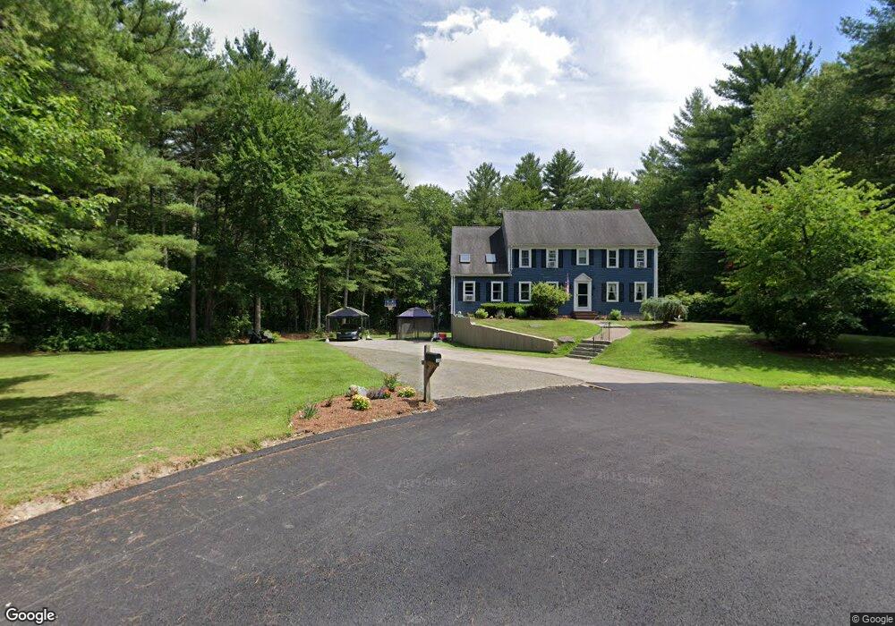
30 River Rd East Bridgewater, MA 02333
Estimated Value: $732,526 - $832,000
3
Beds
3
Baths
2,509
Sq Ft
$317/Sq Ft
Est. Value
About This Home
This home is located at 30 River Rd, East Bridgewater, MA 02333 and is currently estimated at $795,382, approximately $317 per square foot. 30 River Rd is a home located in Plymouth County with nearby schools including Central Elementary School, Gordon W Mitchell Middle School, and East Bridgewater Jr./Sr. High School.
Ownership History
Date
Name
Owned For
Owner Type
Purchase Details
Closed on
Feb 23, 2004
Sold by
Baggia Dev Rt and Baggis Edward J
Bought by
Goahead Rt and Mekjian Edward R
Current Estimated Value
Purchase Details
Closed on
Aug 30, 1988
Sold by
R R Rt
Bought by
Dalessio Kathleen
Home Financials for this Owner
Home Financials are based on the most recent Mortgage that was taken out on this home.
Original Mortgage
$155,000
Interest Rate
10.36%
Mortgage Type
Purchase Money Mortgage
Create a Home Valuation Report for This Property
The Home Valuation Report is an in-depth analysis detailing your home's value as well as a comparison with similar homes in the area
Home Values in the Area
Average Home Value in this Area
Purchase History
| Date | Buyer | Sale Price | Title Company |
|---|---|---|---|
| Goahead Rt | $12,000 | -- | |
| Dalessio Kathleen | $255,000 | -- |
Source: Public Records
Mortgage History
| Date | Status | Borrower | Loan Amount |
|---|---|---|---|
| Previous Owner | Dalessio Kathleen | $151,000 | |
| Previous Owner | Dalessio Kathleen | $155,000 |
Source: Public Records
Tax History Compared to Growth
Tax History
| Year | Tax Paid | Tax Assessment Tax Assessment Total Assessment is a certain percentage of the fair market value that is determined by local assessors to be the total taxable value of land and additions on the property. | Land | Improvement |
|---|---|---|---|---|
| 2025 | $8,458 | $618,700 | $235,100 | $383,600 |
| 2024 | $8,238 | $595,200 | $226,100 | $369,100 |
| 2023 | $8,069 | $558,400 | $226,100 | $332,300 |
| 2022 | $7,566 | $485,000 | $188,600 | $296,400 |
| 2021 | $6,754 | $434,600 | $181,200 | $253,400 |
| 2020 | $7,229 | $418,100 | $174,400 | $243,700 |
| 2019 | $8,379 | $402,100 | $166,700 | $235,400 |
| 2018 | $6,906 | $384,500 | $166,700 | $217,800 |
| 2017 | $6,705 | $366,400 | $158,900 | $207,500 |
| 2016 | $6,507 | $358,300 | $158,900 | $199,400 |
| 2015 | $6,031 | $339,600 | $143,600 | $196,000 |
| 2014 | $5,789 | $333,300 | $140,500 | $192,800 |
Source: Public Records
Map
Nearby Homes
- 26 Meadowbrook Dr
- 587 Bridge St
- 51 Stonegate Dr
- 71 Stonegate Dr
- 1993 Washington St
- 94 Pond St
- 28 Brookbend Way E
- 2045 Washington St
- 182 Crystal Water Dr Unit 182
- 217 Crystal Water Dr
- 78 Crystal Water Dr
- 29 Hayes Rd
- 121 South St
- 455 Plymouth St
- 23 Stone Meadow Dr
- 1 Simmons Place
- 261 Plymouth St
- 67 Country Dr
- 12 Bridge St
- 114 Plain St
- 22 River Rd
- 23 River Rd
- 34 River Rd
- 97 Eliab Latham Way
- 13 River Rd
- 12 River Rd
- 2 Meadowbrook Dr
- 0 Meadowbrook Dr
- 10 Meadowbrook Dr
- 31 Fieldcrest Landing
- 105 Eliab Latham Way
- 101 Eliab Latham Way
- 95 Eliab Latham Way
- 18 Meadowbrook Dr
- 2 River Rd
- 26 Fieldcrest Landing
- 3 River Rd
- 115 Eliab Latham Way
- 25 Fieldcrest Landing
- 125 Eliab Latham Way