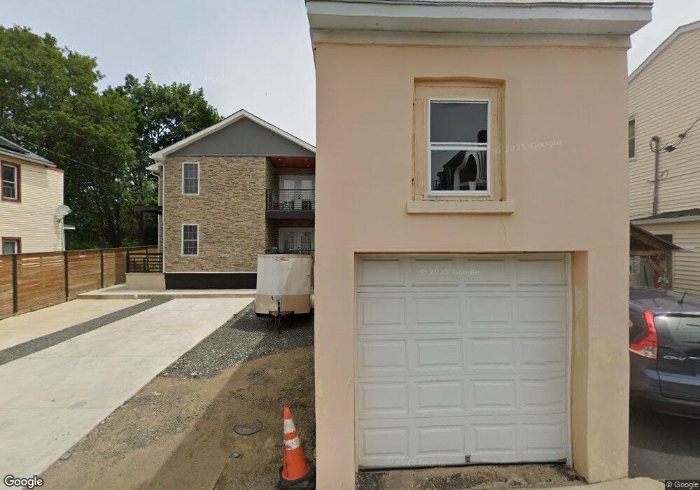
30 Rockland St Unit 2 Haverstraw, NY 10927
Estimated Value: $570,000 - $673,460
2
Beds
1
Bath
700
Sq Ft
$895/Sq Ft
Est. Value
About This Home
This home is located at 30 Rockland St Unit 2, Haverstraw, NY 10927 and is currently estimated at $626,365, approximately $894 per square foot. 30 Rockland St Unit 2 is a home located in Rockland County with nearby schools including Haverstraw Elementary School, West Haverstraw Elementary School, and Fieldstone Secondary School.
Ownership History
Date
Name
Owned For
Owner Type
Purchase Details
Closed on
Oct 17, 2022
Sold by
Hbd Holdings Llc and H & B Partners Inc
Bought by
Deo Enterprises Llc
Current Estimated Value
Purchase Details
Closed on
Dec 3, 2019
Sold by
Hbd Partners Llc
Bought by
H & B Partners Llc
Purchase Details
Closed on
May 15, 2019
Sold by
Slade John W
Bought by
Hbd Holdings Llc
Purchase Details
Closed on
Sep 15, 2006
Sold by
The Haverstraw Church
Bought by
Slade John W and Slade Lucien J
Create a Home Valuation Report for This Property
The Home Valuation Report is an in-depth analysis detailing your home's value as well as a comparison with similar homes in the area
Home Values in the Area
Average Home Value in this Area
Purchase History
| Date | Buyer | Sale Price | Title Company |
|---|---|---|---|
| Deo Enterprises Llc | $185,000 | Old Republic National Title | |
| Deo Enterprises Llc | $185,000 | Old Republic National Title | |
| H & B Partners Llc | -- | Judicial Title | |
| H & B Partners Llc | -- | Judicial Title | |
| Hbd Holdings Llc | $52,500 | Judicial Title | |
| Hbd Holdings Llc | $52,500 | Judicial Title | |
| Slade John W | $55,000 | None Available | |
| Slade John W | $55,000 | None Available | |
| Slade John W | $55,000 | None Available |
Source: Public Records
Tax History Compared to Growth
Tax History
| Year | Tax Paid | Tax Assessment Tax Assessment Total Assessment is a certain percentage of the fair market value that is determined by local assessors to be the total taxable value of land and additions on the property. | Land | Improvement |
|---|---|---|---|---|
| 2024 | $21,553 | $306,000 | $75,000 | $231,000 |
| 2023 | $21,553 | $75,000 | $75,000 | $0 |
| 2022 | $207 | $75,000 | $75,000 | $0 |
| 2021 | $19,530 | $75,000 | $75,000 | $0 |
| 2020 | $3,652 | $75,000 | $75,000 | $0 |
| 2019 | $784 | $75,000 | $75,000 | $0 |
| 2018 | $3,576 | $75,000 | $75,000 | $0 |
| 2017 | $3,372 | $75,000 | $75,000 | $0 |
| 2016 | $3,377 | $75,000 | $75,000 | $0 |
| 2015 | -- | $75,000 | $75,000 | $0 |
| 2014 | -- | $75,000 | $75,000 | $0 |
Source: Public Records
Map
Nearby Homes
- 25 Fourth St
- 20 W Broad St
- 24 Partition St
- 127 Hudson Ave
- 112 Clove Ave
- 9 W Lincoln St
- 59 Hudson Ave
- 27 Conger Ave
- 60 Hudson Ave
- 9 Hillside Ave
- 1308 Round Pointe Dr Unit 1308
- 37 Conklin Ave
- 1207 Round Pointe Dr
- 1320 Round Pointe Dr
- 68 Hillside Ave
- 14 Harbor Pointe Dr
- 37 Harbor Pointe Dr Unit 115
- 2 Leeward Dr Unit 41
- 3203 Leeward Dr
- 3207 Leeward Dr