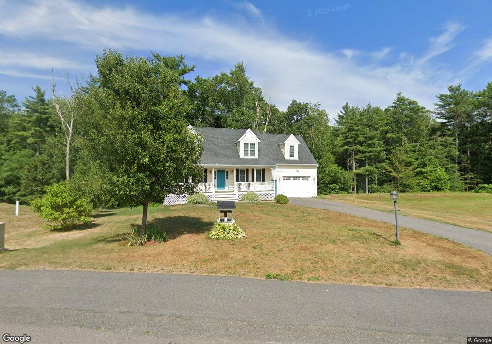
30 Rolling Pines Dr Bridgewater, MA 02324
Estimated Value: $721,224 - $813,000
3
Beds
3
Baths
1,728
Sq Ft
$441/Sq Ft
Est. Value
About This Home
This home is located at 30 Rolling Pines Dr, Bridgewater, MA 02324 and is currently estimated at $761,806, approximately $440 per square foot. 30 Rolling Pines Dr is a home located in Plymouth County with nearby schools including Mitchell Elementary School, Williams Intermediate School, and Bridgewater Middle School.
Ownership History
Date
Name
Owned For
Owner Type
Purchase Details
Closed on
May 4, 2017
Sold by
Brown Builders Inc
Bought by
Skorohod Sean and Skorohod Hope
Current Estimated Value
Home Financials for this Owner
Home Financials are based on the most recent Mortgage that was taken out on this home.
Original Mortgage
$366,000
Outstanding Balance
$305,453
Interest Rate
4.23%
Mortgage Type
New Conventional
Estimated Equity
$456,353
Create a Home Valuation Report for This Property
The Home Valuation Report is an in-depth analysis detailing your home's value as well as a comparison with similar homes in the area
Home Values in the Area
Average Home Value in this Area
Purchase History
| Date | Buyer | Sale Price | Title Company |
|---|---|---|---|
| Skorohod Sean | $457,500 | -- |
Source: Public Records
Mortgage History
| Date | Status | Borrower | Loan Amount |
|---|---|---|---|
| Open | Skorohod Sean | $366,000 |
Source: Public Records
Tax History Compared to Growth
Tax History
| Year | Tax Paid | Tax Assessment Tax Assessment Total Assessment is a certain percentage of the fair market value that is determined by local assessors to be the total taxable value of land and additions on the property. | Land | Improvement |
|---|---|---|---|---|
| 2025 | $7,931 | $670,400 | $238,500 | $431,900 |
| 2024 | $7,764 | $639,500 | $227,200 | $412,300 |
| 2023 | $7,732 | $602,200 | $212,300 | $389,900 |
| 2022 | $7,628 | $532,700 | $186,300 | $346,400 |
| 2021 | $7,152 | $493,900 | $166,300 | $327,600 |
| 2020 | $7,048 | $478,500 | $159,900 | $318,600 |
| 2019 | $6,924 | $466,900 | $159,900 | $307,000 |
| 2018 | $10,189 | $316,300 | $155,300 | $161,000 |
| 2017 | $2,424 | $155,300 | $155,300 | $0 |
Source: Public Records
Map
Nearby Homes
- 74 Magnolia Way
- 40 Old Summit St
- 26 Old Summit St
- 904 Auburn St
- 10 Old Summit St
- 198 Thompson St
- 230 Cherry St
- 228 Thompson St
- 199 Cherry St
- 34 Highland Cir
- 163 Cherry St
- 25 Dominique Dr
- 0 Auburn St
- 89 River St
- 234 River St
- 55 Thompson St
- 61 Thompson St
- 81 Pratt Ave Unit Lot 101
- 67 Thompson St
- 64 Pratt Ave
- 20 Rolling Pines Dr
- 35 Rolling Pines Dr
- 10 Rolling Pines Dr
- 8 Rolling Pines Dr
- Lot 1-5 Rolling Pines Dr
- Lot 2 Rolling Pines Dr
- Lot 3 Rolling Pines Dr
- Lot 6 Rolling Pines Dr
- Lot 5 Rolling Pines Dr
- 0 Rolling Pines Dr Unit 7 71879294
- 6 Rolling Pines Dr
- 36 Holly Ln
- 500 Rolling Pines Dr
- 4 Rolling Pines Dr
- 40 Holly Ln
- 491 Cherry St
- 30 Holly Ln
- 477 Cherry St
- 50 Holly Ln
- 20 Holly Ln