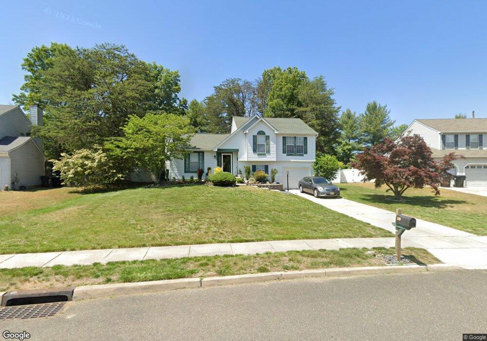
30 Rosalind Cir Sicklerville, NJ 08081
Winslow Township NeighborhoodEstimated Value: $318,566 - $405,000
--
Bed
--
Bath
1,443
Sq Ft
$265/Sq Ft
Est. Value
About This Home
This home is located at 30 Rosalind Cir, Sicklerville, NJ 08081 and is currently estimated at $381,892, approximately $264 per square foot. 30 Rosalind Cir is a home located in Camden County with nearby schools including Winslow Township High School, Erial Community Church Christian School, and South Jersey Christian Academy.
Ownership History
Date
Name
Owned For
Owner Type
Purchase Details
Closed on
Feb 12, 1999
Sold by
Roes Marthalyn Shronk
Bought by
Nuccio Joseph S and Nuccio Michelle G
Current Estimated Value
Home Financials for this Owner
Home Financials are based on the most recent Mortgage that was taken out on this home.
Original Mortgage
$112,475
Outstanding Balance
$26,599
Interest Rate
6.73%
Mortgage Type
FHA
Estimated Equity
$355,293
Create a Home Valuation Report for This Property
The Home Valuation Report is an in-depth analysis detailing your home's value as well as a comparison with similar homes in the area
Home Values in the Area
Average Home Value in this Area
Purchase History
| Date | Buyer | Sale Price | Title Company |
|---|---|---|---|
| Nuccio Joseph S | $113,000 | -- |
Source: Public Records
Mortgage History
| Date | Status | Borrower | Loan Amount |
|---|---|---|---|
| Open | Nuccio Joseph S | $112,475 |
Source: Public Records
Tax History Compared to Growth
Tax History
| Year | Tax Paid | Tax Assessment Tax Assessment Total Assessment is a certain percentage of the fair market value that is determined by local assessors to be the total taxable value of land and additions on the property. | Land | Improvement |
|---|---|---|---|---|
| 2025 | $6,637 | $170,100 | $50,000 | $120,100 |
| 2024 | $6,462 | $170,100 | $50,000 | $120,100 |
| 2023 | $6,462 | $170,100 | $50,000 | $120,100 |
| 2022 | $6,263 | $170,100 | $50,000 | $120,100 |
| 2021 | $5,852 | $170,100 | $50,000 | $120,100 |
| 2020 | $6,137 | $170,100 | $50,000 | $120,100 |
| 2019 | $6,100 | $170,100 | $50,000 | $120,100 |
| 2018 | $6,016 | $170,100 | $50,000 | $120,100 |
| 2017 | $5,909 | $170,100 | $50,000 | $120,100 |
| 2016 | $5,834 | $170,100 | $50,000 | $120,100 |
| 2015 | $5,749 | $170,100 | $50,000 | $120,100 |
| 2014 | $5,622 | $170,100 | $50,000 | $120,100 |
Source: Public Records
Map
Nearby Homes
- 161 Ciseley Dr
- 1 Crisfield Rd
- 185 Sandy Ridge Rd
- LAFAYETTE Plan at Sandy Ridge
- 113 Clinton St
- 115 Clinton St
- 111 Clinton St
- 198 Sandy Ridge Rd
- 204 Sandy Ridge Rd
- 200 Sandy Ridge Rd
- 196 Sandy Ridge Rd
- 77 Rosalind Cir
- 42 Aberdeen Dr
- 50 Kelly Dr
- 18 Parliament Rd
- 81 Rosalind Cir
- 950 New Brooklyn Rd
- 117 Plaza Dr
- 19 Circle Dr
- 57 Circle Dr
- 28 Rosalind Cir
- 32 Rosalind Cir
- 26 Rosalind Cir
- 34 Rosalind Cir
- 27 Rosalind Cir
- 25 Rosalind Cir
- 23 Rosalind Cir
- 29 Rosalind Cir
- 24 Rosalind Cir
- 36 Rosalind Cir
- 104 Crisfield Ct
- 21 Rosalind Cir
- 105 Crisfield Ct
- 31 Rosalind Cir
- 38 Rosalind Cir
- 22 Rosalind Cir
- 102 Crisfield Ct
- 19 Rosalind Cir
- 1 Aberdeen Dr
- 33 Rosalind Cir