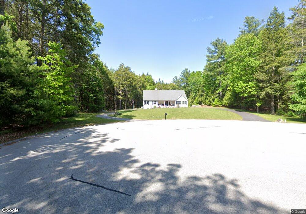
30 Serenity Dr Uxbridge, MA 01569
Estimated Value: $579,000 - $900,000
1
Bed
3
Baths
2,344
Sq Ft
$317/Sq Ft
Est. Value
About This Home
This home is located at 30 Serenity Dr, Uxbridge, MA 01569 and is currently estimated at $742,146, approximately $316 per square foot. 30 Serenity Dr is a home located in Worcester County with nearby schools including Uxbridge High School, Our Lady of the Valley Regional School, and Whitinsville Christian School.
Ownership History
Date
Name
Owned For
Owner Type
Purchase Details
Closed on
Dec 21, 2018
Sold by
Phillips Robert
Bought by
Phillips Robert and Phillips Mildred A
Current Estimated Value
Home Financials for this Owner
Home Financials are based on the most recent Mortgage that was taken out on this home.
Original Mortgage
$300,000
Outstanding Balance
$264,306
Interest Rate
4.8%
Mortgage Type
Adjustable Rate Mortgage/ARM
Estimated Equity
$477,840
Purchase Details
Closed on
Jun 11, 2004
Sold by
Hutnak Arlene M
Bought by
Phillips Robert
Home Financials for this Owner
Home Financials are based on the most recent Mortgage that was taken out on this home.
Original Mortgage
$125,000
Interest Rate
5.99%
Mortgage Type
Purchase Money Mortgage
Purchase Details
Closed on
Oct 31, 2003
Sold by
Hutnak Gary M and Hutnak Wendy L
Bought by
Hutnak Arlene M
Create a Home Valuation Report for This Property
The Home Valuation Report is an in-depth analysis detailing your home's value as well as a comparison with similar homes in the area
Home Values in the Area
Average Home Value in this Area
Purchase History
| Date | Buyer | Sale Price | Title Company |
|---|---|---|---|
| Phillips Robert | -- | -- | |
| Phillips Robert | $150,000 | -- | |
| Hutnak Arlene M | -- | -- |
Source: Public Records
Mortgage History
| Date | Status | Borrower | Loan Amount |
|---|---|---|---|
| Open | Phillips Robert | $300,000 | |
| Previous Owner | Phillips Robert | $125,000 |
Source: Public Records
Tax History
| Year | Tax Paid | Tax Assessment Tax Assessment Total Assessment is a certain percentage of the fair market value that is determined by local assessors to be the total taxable value of land and additions on the property. | Land | Improvement |
|---|---|---|---|---|
| 2025 | $9,994 | $762,300 | $172,000 | $590,300 |
| 2024 | $9,080 | $702,800 | $163,300 | $539,500 |
| 2023 | $8,279 | $593,500 | $141,000 | $452,500 |
| 2022 | $8,026 | $529,400 | $123,600 | $405,800 |
| 2021 | $8,375 | $529,400 | $123,600 | $405,800 |
| 2020 | $8,720 | $520,900 | $132,300 | $388,600 |
| 2019 | $9,074 | $523,000 | $154,700 | $368,300 |
| 2018 | $8,422 | $490,500 | $154,700 | $335,800 |
| 2017 | $8,356 | $492,700 | $140,200 | $352,500 |
| 2016 | $8,968 | $510,400 | $123,900 | $386,500 |
| 2015 | $8,759 | $503,400 | $123,900 | $379,500 |
Source: Public Records
Map
Nearby Homes
- 25 Dunny Cove Ln
- 218 E Hartford Ave Unit 218
- 288-290 Providence Rd
- 35 Pouts Ln
- 4 Moon Hill Rd
- 3 Strathmore Shire Unit A
- 3 Moon Hill Rd
- 44 Pouts Ln
- 597 Mendon Rd
- 24 Olde Canal Way Unit 24
- 76 Pouts Ln
- 255 Prairie St
- 185 Prairie St
- 125 Heritage Dr
- 831 Providence Rd Unit 837
- 164 Heritage Dr Unit 164
- 223 Mendon St
- 12 Hartford Ave E
- 237 Heritage Dr Unit 237
- 240 Heritage Dr
Your Personal Tour Guide
Ask me questions while you tour the home.