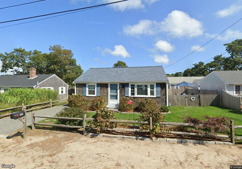
30 Shirley Ave Dennis Port, MA 2639
Dennis Port NeighborhoodEstimated Value: $461,000 - $629,000
2
Beds
1
Bath
744
Sq Ft
$733/Sq Ft
Est. Value
About This Home
This home is located at 30 Shirley Ave, Dennis Port, MA 2639 and is currently estimated at $545,346, approximately $732 per square foot. 30 Shirley Ave is a home located in Barnstable County with nearby schools including Dennis-Yarmouth Regional High School and St. Pius X. School.
Ownership History
Date
Name
Owned For
Owner Type
Purchase Details
Closed on
Jun 19, 2012
Sold by
Wallis Gail J
Bought by
Wallis Gail and Wallis Douglas
Current Estimated Value
Purchase Details
Closed on
Feb 17, 2011
Sold by
Wallis Douglas
Bought by
Kahn Gail J
Home Financials for this Owner
Home Financials are based on the most recent Mortgage that was taken out on this home.
Original Mortgage
$146,000
Interest Rate
4.77%
Purchase Details
Closed on
Mar 23, 2005
Sold by
Kahn Gail J and Kahn Robert I
Bought by
Kahn Gail J
Home Financials for this Owner
Home Financials are based on the most recent Mortgage that was taken out on this home.
Original Mortgage
$155,000
Interest Rate
5.56%
Purchase Details
Closed on
Feb 20, 2001
Sold by
Branzetti Marilyn M
Bought by
Kahn Robert I and Kahn Gail J
Create a Home Valuation Report for This Property
The Home Valuation Report is an in-depth analysis detailing your home's value as well as a comparison with similar homes in the area
Home Values in the Area
Average Home Value in this Area
Purchase History
| Date | Buyer | Sale Price | Title Company |
|---|---|---|---|
| Wallis Gail | -- | -- | |
| Kahn Gail J | -- | -- | |
| Wallis Douglas | -- | -- | |
| Wallis Douglas | -- | -- | |
| Kahn Gail J | -- | -- | |
| Kahn Robert I | $129,900 | -- |
Source: Public Records
Mortgage History
| Date | Status | Borrower | Loan Amount |
|---|---|---|---|
| Previous Owner | Wallis Douglas | $146,000 | |
| Previous Owner | Kahn Gail J | $155,000 |
Source: Public Records
Tax History Compared to Growth
Tax History
| Year | Tax Paid | Tax Assessment Tax Assessment Total Assessment is a certain percentage of the fair market value that is determined by local assessors to be the total taxable value of land and additions on the property. | Land | Improvement |
|---|---|---|---|---|
| 2025 | $2,211 | $510,600 | $269,000 | $241,600 |
| 2024 | $2,056 | $468,300 | $258,700 | $209,600 |
| 2023 | $1,988 | $425,800 | $235,200 | $190,600 |
| 2022 | $1,818 | $324,600 | $185,400 | $139,200 |
| 2021 | $1,779 | $295,100 | $181,700 | $113,400 |
| 2020 | $1,736 | $284,600 | $181,700 | $102,900 |
| 2019 | $1,758 | $284,900 | $193,500 | $91,400 |
| 2018 | $1,688 | $266,200 | $184,200 | $82,000 |
| 2017 | $1,523 | $247,700 | $169,600 | $78,100 |
| 2016 | $1,476 | $226,000 | $160,000 | $66,000 |
| 2015 | $1,446 | $226,000 | $160,000 | $66,000 |
| 2014 | $1,374 | $216,300 | $150,300 | $66,000 |
Source: Public Records
Map
Nearby Homes
- 37 Ocean Dr Unit 2
- 64 Beaten Rd
- 112 Old Wharf Rd Unit E4
- 112 Old Wharf Rd Unit E1
- 120 Old Wharf Rd Unit 11
- 154 Old Wharf Rd Unit 26
- 154 Old Wharf Rd Unit 14
- 80 Michaels Ave
- 217 Old Wharf Rd Unit 64
- 241 Old Wharf Rd Unit 82
- 241 Old Wharf Rd Unit 127
- 241 Old Wharf Rd Unit 90
- 6 Baker Way
- 31 Easy St
- 262 Old Wharf Rd Unit 67
- 262 Old Wharf Rd Unit 5
- 262 Old Wharf Rd Unit 5
- 262 Old Wharf Rd Unit 20
- 262 Old Wharf Rd Unit 87
- 37 Beach Hills Rd
- 30 Shirley Ave
- 32 Shirley Ave
- 28 Shirley Ave
- 0 Shirley Ave
- 37 Ocean Dr Unit 7
- 37 Ocean Dr Unit 6
- 37 Ocean Dr Unit 5
- 37 Ocean Dr Unit 4
- 37 Ocean Dr Unit 3
- 37 Ocean Dr Unit 1
- 37 Ocean Dr
- 34 Shirley Ave
- 29 Shirley Ave
- 33 Ocean Dr
- 27 Shirley Ave
- 25 Shirley Ave
- 39 Ocean Dr Unit 1
- 39 Ocean Dr Unit 3
- 39 Ocean Dr Unit 4
- 39 Ocean Dr Unit 6