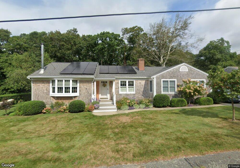
30 Spruce Dr Pocasset, MA 02559
Estimated Value: $750,000 - $1,060,000
3
Beds
3
Baths
1,772
Sq Ft
$500/Sq Ft
Est. Value
About This Home
This home is located at 30 Spruce Dr, Pocasset, MA 02559 and is currently estimated at $885,826, approximately $499 per square foot. 30 Spruce Dr is a home located in Barnstable County with nearby schools including Bourne High School, Cadence Academy Preschool - Bourne, and Heritage Christian Academy.
Ownership History
Date
Name
Owned For
Owner Type
Purchase Details
Closed on
Sep 15, 1988
Sold by
Garfalo Richard A
Bought by
Modic Patrick J
Current Estimated Value
Home Financials for this Owner
Home Financials are based on the most recent Mortgage that was taken out on this home.
Original Mortgage
$90,000
Interest Rate
10.43%
Mortgage Type
Purchase Money Mortgage
Create a Home Valuation Report for This Property
The Home Valuation Report is an in-depth analysis detailing your home's value as well as a comparison with similar homes in the area
Home Values in the Area
Average Home Value in this Area
Purchase History
| Date | Buyer | Sale Price | Title Company |
|---|---|---|---|
| Modic Patrick J | $180,000 | -- |
Source: Public Records
Mortgage History
| Date | Status | Borrower | Loan Amount |
|---|---|---|---|
| Open | Modic Patrick J | $110,000 | |
| Closed | Modic Patrick J | $90,000 |
Source: Public Records
Tax History Compared to Growth
Tax History
| Year | Tax Paid | Tax Assessment Tax Assessment Total Assessment is a certain percentage of the fair market value that is determined by local assessors to be the total taxable value of land and additions on the property. | Land | Improvement |
|---|---|---|---|---|
| 2025 | $5,474 | $700,900 | $383,500 | $317,400 |
| 2024 | $5,353 | $667,400 | $365,200 | $302,200 |
| 2023 | $5,204 | $590,700 | $323,200 | $267,500 |
| 2022 | $4,700 | $465,800 | $253,500 | $212,300 |
| 2021 | $4,566 | $424,000 | $230,700 | $193,300 |
| 2020 | $4,440 | $413,400 | $228,500 | $184,900 |
| 2019 | $4,236 | $403,000 | $228,500 | $174,500 |
| 2018 | $4,019 | $381,300 | $223,300 | $158,000 |
| 2017 | $3,888 | $377,500 | $221,100 | $156,400 |
| 2016 | $3,530 | $347,400 | $210,100 | $137,300 |
| 2015 | $3,331 | $330,800 | $193,500 | $137,300 |
Source: Public Records
Map
Nearby Homes
- 22 Nairn Rd
- 48 Red Brook Harbor Rd
- 1094 County Rd
- 940 County Rd
- 34 Kenwood Rd
- 254 Barlows Landing Rd
- 45 Kenwood Rd
- 70 Wings Neck Rd
- 940 County Rd
- 709 County Rd
- 24 Richmond Rd
- 7 4th Ave
- 174 Barlows Landing Rd
- 1234 Route 28a
- 10 Squeteague Harbor Rd
- 89 Harbor Dr
- 1234 Route 28a
- 15 1st St
- 14 Navajo Rd
- 39 Bennets Neck Dr