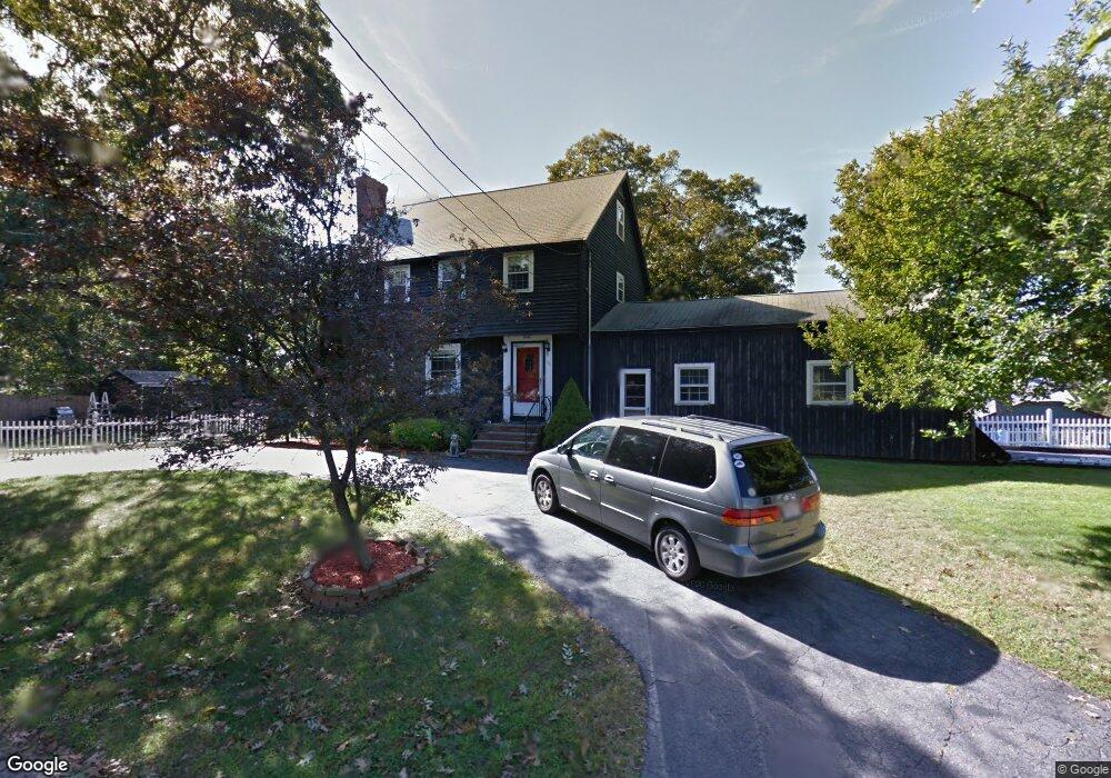
30 Summit Rd Saugus, MA 01906
Oakland Vale NeighborhoodEstimated Value: $854,546 - $915,000
3
Beds
4
Baths
2,379
Sq Ft
$374/Sq Ft
Est. Value
About This Home
This home is located at 30 Summit Rd, Saugus, MA 01906 and is currently estimated at $889,637, approximately $373 per square foot. 30 Summit Rd is a home located in Essex County with nearby schools including Saugus High School, Melrose Montessori School, and St Mary's School.
Ownership History
Date
Name
Owned For
Owner Type
Purchase Details
Closed on
Aug 21, 2002
Sold by
Lee Frank A
Bought by
Osgood Susan P
Current Estimated Value
Home Financials for this Owner
Home Financials are based on the most recent Mortgage that was taken out on this home.
Original Mortgage
$200,000
Outstanding Balance
$84,751
Interest Rate
6.57%
Mortgage Type
Purchase Money Mortgage
Estimated Equity
$804,886
Create a Home Valuation Report for This Property
The Home Valuation Report is an in-depth analysis detailing your home's value as well as a comparison with similar homes in the area
Home Values in the Area
Average Home Value in this Area
Purchase History
| Date | Buyer | Sale Price | Title Company |
|---|---|---|---|
| Osgood Susan P | $399,000 | -- |
Source: Public Records
Mortgage History
| Date | Status | Borrower | Loan Amount |
|---|---|---|---|
| Open | Osgood Susan P | $200,000 |
Source: Public Records
Tax History
| Year | Tax Paid | Tax Assessment Tax Assessment Total Assessment is a certain percentage of the fair market value that is determined by local assessors to be the total taxable value of land and additions on the property. | Land | Improvement |
|---|---|---|---|---|
| 2025 | $7,632 | $714,600 | $337,900 | $376,700 |
| 2024 | $7,315 | $686,900 | $318,600 | $368,300 |
| 2023 | $6,956 | $617,800 | $280,000 | $337,800 |
| 2022 | $6,466 | $538,400 | $256,800 | $281,600 |
| 2021 | $6,227 | $504,600 | $223,000 | $281,600 |
| 2020 | $5,888 | $494,000 | $212,400 | $281,600 |
| 2019 | $5,628 | $462,100 | $193,100 | $269,000 |
| 2018 | $5,242 | $452,700 | $187,300 | $265,400 |
| 2017 | $5,194 | $431,000 | $174,700 | $256,300 |
| 2016 | $4,754 | $389,700 | $174,300 | $215,400 |
| 2015 | $4,462 | $371,200 | $166,000 | $205,200 |
| 2014 | $4,404 | $379,300 | $166,000 | $213,300 |
Source: Public Records
Map
Nearby Homes
- 34 Golden Hills Rd
- 93 Sweetwater St
- 176 Bay State Rd
- 9 Ledge St
- 7 West St
- 70 Old Nahant Rd
- 177 Oak St
- 89 Lovell Rd
- 86 Lynn Fells Pkwy
- 225 Howard St
- 21 Athens Dr
- 0 Everett St
- 15 Hickory Hill Rd
- 104 Myrtle Ave
- 24 Gladstone St
- 824 Main St Unit 1
- 1 Sidney St
- 1215 Sheffield Way
- 348 Lynn Fells Pkwy
- 148 Forest St
- 31 Castle Rock Rd
- 25 Castle Rock Rd
- 38 Summit Rd
- 31 Summit Rd
- 35 Castle Rock Rd
- 27 Summit Rd
- 23 Summit Rd
- 40 Summit Rd
- 21 Castle Rock Rd
- 37 Castle Rock Rd
- 41 Castle Rock Rd
- 13 Summit Rd
- 45 Castle Rock Rd
- 13 Castle Rock Rd
- 12 Summit Rd
- 10 Summit Rd
- 9 Castle Rock Rd
- 47 Castle Rock Rd
- 7 Summit Rd
- 5 Castle Rock Rd
Your Personal Tour Guide
Ask me questions while you tour the home.