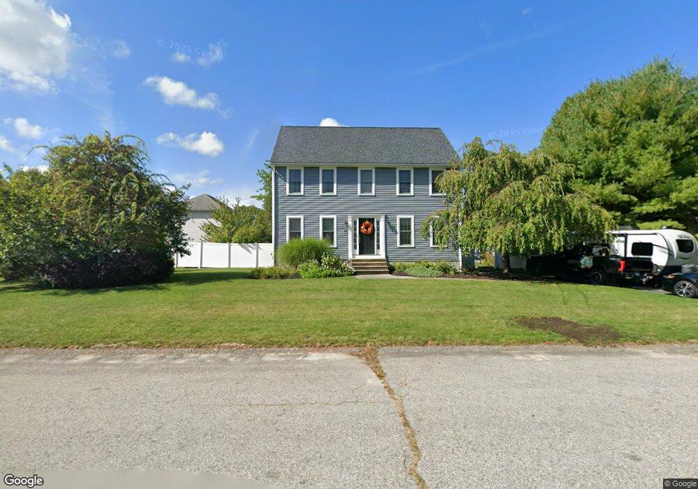
30 Turnstone Dr Attleboro, MA 02703
Estimated Value: $581,071 - $706,000
3
Beds
2
Baths
1,656
Sq Ft
$382/Sq Ft
Est. Value
About This Home
This home is located at 30 Turnstone Dr, Attleboro, MA 02703 and is currently estimated at $631,768, approximately $381 per square foot. 30 Turnstone Dr is a home located in Bristol County with nearby schools including Hyman Fine Elementary School, Wamsutta Middle School, and Attleboro High School.
Ownership History
Date
Name
Owned For
Owner Type
Purchase Details
Closed on
Dec 30, 1994
Sold by
Allen Homes Lp 1St
Bought by
Quilty Dennis P and Quilty Toni Lynn
Current Estimated Value
Home Financials for this Owner
Home Financials are based on the most recent Mortgage that was taken out on this home.
Original Mortgage
$130,400
Interest Rate
9.2%
Mortgage Type
Purchase Money Mortgage
Create a Home Valuation Report for This Property
The Home Valuation Report is an in-depth analysis detailing your home's value as well as a comparison with similar homes in the area
Home Values in the Area
Average Home Value in this Area
Purchase History
| Date | Buyer | Sale Price | Title Company |
|---|---|---|---|
| Quilty Dennis P | $144,900 | -- |
Source: Public Records
Mortgage History
| Date | Status | Borrower | Loan Amount |
|---|---|---|---|
| Open | Quilty Dennis P | $21,800 | |
| Open | Quilty Dennis P | $153,000 | |
| Closed | Quilty Dennis P | $26,000 | |
| Closed | Quilty Dennis P | $130,400 |
Source: Public Records
Tax History Compared to Growth
Tax History
| Year | Tax Paid | Tax Assessment Tax Assessment Total Assessment is a certain percentage of the fair market value that is determined by local assessors to be the total taxable value of land and additions on the property. | Land | Improvement |
|---|---|---|---|---|
| 2025 | $6,044 | $481,600 | $174,500 | $307,100 |
| 2024 | $5,697 | $447,500 | $157,100 | $290,400 |
| 2023 | $5,435 | $397,000 | $158,900 | $238,100 |
| 2022 | $5,232 | $362,100 | $151,200 | $210,900 |
| 2021 | $5,035 | $340,200 | $145,600 | $194,600 |
| 2020 | $4,793 | $329,200 | $138,800 | $190,400 |
| 2019 | $4,659 | $329,000 | $136,100 | $192,900 |
| 2018 | $4,541 | $306,400 | $132,100 | $174,300 |
| 2017 | $4,419 | $303,700 | $128,900 | $174,800 |
| 2016 | $4,548 | $306,900 | $120,300 | $186,600 |
| 2015 | $4,426 | $300,900 | $120,300 | $180,600 |
| 2014 | $4,360 | $293,600 | $115,000 | $178,600 |
Source: Public Records
Map
Nearby Homes
- 10 French Farm Rd
- 599 Oakhill Ave
- 96 Mary Rocha Way
- 51 Saveena Dr
- 58 Saveena Dr
- 74 Saveena Dr
- 78 Saveena Dr
- 38 Standish Rd
- 1080 Oakhill Ave
- 172 Downing Dr
- 2 Valley Run Dr
- 12 Valley Run Dr
- 73 Valley Run Dr
- 139 Downing Dr
- 12 Knollcrest Cir
- 45 Spruce Ln
- 1325 Park St
- 3 Wilmarth St
- 429 S Main St Unit 1
- 71 Parsonage Way
- 34 Blue Heron Dr
- 22 Turnstone Dr
- 37 Turnstone Dr
- 41 Blue Heron Dr
- 23 Sandpiper Ln
- 15 Sandpiper Ln
- 29 Turnstone Dr
- 38 Turnstone Dr
- 33 Blue Heron Dr
- 45 Turnstone Dr
- 16 Sandpiper Ln
- 46 Turnstone Dr
- 132 Richie Rd
- 21 Turnstone Dr
- 25 Blue Heron Dr
- 124 Richie Rd
- 53 Turnstone Dr
- 32 Sandpiper Ln
- 148 Richie Rd
- 24 Sandpiper Ln