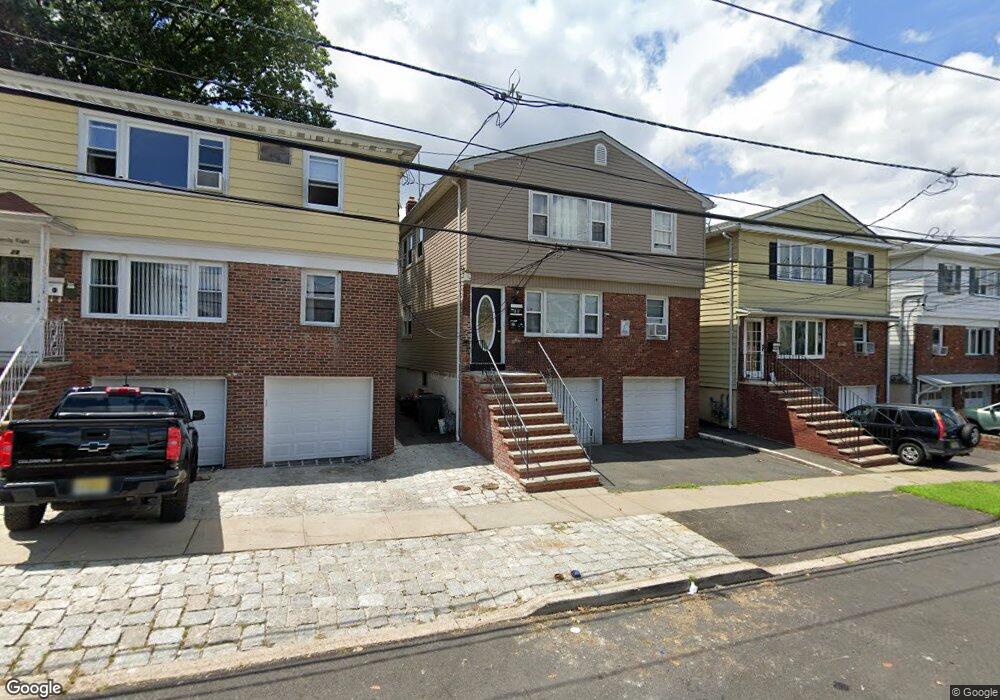
30 Vine St Hillside, NJ 07205
Estimated Value: $488,000 - $712,000
--
Bed
--
Bath
2,430
Sq Ft
$250/Sq Ft
Est. Value
About This Home
This home is located at 30 Vine St, Hillside, NJ 07205 and is currently estimated at $607,667, approximately $250 per square foot. 30 Vine St is a home located in Union County with nearby schools including Abram P. Morris-Saybrook Elementary School, Hurden Looker School, and Ola Edwards Community School.
Ownership History
Date
Name
Owned For
Owner Type
Purchase Details
Closed on
Oct 21, 2024
Sold by
Bastos Sara
Bought by
Vineestates Llc
Current Estimated Value
Purchase Details
Closed on
Dec 20, 2002
Sold by
Camacho Joaquim
Bought by
Bastos Sara
Home Financials for this Owner
Home Financials are based on the most recent Mortgage that was taken out on this home.
Original Mortgage
$275,000
Interest Rate
5.99%
Purchase Details
Closed on
Aug 26, 1993
Sold by
Trujillo Richard
Bought by
Comacho Joaquim C and Comacho Luzia
Home Financials for this Owner
Home Financials are based on the most recent Mortgage that was taken out on this home.
Original Mortgage
$125,000
Interest Rate
7.11%
Create a Home Valuation Report for This Property
The Home Valuation Report is an in-depth analysis detailing your home's value as well as a comparison with similar homes in the area
Home Values in the Area
Average Home Value in this Area
Purchase History
| Date | Buyer | Sale Price | Title Company |
|---|---|---|---|
| Vineestates Llc | -- | None Listed On Document | |
| Vineestates Llc | -- | None Listed On Document | |
| Vineestates Llc | -- | None Listed On Document | |
| Bastos Sara | $295,000 | -- | |
| Comacho Joaquim C | $165,000 | -- |
Source: Public Records
Mortgage History
| Date | Status | Borrower | Loan Amount |
|---|---|---|---|
| Previous Owner | Bastos Sara | $275,000 | |
| Previous Owner | Comacho Joaquim C | $125,000 |
Source: Public Records
Tax History Compared to Growth
Tax History
| Year | Tax Paid | Tax Assessment Tax Assessment Total Assessment is a certain percentage of the fair market value that is determined by local assessors to be the total taxable value of land and additions on the property. | Land | Improvement |
|---|---|---|---|---|
| 2025 | $12,660 | $153,400 | $46,200 | $107,200 |
| 2024 | $12,292 | $153,400 | $46,200 | $107,200 |
| 2023 | $12,292 | $153,400 | $46,200 | $107,200 |
| 2022 | $12,178 | $153,400 | $46,200 | $107,200 |
| 2021 | $12,099 | $153,400 | $46,200 | $107,200 |
| 2020 | $12,028 | $153,400 | $46,200 | $107,200 |
| 2019 | $11,795 | $153,400 | $46,200 | $107,200 |
| 2018 | $11,677 | $153,400 | $46,200 | $107,200 |
| 2017 | $11,606 | $153,400 | $46,200 | $107,200 |
| 2016 | $11,592 | $153,400 | $46,200 | $107,200 |
| 2015 | $11,490 | $153,400 | $46,200 | $107,200 |
| 2014 | $11,309 | $153,400 | $46,200 | $107,200 |
Source: Public Records
Map
Nearby Homes
- 1290 Baker St
- 1282 Baker St
- 155 Silver Ave
- 1406 Maple Ave
- 149 Baltimore Ave
- 1414 Boa Place Unit 2
- 1451 Bond St
- 628 Us Highway 22 and 3
- 220 Silver Ave
- 1473 Center St
- 1141 Church St
- 420 Hollywood Ave
- 1444 N Broad St
- 383 Conant St
- 257 Herbert Ave
- 124 Woodruff Place
- 105 Liberty Ct Unit 105
- 146 Williamson Ave
- 1451 Franklin St
- 1470B Liberty Ave