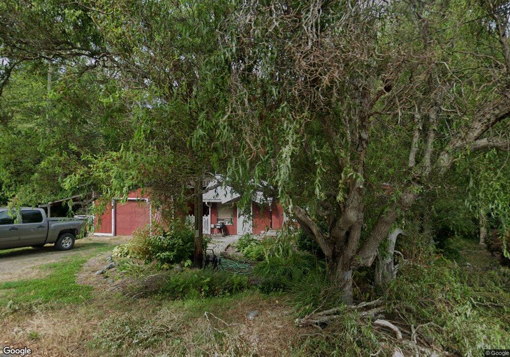
30 W Cedar St Port Ludlow, WA 98365
Estimated Value: $430,563 - $608,000
3
Beds
2
Baths
1,405
Sq Ft
$356/Sq Ft
Est. Value
About This Home
This home is located at 30 W Cedar St, Port Ludlow, WA 98365 and is currently estimated at $500,641, approximately $356 per square foot. 30 W Cedar St is a home with nearby schools including Chimacum Creek Primary School, Chimacum School Pi Program, and Chimacum Elementary School.
Ownership History
Date
Name
Owned For
Owner Type
Purchase Details
Closed on
May 16, 2016
Sold by
Bauman David
Bought by
Bauman David and Bauman Camille
Current Estimated Value
Home Financials for this Owner
Home Financials are based on the most recent Mortgage that was taken out on this home.
Original Mortgage
$142,000
Outstanding Balance
$112,783
Interest Rate
3.59%
Mortgage Type
New Conventional
Estimated Equity
$387,858
Purchase Details
Closed on
Nov 22, 2005
Sold by
Force Robert D and Force Janet M
Bought by
Bauman David
Home Financials for this Owner
Home Financials are based on the most recent Mortgage that was taken out on this home.
Original Mortgage
$29,250
Interest Rate
5.97%
Mortgage Type
Credit Line Revolving
Create a Home Valuation Report for This Property
The Home Valuation Report is an in-depth analysis detailing your home's value as well as a comparison with similar homes in the area
Home Values in the Area
Average Home Value in this Area
Purchase History
| Date | Buyer | Sale Price | Title Company |
|---|---|---|---|
| Bauman David | $280 | Jefferson Title Co Inc | |
| Bauman David | $195,000 | First American Title |
Source: Public Records
Mortgage History
| Date | Status | Borrower | Loan Amount |
|---|---|---|---|
| Open | Bauman David | $142,000 | |
| Previous Owner | Bauman David | $29,250 |
Source: Public Records
Tax History Compared to Growth
Tax History
| Year | Tax Paid | Tax Assessment Tax Assessment Total Assessment is a certain percentage of the fair market value that is determined by local assessors to be the total taxable value of land and additions on the property. | Land | Improvement |
|---|---|---|---|---|
| 2024 | $1,883 | $247,702 | $64,575 | $183,127 |
| 2023 | $1,883 | $231,303 | $56,500 | $174,803 |
| 2022 | $1,587 | $226,303 | $51,500 | $174,803 |
| 2021 | $1,680 | $167,545 | $39,000 | $128,545 |
| 2020 | $1,553 | $167,545 | $39,000 | $128,545 |
| 2019 | $1,477 | $149,463 | $35,750 | $113,713 |
| 2018 | $1,527 | $142,894 | $34,125 | $108,769 |
| 2017 | $1,490 | $131,381 | $32,500 | $98,881 |
| 2016 | $1,510 | $131,381 | $32,500 | $98,881 |
| 2015 | $1,487 | $133,687 | $27,500 | $106,187 |
| 2014 | -- | $133,687 | $27,500 | $106,187 |
| 2013 | -- | $133,685 | $27,500 | $106,185 |
Source: Public Records
Map
Nearby Homes
- 24 W Spruce St
- 0 Hill St
- 15 White Rock Ln
- 13 White Rock Ln
- 54 Ship View Ct Unit Port Ludlow WA 98365
- 54 Ship View Ct
- 90 Mccartney Ln
- 61 McCartney Peak Ln
- 61 McCartney Peak Ln Unit 73
- 0 xxx E Tala Shore Dr
- 71 Mccartney Ln
- 11 McCartney Peak Ln Unit 78
- 51 McCartney Peak Ln Unit 74
- 71 McCartney Peak Ln Unit 72
- 90 McCartney Peak Ln Unit 70
- 21 Mount Lena Ln
- 60 McCartney Peak Ln Unit 67
- 644 & 634 Bywater Way
- 306 Crestview Dr
- 713 Olympic Ridge Dr