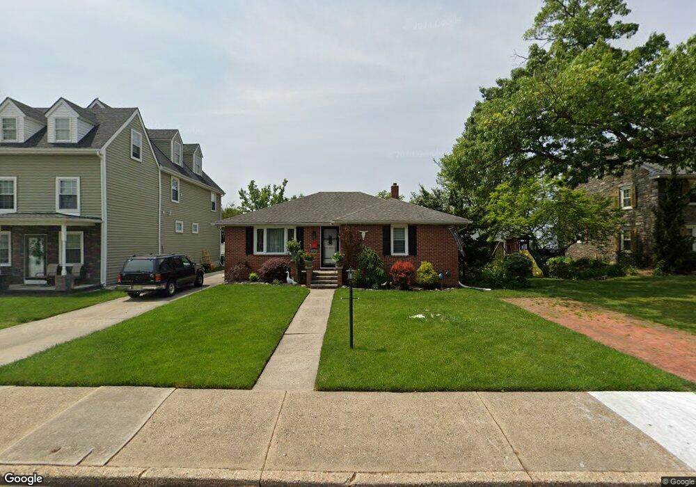
30 W Maple Ave Penns Grove, NJ 08069
Estimated Value: $191,393 - $300,000
--
Bed
--
Bath
1,342
Sq Ft
$186/Sq Ft
Est. Value
About This Home
This home is located at 30 W Maple Ave, Penns Grove, NJ 08069 and is currently estimated at $249,848, approximately $186 per square foot. 30 W Maple Ave is a home located in Salem County with nearby schools including Lafayette-Pershing Elementary School, Paul W. Carleton Elementary School, and Field Street Elementary School.
Ownership History
Date
Name
Owned For
Owner Type
Purchase Details
Closed on
May 14, 2004
Sold by
Nicholas Rosemarie
Bought by
Scofield Rachel and Plagge Arthur
Current Estimated Value
Home Financials for this Owner
Home Financials are based on the most recent Mortgage that was taken out on this home.
Original Mortgage
$80,000
Outstanding Balance
$37,429
Interest Rate
5.47%
Mortgage Type
Stand Alone First
Estimated Equity
$212,419
Purchase Details
Closed on
Feb 1, 2000
Sold by
Nicholas Ernest J
Bought by
Nicholas Rosemarie
Create a Home Valuation Report for This Property
The Home Valuation Report is an in-depth analysis detailing your home's value as well as a comparison with similar homes in the area
Home Values in the Area
Average Home Value in this Area
Purchase History
| Date | Buyer | Sale Price | Title Company |
|---|---|---|---|
| Scofield Rachel | $130,000 | West Jersey Title Agency | |
| Nicholas Rosemarie | -- | -- |
Source: Public Records
Mortgage History
| Date | Status | Borrower | Loan Amount |
|---|---|---|---|
| Open | Scofield Rachel | $80,000 |
Source: Public Records
Tax History Compared to Growth
Tax History
| Year | Tax Paid | Tax Assessment Tax Assessment Total Assessment is a certain percentage of the fair market value that is determined by local assessors to be the total taxable value of land and additions on the property. | Land | Improvement |
|---|---|---|---|---|
| 2025 | $6,289 | $113,400 | $51,600 | $61,800 |
| 2024 | $6,078 | $113,400 | $51,600 | $61,800 |
| 2023 | $6,078 | $113,400 | $51,600 | $61,800 |
| 2022 | $5,859 | $113,400 | $51,600 | $61,800 |
| 2021 | $5,607 | $113,400 | $51,600 | $61,800 |
| 2020 | $5,680 | $113,400 | $51,600 | $61,800 |
| 2019 | $5,704 | $113,400 | $51,600 | $61,800 |
| 2018 | $5,244 | $130,000 | $74,600 | $55,400 |
| 2017 | $5,262 | $130,000 | $74,600 | $55,400 |
| 2016 | $5,064 | $130,000 | $74,600 | $55,400 |
| 2015 | $5,735 | $153,700 | $74,600 | $79,100 |
| 2014 | $5,672 | $153,700 | $74,600 | $79,100 |
Source: Public Records
Map
Nearby Homes