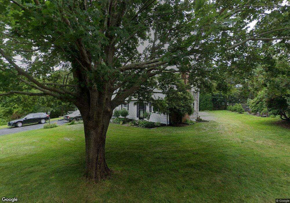
30 Wampanog Ln Tiverton, RI 02878
South Tiverton NeighborhoodEstimated Value: $658,206 - $1,128,000
4
Beds
3
Baths
2,475
Sq Ft
$362/Sq Ft
Est. Value
About This Home
This home is located at 30 Wampanog Ln, Tiverton, RI 02878 and is currently estimated at $895,552, approximately $361 per square foot. 30 Wampanog Ln is a home located in Newport County with nearby schools including Tiverton High School.
Ownership History
Date
Name
Owned For
Owner Type
Purchase Details
Closed on
Jan 29, 2000
Sold by
Dellea David C and Dellea Janet A
Bought by
Ekstrom Robert W and Ekstrom Linda
Current Estimated Value
Purchase Details
Closed on
Sep 17, 1992
Sold by
Morich Petral and Morich Virginia
Bought by
Dellea David C and Dellea Janet
Create a Home Valuation Report for This Property
The Home Valuation Report is an in-depth analysis detailing your home's value as well as a comparison with similar homes in the area
Home Values in the Area
Average Home Value in this Area
Purchase History
| Date | Buyer | Sale Price | Title Company |
|---|---|---|---|
| Ekstrom Robert W | $235,000 | -- | |
| Dellea David C | $150,000 | -- |
Source: Public Records
Mortgage History
| Date | Status | Borrower | Loan Amount |
|---|---|---|---|
| Closed | Dellea David C | $100,000 | |
| Closed | Dellea David C | $75,000 | |
| Open | Dellea David C | $203,000 |
Source: Public Records
Tax History Compared to Growth
Tax History
| Year | Tax Paid | Tax Assessment Tax Assessment Total Assessment is a certain percentage of the fair market value that is determined by local assessors to be the total taxable value of land and additions on the property. | Land | Improvement |
|---|---|---|---|---|
| 2025 | $5,952 | $538,600 | $191,100 | $347,500 |
| 2024 | $5,952 | $538,600 | $191,100 | $347,500 |
| 2023 | $5,517 | $370,300 | $160,000 | $210,300 |
| 2022 | $5,417 | $370,300 | $160,000 | $210,300 |
| 2021 | $5,284 | $370,300 | $160,000 | $210,300 |
| 2020 | $6,282 | $388,000 | $151,400 | $236,600 |
| 2019 | $6,127 | $388,000 | $151,400 | $236,600 |
| 2018 | $6,359 | $388,000 | $151,400 | $236,600 |
| 2017 | $6,338 | $332,700 | $130,100 | $202,600 |
| 2016 | $6,368 | $332,700 | $130,100 | $202,600 |
| 2015 | $6,368 | $332,700 | $130,100 | $202,600 |
| 2014 | $6,624 | $343,200 | $130,100 | $213,100 |
Source: Public Records
Map
Nearby Homes
- 82 Nonquit Ln
- 7 Gadsby Ln
- 3333 Main Rd
- 3622 Main Rd
- 0 Seapowet Ave
- 451 Seapowet Ave
- 3118 Main Rd
- 24 Peaceful Way
- 32 Arrowhead Dr
- 46 Arrowhead Dr
- 0 Main Rd
- 68 Riverscape Ln
- 0 Riverscape Ln Unit 73452278
- 0 Riverscape Ln Unit 1399502
- 0 S Lake Rd Unit 73361665
- 0 S Lake Rd Unit 1382842
- 0 S Lake Rd Unit 1400795
- 58 Leonard Dr
- 60 Edmond Ln
- 219 Nanaquaket Rd