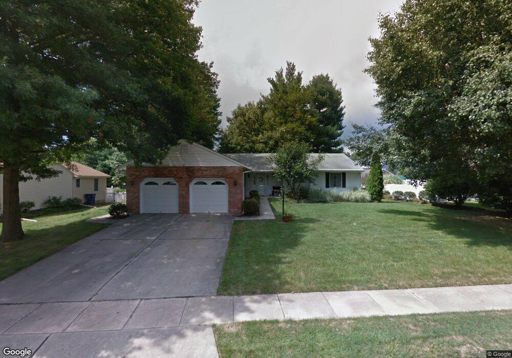
30 Wynnwood St Woodstown, NJ 08098
Estimated Value: $337,980 - $421,000
--
Bed
--
Bath
1,983
Sq Ft
$197/Sq Ft
Est. Value
About This Home
This home is located at 30 Wynnwood St, Woodstown, NJ 08098 and is currently estimated at $390,245, approximately $196 per square foot. 30 Wynnwood St is a home located in Salem County with nearby schools including Mary S. Shoemaker School and Woodstown High School.
Ownership History
Date
Name
Owned For
Owner Type
Purchase Details
Closed on
May 12, 2004
Sold by
Layton Florence C
Bought by
Lewis Michael H and Lewis Linda F
Current Estimated Value
Purchase Details
Closed on
Feb 12, 1997
Sold by
Boyer P Scott and Constance Shoemaker L
Bought by
Layton Florence C
Home Financials for this Owner
Home Financials are based on the most recent Mortgage that was taken out on this home.
Original Mortgage
$160,000
Interest Rate
7.6%
Create a Home Valuation Report for This Property
The Home Valuation Report is an in-depth analysis detailing your home's value as well as a comparison with similar homes in the area
Home Values in the Area
Average Home Value in this Area
Purchase History
| Date | Buyer | Sale Price | Title Company |
|---|---|---|---|
| Lewis Michael H | $199,000 | West Jersey Title Agency | |
| Layton Florence C | $135,000 | Intercoastal Title Agency In |
Source: Public Records
Mortgage History
| Date | Status | Borrower | Loan Amount |
|---|---|---|---|
| Previous Owner | Layton Florence C | $160,000 |
Source: Public Records
Tax History Compared to Growth
Tax History
| Year | Tax Paid | Tax Assessment Tax Assessment Total Assessment is a certain percentage of the fair market value that is determined by local assessors to be the total taxable value of land and additions on the property. | Land | Improvement |
|---|---|---|---|---|
| 2025 | $9,839 | $245,000 | $97,400 | $147,600 |
| 2024 | $9,717 | $245,000 | $97,400 | $147,600 |
| 2023 | $9,717 | $245,000 | $97,400 | $147,600 |
| 2022 | $9,572 | $245,000 | $97,400 | $147,600 |
| 2021 | $8,824 | $245,000 | $97,400 | $147,600 |
| 2020 | $9,161 | $245,000 | $97,400 | $147,600 |
| 2019 | $8,815 | $245,000 | $97,400 | $147,600 |
| 2018 | $8,499 | $245,000 | $97,400 | $147,600 |
| 2017 | $8,318 | $245,000 | $97,400 | $147,600 |
| 2016 | $8,617 | $262,000 | $97,400 | $164,600 |
| 2015 | $8,017 | $262,000 | $97,400 | $164,600 |
| 2014 | $7,603 | $262,000 | $97,400 | $164,600 |
Source: Public Records
Map
Nearby Homes
- 15 E Grant St
- 50 Colson Ct
- L13 Highway 40 W
- 36 Bowen Ave
- 76 West Ave
- 35 Green St
- 39 Green St
- 47 Dickinson St
- 133 Spring Garden St
- 8 Eichmann Way
- 64 W Millbrooke Ave
- 96 Kingsberry Ln
- 73 Kingsberry Ln
- 29 Kingsberry Ln
- 178 E Millbrooke Ave
- 13 Alloway Rd
- 22 Alloway Rd
- 444 S Main St
- 438 Bailey St
- 440 Bailey St