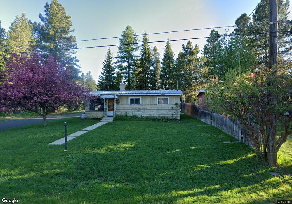
300#307 Mcbride St McCall, ID 83638
Estimated Value: $432,000 - $547,000
2
Beds
2
Baths
864
Sq Ft
$563/Sq Ft
Est. Value
About This Home
This home is located at 300#307 Mcbride St, McCall, ID 83638 and is currently estimated at $486,445, approximately $563 per square foot. 300#307 Mcbride St is a home located in Valley County with nearby schools including McCall-Donnelly High School, Mountain Life Education, and The North Fork School.
Ownership History
Date
Name
Owned For
Owner Type
Purchase Details
Closed on
Jan 5, 2005
Sold by
Heinrich Carl F
Bought by
Morell Randail E and Morell Deanna J
Current Estimated Value
Home Financials for this Owner
Home Financials are based on the most recent Mortgage that was taken out on this home.
Original Mortgage
$85,500
Outstanding Balance
$43,025
Interest Rate
5.7%
Mortgage Type
New Conventional
Estimated Equity
$443,420
Create a Home Valuation Report for This Property
The Home Valuation Report is an in-depth analysis detailing your home's value as well as a comparison with similar homes in the area
Home Values in the Area
Average Home Value in this Area
Purchase History
| Date | Buyer | Sale Price | Title Company |
|---|---|---|---|
| Morell Randail E | -- | -- |
Source: Public Records
Mortgage History
| Date | Status | Borrower | Loan Amount |
|---|---|---|---|
| Open | Morell Randail E | $85,500 |
Source: Public Records
Tax History Compared to Growth
Tax History
| Year | Tax Paid | Tax Assessment Tax Assessment Total Assessment is a certain percentage of the fair market value that is determined by local assessors to be the total taxable value of land and additions on the property. | Land | Improvement |
|---|---|---|---|---|
| 2025 | $1,642 | $329,359 | $164,110 | $165,249 |
| 2023 | $1,642 | $336,023 | $182,345 | $153,678 |
| 2022 | $1,533 | $296,740 | $161,220 | $135,520 |
| 2021 | $1,437 | $180,669 | $59,337 | $121,332 |
| 2020 | $1,259 | $137,303 | $45,571 | $91,732 |
| 2019 | $1,384 | $139,700 | $49,886 | $89,814 |
| 2018 | $1,254 | $116,493 | $41,290 | $75,203 |
| 2017 | $1,467 | $129,832 | $52,915 | $76,917 |
| 2016 | $1,383 | $119,216 | $45,783 | $73,433 |
| 2015 | $1,314 | $108,515 | $0 | $0 |
| 2013 | -- | $102,793 | $0 | $0 |
Source: Public Records
Map
Nearby Homes
- 300 Mcbride St Unit 101
- 300 Mcbride St
- 304 Mcbride St Unit 301
- 1530 Dragonfly Loop
- Lot 14 Sunbridge Dr Unit 14
- Lot 14 Sunbridge Dr
- Lot 9 Sunbridge Dr Unit 9
- Lot 5 Sunbridge Dr Unit 5
- Lot 12 Sunbridge Dr
- Lot 3 Sunbridge Dr
- Lot 12 Sunbridge Dr Unit 12
- Lot 3 Sunbridge Dr Unit 3
- TBD Sunbridge Dr
- TBD Sunbridge Dr Unit 3-6,9, 10, 12-15
- Lot 36 To Be Determined Unit 36
- Lot 37 To Be Determined Unit 37
- Lot 32 To Be Determined Unit 32
- Lot 34 To Be Determined Unit 34
- Lot 33 To Be Determined Unit 33
- Lot 31 To Be Determined Unit 31
- 0 Mcbride St
- 304 #105 Mcbride St
- 300 #107 Mcbride St
- 304 #104 Mcbride St
- #107 Mcbride St
- TBD Mcbride St
- 304 #103 Mcbride
- 304 #103 Mcbride Unit 103
- 304 #101 Mcbride St
- 307 Mcbride St
- 304 0 McBride St Unit 104
- 304 McBribe St 302
- 304 Mcbride St Unit 308
- 304 Mcbride St Unit 11
- 304 Mcbride St Unit 306
- 304 Mcbride St Unit 104
- 304 Mcbride St
- 304 Mcbride St Unit 208
- 304 Mcbride St Unit 108
- 304 Mcbride St Unit 1