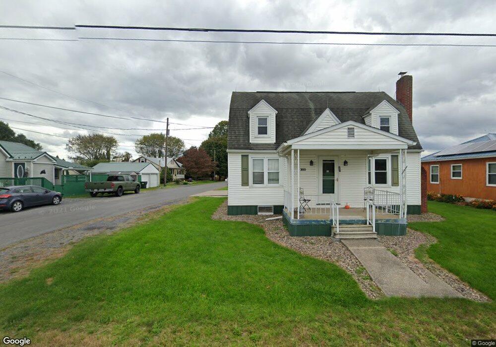
300 Airport Rd Selinsgrove, PA 17870
Estimated Value: $135,582 - $218,000
--
Bed
--
Bath
--
Sq Ft
7,405
Sq Ft Lot
About This Home
This home is located at 300 Airport Rd, Selinsgrove, PA 17870 and is currently estimated at $191,146. 300 Airport Rd is a home located in Snyder County with nearby schools including Selinsgrove Area Elementary School, Selinsgrove Intermediate School, and Selinsgrove Area Middle School.
Ownership History
Date
Name
Owned For
Owner Type
Purchase Details
Closed on
Aug 7, 2017
Sold by
Shaffer David A
Bought by
Gray Rodney
Current Estimated Value
Home Financials for this Owner
Home Financials are based on the most recent Mortgage that was taken out on this home.
Original Mortgage
$56,925
Outstanding Balance
$39,136
Interest Rate
3.96%
Mortgage Type
Unknown
Estimated Equity
$152,010
Purchase Details
Closed on
Dec 16, 2014
Sold by
Shaffer David A
Bought by
Shaffer David A
Purchase Details
Closed on
Aug 11, 2010
Sold by
Shaffer Esther
Bought by
Shaffer Esther and Shaffer David A
Create a Home Valuation Report for This Property
The Home Valuation Report is an in-depth analysis detailing your home's value as well as a comparison with similar homes in the area
Home Values in the Area
Average Home Value in this Area
Purchase History
| Date | Buyer | Sale Price | Title Company |
|---|---|---|---|
| Gray Rodney | $75,900 | None Available | |
| Shaffer David A | -- | None Available | |
| Shaffer Esther | -- | -- |
Source: Public Records
Mortgage History
| Date | Status | Borrower | Loan Amount |
|---|---|---|---|
| Open | Gray Rodney | $56,925 | |
| Closed | Shaffer Esther | $0 |
Source: Public Records
Tax History Compared to Growth
Tax History
| Year | Tax Paid | Tax Assessment Tax Assessment Total Assessment is a certain percentage of the fair market value that is determined by local assessors to be the total taxable value of land and additions on the property. | Land | Improvement |
|---|---|---|---|---|
| 2025 | $1,513 | $15,580 | $1,650 | $13,930 |
| 2024 | $1,469 | $15,580 | $1,650 | $13,930 |
| 2023 | $371 | $15,580 | $1,650 | $13,930 |
| 2022 | $1,399 | $15,580 | $1,650 | $13,930 |
| 2021 | $1,399 | $15,580 | $1,650 | $13,930 |
| 2020 | $1,399 | $15,580 | $1,650 | $13,930 |
| 2019 | $1,399 | $15,580 | $1,650 | $13,930 |
| 2018 | $1,399 | $15,580 | $1,650 | $13,930 |
| 2017 | $1,384 | $15,580 | $1,650 | $13,930 |
| 2016 | $402 | $15,580 | $1,650 | $13,930 |
| 2015 | $33,984 | $15,580 | $1,650 | $13,930 |
| 2014 | $33,984 | $15,580 | $1,650 | $13,930 |
Source: Public Records
Map
Nearby Homes
- 722 N 8th St
- 0 Mill Rd
- 34 Oakmont Ct
- 610 N 10th St
- 594 Augusta Dr
- 107 Saint Andrews Way
- 81 Saint Andrews Way
- 79 Saint Andrews Way
- 20 Quarry Rd
- 501 N 9th St
- 0 Roosevelt Ave
- 500 N Orange St
- 1262 N Old Trail
- 90 Limerick Ln
- 88 Limerick Ln
- 86 Limerick Ln
- 84 Limerick Ln
- Phase 4 N Oakwood Ln
- 71 N Oakwood Ln
- 195 N Oakwood Ln