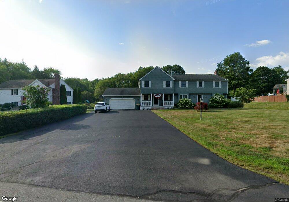
300 Ashland St Abington, MA 02351
Estimated Value: $775,000 - $843,000
3
Beds
2
Baths
3,024
Sq Ft
$265/Sq Ft
Est. Value
About This Home
This home is located at 300 Ashland St, Abington, MA 02351 and is currently estimated at $802,620, approximately $265 per square foot. 300 Ashland St is a home located in Plymouth County with nearby schools including Beaver Brook Elementary School, Abington Middle School, and Woodsdale School.
Ownership History
Date
Name
Owned For
Owner Type
Purchase Details
Closed on
Dec 18, 2007
Sold by
Littman Carole I
Bought by
Littman Carole I and Littman Adam L
Current Estimated Value
Purchase Details
Closed on
Apr 4, 1994
Sold by
Slawatycki Maria and Slawatycki Tadeusz
Bought by
Littman Carole I
Home Financials for this Owner
Home Financials are based on the most recent Mortgage that was taken out on this home.
Original Mortgage
$141,300
Interest Rate
7.07%
Mortgage Type
Purchase Money Mortgage
Create a Home Valuation Report for This Property
The Home Valuation Report is an in-depth analysis detailing your home's value as well as a comparison with similar homes in the area
Home Values in the Area
Average Home Value in this Area
Purchase History
| Date | Buyer | Sale Price | Title Company |
|---|---|---|---|
| Littman Carole I | -- | -- | |
| Littman Carole I | $163,000 | -- |
Source: Public Records
Mortgage History
| Date | Status | Borrower | Loan Amount |
|---|---|---|---|
| Previous Owner | Littman Carole I | $141,300 |
Source: Public Records
Tax History Compared to Growth
Tax History
| Year | Tax Paid | Tax Assessment Tax Assessment Total Assessment is a certain percentage of the fair market value that is determined by local assessors to be the total taxable value of land and additions on the property. | Land | Improvement |
|---|---|---|---|---|
| 2025 | $9,663 | $739,900 | $265,500 | $474,400 |
| 2024 | $9,702 | $725,100 | $264,400 | $460,700 |
| 2023 | $9,103 | $640,600 | $231,800 | $408,800 |
| 2022 | $8,990 | $590,700 | $195,500 | $395,200 |
| 2021 | $8,332 | $505,600 | $186,900 | $318,700 |
| 2020 | $8,231 | $484,200 | $173,700 | $310,500 |
| 2019 | $8,559 | $492,200 | $173,700 | $318,500 |
| 2018 | $0 | $451,600 | $173,700 | $277,900 |
| 2017 | $8,129 | $443,000 | $173,700 | $269,300 |
| 2016 | $7,466 | $416,400 | $159,500 | $256,900 |
| 2015 | $6,866 | $403,900 | $159,500 | $244,400 |
Source: Public Records
Map
Nearby Homes
- 34 George h Gillespie Way
- 101 Highfields Rd
- 360 High St
- 91 Clapp St
- 63 Rice St
- 14 Doris Dr
- 79 Groveland St
- 78 Linda St
- 4 Locust Hill Ln
- 1098 Bedford St
- 300 High St
- 229 Washington Terrace
- 9 Karen Ln
- 40 Bedford St
- 37 Rockland St
- 16 Davis St
- 87 Summer St
- 257 Rockland St Unit 257
- 10 Bank St
- 521 Washington St Unit 1