Estimated Value: $191,000 - $252,000
2
Beds
2
Baths
1,204
Sq Ft
$195/Sq Ft
Est. Value
About This Home
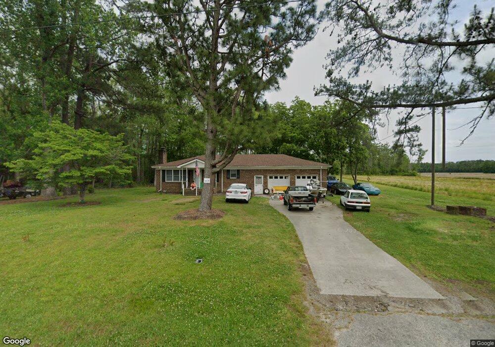
This home is located at 300 Barfield Rd, Eure, NC 27935 and is currently estimated at $234,589, approximately $194 per square foot. 300 Barfield Rd is a home located in Gates County with nearby schools including Gates County Senior High School.
Ownership History
Date
Name
Owned For
Owner Type
Purchase Details
Closed on
Oct 29, 2018
Sold by
Stevens Ronald E and Stevens Nancy M
Bought by
Wills Michael
Current Estimated Value
Home Financials for this Owner
Home Financials are based on the most recent Mortgage that was taken out on this home.
Original Mortgage
$75,080
Outstanding Balance
$65,746
Interest Rate
4.6%
Mortgage Type
VA
Estimated Equity
$168,843
Purchase Details
Closed on
Nov 26, 2003
Bought by
Stevens Ronald E
Create a Home Valuation Report for This Property
The Home Valuation Report is an in-depth analysis detailing your home's value as well as a comparison with similar homes in the area
Purchase History
| Date | Buyer | Sale Price | Title Company |
|---|---|---|---|
| Wills Michael | $73,500 | Amrock Inc | |
| Stevens Ronald E | $88,000 | -- |
Source: Public Records
Mortgage History
| Date | Status | Borrower | Loan Amount |
|---|---|---|---|
| Open | Wills Michael | $75,080 |
Source: Public Records
Tax History
| Year | Tax Paid | Tax Assessment Tax Assessment Total Assessment is a certain percentage of the fair market value that is determined by local assessors to be the total taxable value of land and additions on the property. | Land | Improvement |
|---|---|---|---|---|
| 2025 | $1,536 | $185,902 | $24,213 | $161,689 |
| 2024 | $1,317 | $122,261 | $20,538 | $101,723 |
| 2023 | $1,317 | $122,261 | $20,538 | $101,723 |
| 2022 | $1,317 | $122,261 | $20,538 | $101,723 |
| 2021 | $1,256 | $122,261 | $20,538 | $101,723 |
| 2020 | $1,256 | $122,261 | $20,538 | $101,723 |
| 2019 | $1,256 | $12,226,100 | $2,053,800 | $10,172,300 |
| 2018 | $979 | $122,261 | $20,538 | $101,723 |
| 2017 | $929 | $122,261 | $0 | $0 |
| 2016 | -- | $132,628 | $0 | $0 |
| 2015 | -- | $132,628 | $0 | $0 |
| 2014 | -- | $132,628 | $0 | $0 |
Source: Public Records
Map
Nearby Homes
- 1640 U S 158
- Lot 12 River St
- Lot 13 River St
- 122 River St
- 218 River Trail
- 602 N N King St
- 602 N King St
- Lot 10 River View Ct
- Lot 9 Riversedge Dr
- 546 River Rd
- 201 N Main St
- 305 S Camp St
- 116 Farmers Chemical Rd
- 120 Farmers Chemical Rd
- 309 Old Us Highway 13
- 106 White Oak Rd
- 515 US Highway 13 S
- Lot 2 Blue Foot Rd
- 545 U S 158
- 541 E Saluda Hall Rd
- 299 Barfield Rd
- 326 Barfield Rd
- 340 Barfield Rd
- 341 Barfield Rd
- 260 Barfield Rd
- 359 Barfield Rd
- 379 Barfield Rd
- 407 Barfield Rd
- 7 Small Ln
- 20 Horton Ln
- 278 Little Island Rd
- 270 Little Island Rd
- 0 Barfield Rd
- 1129 Horton
- 260 Little Island Rd
- 40 Horton Ln
- 30 Small Ln
- 22 Avalon Ln
- 1558 Nc 137
- 1579 Nc 137
Your Personal Tour Guide
Ask me questions while you tour the home.