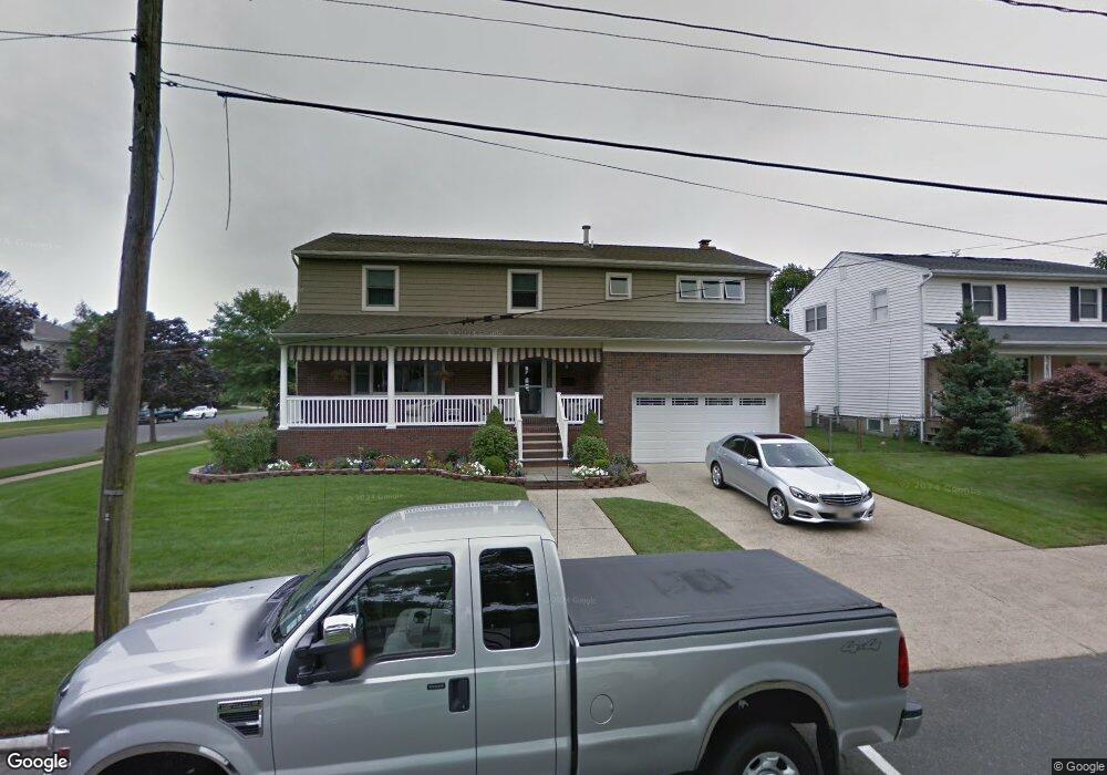
300 C St Belmar, NJ 07719
Estimated Value: $1,891,614 - $2,480,000
4
Beds
3
Baths
2,866
Sq Ft
$746/Sq Ft
Est. Value
About This Home
This home is located at 300 C St, Belmar, NJ 07719 and is currently estimated at $2,137,904, approximately $745 per square foot. 300 C St is a home located in Monmouth County with nearby schools including Belmar Elementary School, St. Rose Grammar School, and St Rose High School.
Ownership History
Date
Name
Owned For
Owner Type
Purchase Details
Closed on
Jul 16, 2021
Sold by
Carlson David and Carlson Kathryn
Bought by
Carlson Family Revocable Trust
Current Estimated Value
Purchase Details
Closed on
Nov 22, 1999
Sold by
Valente Oswald
Bought by
Carlson David and Carlson Kathryn
Purchase Details
Closed on
Nov 11, 1993
Sold by
Fenty Maxine
Bought by
Schneck David and Oliveri Karen
Home Financials for this Owner
Home Financials are based on the most recent Mortgage that was taken out on this home.
Original Mortgage
$161,000
Interest Rate
6.78%
Create a Home Valuation Report for This Property
The Home Valuation Report is an in-depth analysis detailing your home's value as well as a comparison with similar homes in the area
Home Values in the Area
Average Home Value in this Area
Purchase History
| Date | Buyer | Sale Price | Title Company |
|---|---|---|---|
| Carlson Family Revocable Trust | -- | None Available | |
| Carlson Family Revocable Trust | -- | None Listed On Document | |
| Carlson David | $327,000 | -- | |
| Schneck David | $201,000 | -- |
Source: Public Records
Mortgage History
| Date | Status | Borrower | Loan Amount |
|---|---|---|---|
| Previous Owner | Schneck David | $161,000 |
Source: Public Records
Tax History
| Year | Tax Paid | Tax Assessment Tax Assessment Total Assessment is a certain percentage of the fair market value that is determined by local assessors to be the total taxable value of land and additions on the property. | Land | Improvement |
|---|---|---|---|---|
| 2025 | $14,317 | $984,000 | $626,000 | $358,000 |
| 2024 | $13,835 | $984,000 | $626,000 | $358,000 |
Source: Public Records
Map
Nearby Homes
- 201 2nd Ave Unit 4B
- 106 2nd Ave
- 203 4th Ave
- 100 1st Ave
- 23 Washington Ave
- 106 8th Ave
- 120 Garfield Ave
- 503 11th Ave
- 501 Main St Unit 40
- 1 Railroad Ave Unit C1
- 1 Railroad Ave Unit B3
- 1 Railroad Ave Unit C3
- 105 11th Ave
- 20 Laird Way
- 308 Sea Spray Ln
- 129 Spinnaker Way
- 371 Sea Spray Ct
- 113 12th Ave
- 226 Norwood Ave
- 1203 D St
Your Personal Tour Guide
Ask me questions while you tour the home.