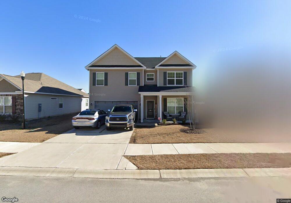
300 Council Loop Columbia, SC 29209
Southeast Columbia NeighborhoodEstimated Value: $299,000 - $327,000
4
Beds
3
Baths
2,696
Sq Ft
$116/Sq Ft
Est. Value
About This Home
This home is located at 300 Council Loop, Columbia, SC 29209 and is currently estimated at $312,843, approximately $116 per square foot. 300 Council Loop is a home located in Richland County with nearby schools including Annie Burnside Elementary School, Crayton Middle School, and A. C. Flora High School.
Ownership History
Date
Name
Owned For
Owner Type
Purchase Details
Closed on
Feb 12, 2024
Sold by
Williams Mitchell Charlie
Bought by
Mclean Andre and Zeledon Jennifer
Current Estimated Value
Home Financials for this Owner
Home Financials are based on the most recent Mortgage that was taken out on this home.
Original Mortgage
$304,735
Outstanding Balance
$299,360
Interest Rate
6.62%
Mortgage Type
New Conventional
Estimated Equity
$13,483
Purchase Details
Closed on
May 12, 2021
Sold by
Stanley Martin Homes Llc
Bought by
Williams Mitchell Charlie
Home Financials for this Owner
Home Financials are based on the most recent Mortgage that was taken out on this home.
Original Mortgage
$222,625
Interest Rate
2.9%
Mortgage Type
New Conventional
Purchase Details
Closed on
Sep 10, 2020
Sold by
Burnside Farm Associates Llc
Bought by
Stanley Martin Companies Llc
Create a Home Valuation Report for This Property
The Home Valuation Report is an in-depth analysis detailing your home's value as well as a comparison with similar homes in the area
Home Values in the Area
Average Home Value in this Area
Purchase History
| Date | Buyer | Sale Price | Title Company |
|---|---|---|---|
| Mclean Andre | $295,000 | None Listed On Document | |
| Williams Mitchell Charlie | $229,510 | Harvey & Vallini Llc | |
| Stanley Martin Companies Llc | $178,500 | Harvey And Vallini Llc |
Source: Public Records
Mortgage History
| Date | Status | Borrower | Loan Amount |
|---|---|---|---|
| Open | Mclean Andre | $304,735 | |
| Previous Owner | Williams Mitchell Charlie | $222,625 |
Source: Public Records
Tax History Compared to Growth
Tax History
| Year | Tax Paid | Tax Assessment Tax Assessment Total Assessment is a certain percentage of the fair market value that is determined by local assessors to be the total taxable value of land and additions on the property. | Land | Improvement |
|---|---|---|---|---|
| 2024 | $8,240 | $263,900 | $0 | $0 |
| 2023 | $1,821 | $9,180 | $0 | $0 |
| 2022 | $1,664 | $229,500 | $33,500 | $196,000 |
| 2021 | $251 | $1,340 | $0 | $0 |
| 2020 | $98 | $200 | $0 | $0 |
Source: Public Records
Map
Nearby Homes
- 296 Council Loop
- 797 Phipps Ln
- 360 Council Loop
- 300 E Lake Trail
- 225 E Lake Trail
- 174 Preston Green Dr
- 184 Springway Dr
- 11 Paperbark Ct
- 31 Silverleaf Ct
- 25 Willow Hurst Ct
- 404 Hampton Forest Dr
- 1191 Rockwood Rd
- 349 Eastfair Dr
- 26 Vendue Ct
- 1527 Burnside Ave
- 1006 Coatesdale Rd
- The Yarmouth Plan at Garners Mill
- 208 Wheat Farm Rd
- 217 Wheat Farm Rd
- 833 Forest Park Rd Unit 115
- 304 Council Loop
- 308 Council Loop
- 236 Council Loop
- 240 Council Loop
- 301 Council Loop
- 297 Council Loop
- 232 Council Loop
- 293 Council Loop
- 305 Council Loop
- 228 Council Loop
- 312 Council Loop
- 309 Council Loop
- 275 Council Loop
- 271 Council Loop
- 287 Council Loop
- 267 Council Loop
- 313 Council Loop
- 281 Council Loop
- 263 Council Loop
- 229 Council Loop