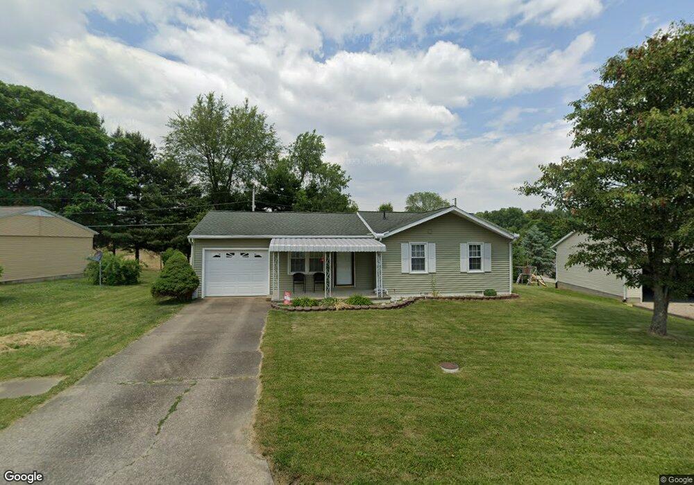
300 David St Somerset, OH 43783
Estimated Value: $198,479 - $246,000
3
Beds
1
Bath
1,006
Sq Ft
$217/Sq Ft
Est. Value
About This Home
This home is located at 300 David St, Somerset, OH 43783 and is currently estimated at $218,120, approximately $216 per square foot. 300 David St is a home located in Perry County with nearby schools including Sheridan High School and Holy Trinity Elementary School.
Ownership History
Date
Name
Owned For
Owner Type
Purchase Details
Closed on
Apr 20, 2012
Sold by
Paxton David L and Paxton Bevelry K
Bought by
Householder Dustin W
Current Estimated Value
Home Financials for this Owner
Home Financials are based on the most recent Mortgage that was taken out on this home.
Original Mortgage
$81,600
Outstanding Balance
$56,362
Interest Rate
3.91%
Mortgage Type
New Conventional
Estimated Equity
$161,758
Purchase Details
Closed on
Jun 16, 2006
Sold by
Stall Amy R
Bought by
Paxton David L and Paxton Beverly K
Create a Home Valuation Report for This Property
The Home Valuation Report is an in-depth analysis detailing your home's value as well as a comparison with similar homes in the area
Home Values in the Area
Average Home Value in this Area
Purchase History
| Date | Buyer | Sale Price | Title Company |
|---|---|---|---|
| Householder Dustin W | $80,000 | None Available | |
| Paxton David L | $78,000 | None Available |
Source: Public Records
Mortgage History
| Date | Status | Borrower | Loan Amount |
|---|---|---|---|
| Open | Householder Dustin W | $81,600 |
Source: Public Records
Tax History Compared to Growth
Tax History
| Year | Tax Paid | Tax Assessment Tax Assessment Total Assessment is a certain percentage of the fair market value that is determined by local assessors to be the total taxable value of land and additions on the property. | Land | Improvement |
|---|---|---|---|---|
| 2024 | $1,720 | $38,380 | $6,590 | $31,790 |
| 2023 | $1,720 | $38,380 | $6,590 | $31,790 |
| 2022 | $1,790 | $31,650 | $3,890 | $27,760 |
| 2021 | $1,641 | $31,650 | $3,890 | $27,760 |
| 2020 | $1,611 | $31,650 | $3,890 | $27,760 |
| 2019 | $1,462 | $28,560 | $3,720 | $24,840 |
| 2018 | $1,482 | $28,560 | $3,720 | $24,840 |
| 2017 | $1,400 | $29,800 | $3,720 | $26,080 |
| 2016 | $1,392 | $29,160 | $6,110 | $23,050 |
| 2015 | $1,385 | $29,160 | $6,110 | $23,050 |
| 2014 | $1,339 | $29,160 | $6,110 | $23,050 |
| 2013 | $1,363 | $29,160 | $6,110 | $23,050 |
| 2012 | -- | $29,160 | $6,110 | $23,050 |
Source: Public Records
Map
Nearby Homes
- 105 S Columbus St
- 300 E Main St
- 101 Shady Ln
- 212 N Market St
- 8151 Township Road 68 NW
- 403 N Columbus St
- 3783 U S 22
- 4190 State Route 669 NE
- 0 Toll Gate Rd
- 5475 Rush Creek Rd NW
- 4190 Township Road 143 NE
- 10705 Township Road 92
- 3064 Township Road 124 NE
- 0 Ohio 669
- 3760 Township Road 138 NW
- 5930 U S 22
- 2128 County Road 51
- 11284 State Route 668 N
- 4486 Cooperriders Rd NW
- 4287 Otterbein Rd NW
- 302 David St
- 106 Saint Patrick Dr
- 304 David St
- 104 Saint Patrick Dr
- 301 David St
- 415 Fancy Ct
- 109 Saint Patrick Dr
- 424 Fancy Ct
- 303 David St
- 107 Saint Patrick Dr
- 413 Fancy Ct
- 102 Saint Patrick Dr
- 307 David St
- 105 Saint Patrick Dr
- 202 Fancy St
- 416 Fancy Ct
- 420 Fancy Ct
- 0 Fancy Ct Unit L-20
- 103 Saint Patrick Dr
- 414 Fancy Ct