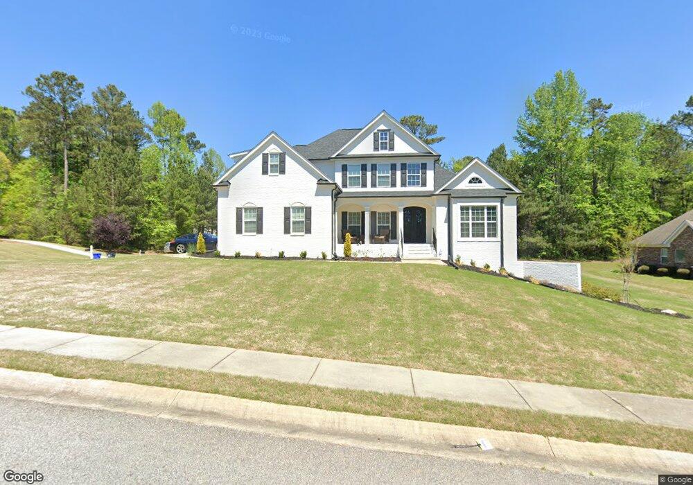
300 Doe Hollow Trace Unit 52 Fayetteville, GA 30215
Estimated Value: $603,000 - $675,000
6
Beds
4
Baths
4,586
Sq Ft
$137/Sq Ft
Est. Value
About This Home
This home is located at 300 Doe Hollow Trace Unit 52, Fayetteville, GA 30215 and is currently estimated at $630,281, approximately $137 per square foot. 300 Doe Hollow Trace Unit 52 is a home located in Fayette County with nearby schools including Cleveland Elementary School, Bennett's Mill Middle School, and Fayette County High School.
Ownership History
Date
Name
Owned For
Owner Type
Purchase Details
Closed on
Feb 25, 2013
Sold by
Herbert Philip
Bought by
Thompson Loray and Baker-Thompson Angela L
Current Estimated Value
Home Financials for this Owner
Home Financials are based on the most recent Mortgage that was taken out on this home.
Original Mortgage
$331,076
Outstanding Balance
$232,464
Interest Rate
3.43%
Mortgage Type
VA
Estimated Equity
$397,817
Purchase Details
Closed on
Apr 11, 2008
Sold by
Arbor Construction Inc
Bought by
Herbert Philip
Home Financials for this Owner
Home Financials are based on the most recent Mortgage that was taken out on this home.
Original Mortgage
$385,000
Interest Rate
6.22%
Mortgage Type
New Conventional
Create a Home Valuation Report for This Property
The Home Valuation Report is an in-depth analysis detailing your home's value as well as a comparison with similar homes in the area
Home Values in the Area
Average Home Value in this Area
Purchase History
| Date | Buyer | Sale Price | Title Company |
|---|---|---|---|
| Thompson Loray | $320,500 | -- | |
| Herbert Philip | $385,000 | -- |
Source: Public Records
Mortgage History
| Date | Status | Borrower | Loan Amount |
|---|---|---|---|
| Open | Thompson Loray | $331,076 | |
| Previous Owner | Herbert Philip | $385,000 |
Source: Public Records
Tax History Compared to Growth
Tax History
| Year | Tax Paid | Tax Assessment Tax Assessment Total Assessment is a certain percentage of the fair market value that is determined by local assessors to be the total taxable value of land and additions on the property. | Land | Improvement |
|---|---|---|---|---|
| 2024 | $3,705 | $245,468 | $32,000 | $213,468 |
| 2023 | $7,405 | $243,280 | $32,000 | $211,280 |
| 2022 | $6,238 | $205,280 | $22,000 | $183,280 |
| 2021 | $4,948 | $160,760 | $22,000 | $138,760 |
| 2020 | $4,827 | $156,120 | $22,000 | $134,120 |
| 2019 | $4,737 | $151,720 | $22,000 | $129,720 |
| 2018 | $4,548 | $144,120 | $17,600 | $126,520 |
| 2017 | $4,429 | $148,120 | $17,600 | $130,520 |
| 2016 | $4,196 | $137,320 | $17,600 | $119,720 |
| 2015 | $4,097 | $131,680 | $17,600 | $114,080 |
| 2014 | $3,618 | $114,160 | $17,600 | $96,560 |
| 2013 | -- | $127,540 | $0 | $0 |
Source: Public Records
Map
Nearby Homes
- 145 Cutstone Ct
- 130 Edgewater Trail
- 227 Blue Point Pkwy
- 165 Blackjack Ct
- 120 Godby Dr
- 180 Dockside Dr Unit LOT 385
- 135 Waterlace Way
- 130 Dockside Dr Unit 380
- 155 Mine Run
- 140 Ridgecrest Dr Unit 2
- 111 Windsail Way
- 180 Sunderland Cir
- 0 Davis Rd Unit 10490616
- 262 Otter Cir
- 230 Hidden Brook Trail
- 175 Ferncliff
- 322 Hambrick Park
- 155 Cottage Cir
- 135 Discovery Lake Dr
- 490 Grand Teton Cir
- 300 Doe Hollow Trace
- 110 Mays Bluff
- 290 Doe Hollow Trace
- 105 Mays Bluff
- 295 Doe Hollow Trace
- 120 Mays Bluff
- 120 Mays Bluff Unit 54
- 280 Doe Hollow Trace
- 105 Edgewater Trail
- 115 Mays Bluff
- 115 Mays Bluff Unit 43
- 285 Doe Hollow Trace
- 267 Willow Rock Point
- 272 Willow Rock Point Unit 41
- 272 Willow Rock Point
- 315 Doe Hollow Trace
- 130 Mays Bluff
- 320 Doe Hollow Trace
- 320 Doe Hollow Trace Unit 45
- 270 Doe Hollow Trace