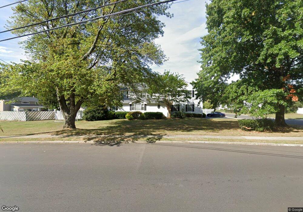
300 Harmony Rd Middletown, NJ 07748
New Monmouth NeighborhoodEstimated Value: $864,000 - $979,000
5
Beds
3
Baths
3,232
Sq Ft
$288/Sq Ft
Est. Value
About This Home
This home is located at 300 Harmony Rd, Middletown, NJ 07748 and is currently estimated at $931,920, approximately $288 per square foot. 300 Harmony Rd is a home located in Monmouth County with nearby schools including Harmony Elementary School, Thorne Middle School, and Middletown High School North.
Ownership History
Date
Name
Owned For
Owner Type
Purchase Details
Closed on
Sep 8, 1999
Sold by
Halliwell Lester
Bought by
Lamalfa August and Lamalfa Graziella
Current Estimated Value
Home Financials for this Owner
Home Financials are based on the most recent Mortgage that was taken out on this home.
Original Mortgage
$150,000
Outstanding Balance
$43,889
Interest Rate
7.65%
Mortgage Type
Purchase Money Mortgage
Estimated Equity
$888,031
Purchase Details
Closed on
Sep 29, 1993
Sold by
Capone Lillian
Bought by
Ferraro Guy
Create a Home Valuation Report for This Property
The Home Valuation Report is an in-depth analysis detailing your home's value as well as a comparison with similar homes in the area
Home Values in the Area
Average Home Value in this Area
Purchase History
| Date | Buyer | Sale Price | Title Company |
|---|---|---|---|
| Lamalfa August | $212,500 | -- | |
| Ferraro Guy | $115,000 | -- |
Source: Public Records
Mortgage History
| Date | Status | Borrower | Loan Amount |
|---|---|---|---|
| Open | Lamalfa August | $150,000 |
Source: Public Records
Tax History
| Year | Tax Paid | Tax Assessment Tax Assessment Total Assessment is a certain percentage of the fair market value that is determined by local assessors to be the total taxable value of land and additions on the property. | Land | Improvement |
|---|---|---|---|---|
| 2025 | $14,237 | $915,400 | $362,800 | $552,600 |
| 2024 | $13,330 | $865,500 | $323,100 | $542,400 |
| 2023 | $13,330 | $767,000 | $312,000 | $455,000 |
| 2022 | $12,334 | $653,900 | $220,700 | $433,200 |
| 2021 | $12,522 | $593,000 | $207,700 | $385,300 |
| 2020 | $12,366 | $578,400 | $201,800 | $376,600 |
| 2019 | $12,522 | $592,900 | $201,800 | $391,100 |
| 2018 | $12,454 | $574,700 | $201,800 | $372,900 |
| 2017 | $12,626 | $576,800 | $193,300 | $383,500 |
| 2016 | $11,205 | $525,800 | $170,800 | $355,000 |
| 2015 | $11,578 | $524,600 | $170,800 | $353,800 |
| 2014 | $10,978 | $485,100 | $161,800 | $323,300 |
Source: Public Records
Map
Nearby Homes
- 42 Bonnie Dr
- 34 Michele Dr
- 901 Palmer Ave
- 424 Middlewood Rd Unit 424
- 375 Middlewood Rd
- 14 Ambrose Ln
- 13 Arthur Place
- 1901 Evans Ln
- 22 Mercer Ave
- 901 Arose Ln
- 19 Avenue A
- 17 Avenue A
- 17 Avenue A Unit 99
- 18 Avenue A Unit 98
- 18 Avenue A
- 4 Pine Tree Terrace
- 14 Avenue A Unit 102
- 8a Avenue A Unit 108
- 8a Avenue A
- 18 Avenue B
- 8 Kearney Dr
- 1 Barbara Terrace
- 1 Kearney Dr
- 3 Barbara Terrace
- 2 Bennett Place
- 275 Harmony Rd
- 5 Barbara Terrace
- 312 Harmony Rd
- 10 Kearney Dr
- 15 Stephanie Rd
- 277 Harmony Rd
- 8 Bennett Place
- 273 Harmony Rd
- 11 Stephenville Blvd
- 1 Bennett Place
- 7 Barbara Terrace
- 279 Harmony Rd
- 316 Harmony Rd
- 2 Barbara Terrace
- 10 Bennett Place
Your Personal Tour Guide
Ask me questions while you tour the home.