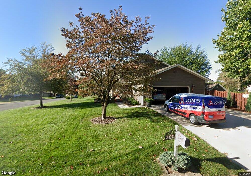
300 Jamestown Ct Collinsville, IL 62234
Estimated Value: $289,267 - $339,000
4
Beds
3
Baths
2,288
Sq Ft
$141/Sq Ft
Est. Value
About This Home
This home is located at 300 Jamestown Ct, Collinsville, IL 62234 and is currently estimated at $321,567, approximately $140 per square foot. 300 Jamestown Ct is a home located in Madison County with nearby schools including John A Renfro Elementary School, Dorris Intermediate School, and Collinsville Middle School.
Ownership History
Date
Name
Owned For
Owner Type
Purchase Details
Closed on
Feb 27, 2014
Sold by
Welle Richard W and Welle Kim A
Bought by
Mitzel Robert B and Mitzel Debra A
Current Estimated Value
Home Financials for this Owner
Home Financials are based on the most recent Mortgage that was taken out on this home.
Original Mortgage
$100,000
Outstanding Balance
$28,033
Interest Rate
3.37%
Mortgage Type
New Conventional
Estimated Equity
$293,534
Create a Home Valuation Report for This Property
The Home Valuation Report is an in-depth analysis detailing your home's value as well as a comparison with similar homes in the area
Home Values in the Area
Average Home Value in this Area
Purchase History
| Date | Buyer | Sale Price | Title Company |
|---|---|---|---|
| Mitzel Robert B | $186,000 | Abstracts & Titles Inc |
Source: Public Records
Mortgage History
| Date | Status | Borrower | Loan Amount |
|---|---|---|---|
| Open | Mitzel Robert B | $100,000 |
Source: Public Records
Tax History Compared to Growth
Tax History
| Year | Tax Paid | Tax Assessment Tax Assessment Total Assessment is a certain percentage of the fair market value that is determined by local assessors to be the total taxable value of land and additions on the property. | Land | Improvement |
|---|---|---|---|---|
| 2024 | $4,784 | $85,830 | $14,650 | $71,180 |
| 2023 | $4,784 | $78,190 | $13,330 | $64,860 |
| 2022 | $4,422 | $72,310 | $12,330 | $59,980 |
| 2021 | $3,933 | $67,930 | $11,580 | $56,350 |
| 2020 | $3,756 | $64,810 | $11,050 | $53,760 |
| 2019 | $3,732 | $64,040 | $10,310 | $53,730 |
| 2018 | $3,979 | $60,670 | $9,770 | $50,900 |
| 2017 | $3,976 | $59,470 | $9,580 | $49,890 |
| 2016 | $4,179 | $59,470 | $9,580 | $49,890 |
| 2015 | $4,296 | $57,920 | $9,330 | $48,590 |
| 2014 | $4,296 | $57,920 | $9,330 | $48,590 |
| 2013 | $4,296 | $57,920 | $9,330 | $48,590 |
Source: Public Records
Map
Nearby Homes
- 414 Bunker Hill Dr
- 22 Brookwood Dr
- 5 Brookwood Dr
- 10 White Lily Dr
- 2007 Belt Line Rd
- 1224 Cedar Ridge Ct
- 0 N Keebler Ave
- 1121 Carraway Ct
- 203 Greenfield Dr
- 1059 Lafayette Ct Unit A
- 1035 Lafayette Ct Unit B
- 1051 Lafayette Ct Unit A
- 123 Elliot St
- 1120 Williams St
- 308 Brown Ave
- 0 Strong Ave
- 617 N Morrison Ave
- 1210 Constance St
- 123 W Wickliffe Ave
- 100 Debbie Dr
- 311 Chesapeake Ln
- 302 Jamestown Ct
- 315 Chesapeake Ln
- 309 Chesapeake Ln
- 304 Jamestown Ct
- 303 Jamestown Ct
- 307 Chesapeake Ln
- 318 Chesapeake Ln
- 316 Chesapeake Ln
- 320 Chesapeake Ln
- 305 Jamestown Ct
- 314 Chesapeake Ln
- 305 Chesapeake Ln
- 306 Jamestown Ct
- 317 Chesapeake Ln
- 312 Chesapeake Ln
- 307 Jamestown Ct
- 428 Chapel Dr
- 432 Chapel Dr
- 434 Chapel Dr